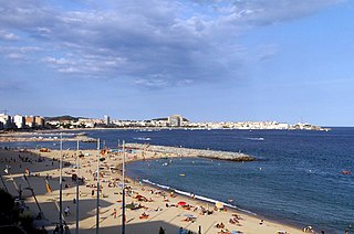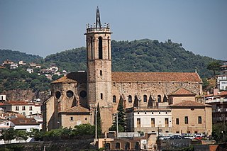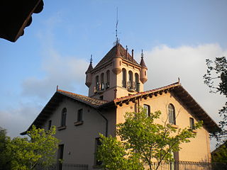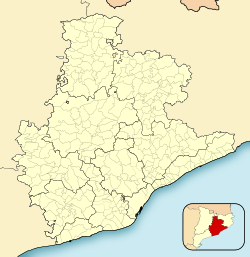
Palamós is a town and municipality in the Mediterranean Costa Brava, located in the comarca of Baix Empordà, in the province of Girona, Catalonia, Spain. Palamós is located at the northern end of a large bay. The town is by-passed by the C31 which connects the coastal towns of the central Costa Brava with Girona. Palafrugell lies 8.5 kilometres (5.3 mi) to the north and Castell-Platja d'Aro 7 kilometres (4.3 mi) to the south.

Olot is the capital city of the comarca of Garrotxa, in the Province of Girona, Catalonia, Spain. The city is known for its natural landscape, including four volcanoes scattered around the city center. The municipality is part of the Zona Volcànica de la Garrotxa Natural Park. Olot is also well known for its cultural activity, with historical art movements like Olot school or factories of religious imagery, which contributed to the location in the city of the main Design and Arts & Crafts school of the province of Girona, the Escola d'Art i Superior de Disseny d'Olot.

Cambrils is a coastal town in the comarca of Baix Camp, province of Tarragona, Catalonia, Spain. The town is near the tourist town Salou and is frequently visited by those travelling by air using Reus Airport.

Vallès Occidental is a comarca (county) in the Barcelona region in Catalonia (Spain). It has two capitals, Sabadell and Terrassa. Along with Vallès Oriental, it forms the historical Vallès region.

L'Escala is a municipality in the comarca of the Alt Empordà in Girona, Catalonia, Spain. It is situated on the Costa Brava, located between the southern end of the Gulf of Roses and Cala (bay) Montgó. It is an important fishing port and tourist centre, and has a festival dedicated to its famous anchovies. The GE-513 road runs inland from the town.

Portbou is a town in the Alt Empordà county, in the Province of Girona, Catalonia, Spain. It has a population of 1077 people (2018).

Vilanova i la Geltrú is the capital city of Garraf comarca, in the province of Barcelona, Catalonia, Spain. Historically, it is the result of the aggregation of the medieval center of La Geltrú with the center built outside the medieval walls, Vilanova. Initially, the lands of Vilanova belonged to Cubelles, the neighboring town. The city of Vilanova i la Geltrú has a growing population of approximately 66,000, and is situated 40 km south-west of Barcelona, with the coastal resort of Sitges some 10 km to the north-east.

Òdena is a municipality in the comarca of the Anoia in Barcelona province, Catalonia, Spain. It is situated in the centre of the Òdena Basin, on the side of a small hill. The remains of Òdena castle with its octagonal tower are at the top of the hill. The town is served by the C-241 road from Igualada to Manresa, and the main N-II road from Barcelona to Lleida runs through the municipality.

Sant Vicenç dels Horts is a municipality in the Province of Barcelona in Catalonia, Spain. It is situated on the right bank of the Llobregat river, on the N-340 road from Molins de Rei to Vilafranca del Penedès. The main rail lines of the Llobregat corridor pass through the town: the station is served by the FGC services S3, S4, S8, S9, R5 and R6. The remains of an Iberic village are visible at Puig Castellar.

El Papiol is a municipality in the comarca of the Baix Llobregat in Catalonia, Spain. It is situated on the left bank of the Llobregat river, on the A-7 autopista from Valencia to La Jonquera and the C-1413 road from Sabadell to Molins de Rei. At West it borders on Castellbisbal and Pallejà, at North on Valldoreix and at East on Molins de Rei. It is served by the Renfe railway line R4 from Barcelona to Martorell, Vilafranca del Penedès and Sant Vicenç de Calders, which is connected to the village center by a minibus service. It is also served by a bus service (L67) and a night bus service (N51) from Barcelona to Esparreguera.

Barberà del Vallès is a municipality in the comarca of the Vallès Occidental, in the province of Barcelona, Spain. It is situated in the valley of the Ripoll river to the south of Sabadell, about 17 kilometers from Barcelona. It's integrated in the Metropolitan Area of Barcelona.

Caldes de Montbui is a Spanish town and municipality in the comarca of the Vallès Oriental in Catalonia. It is situated in the upper valley of the Caldes river, and the highest point of the municipality is the peak of el Farell at 816 m. It lies about 30 km from Barcelona and it part of its metropolitan area.

Coll de Nargó is a municipality in the comarca of the Alt Urgell in Catalonia, a region of Spain. It is situated in the Segre valley by the Oliana reservoir. The municipality is served by the C-14 road between Ponts and La Seu d'Urgell, the L-511 road to Isona and the L-401 road to Sant Llorenç de Morunys. The Romanesque church of Sant Climent dates from the eleventh century, and has a rectangular pre-Romanesque bell-tower.

Fígols i Alinyà is a municipality in the comarca of the Alt Urgell in Catalonia, Spain. It is situated on the left bank of the Segre river between Coll de Nargó and Organyà, just above the Oliana reservoir. The municipality was formed in 1972 by the merger of the municipalities of Fígols d'Organyà and Alinyà: the ajuntament is in Fígols. A local road links the municipality with Organyà.
L'Ampolla is a municipality in the comarca of the Baix Ebre in Catalonia, Spain. It was created in 1990 by the division of the municipality of el Perelló. It is situated on the coast south of l'Ametlla de Mar, and is an important tourist centre and minor fishing port. The town is served by the A-7 autopista, the N-340 coast road and by a station on the RENFE railway line between Tarragona and Valencia.

Vallgorguina is a municipality in the comarca of Vallès Oriental in Catalonia, Spain. It is situated in the hollow between the ranges of el Corredor and Montnegre. It is linked to Sant Celoni and to Arenys de Munt by a local road.

Llançà is a municipality in the comarca of the Alt Empordà in Catalonia, Spain. It is situated on the coastline of the Costa Brava, between the Cap de Creus and the French frontier and is an important fishing port and tourist centre. The N-260 connects the town with Figueres and continues on to the border at Portbou.

Baixador de Vallvidrera is a railway station in the Sarrià-Sant Gervasi district of Barcelona. It is served by lines S1 and S2 of the Metro del Vallès commuter rail system, which are operated by Ferrocarrils de la Generalitat de Catalunya, who also run the station.
The Coll de la Font de Cera is a mountain pass on the BP-5002 road across the Catalan Coastal Range from El Masnou to Granollers. The pass lies between the municipality of Alella, in the comarca of Maresme, and the municipality of Vallromanes, in the comarca of Vallès Oriental. Both municipalities are in the province of Barcelona, Catalonia, Spain.

The Coll de Can Bordoi is a mountain pass on the B-510 road across the Catalan Coastal Range from Dosrius to Llinars del Vallès. The pass lies in the municipality of Llinars del Vallès, comarca of Vallès Oriental, province of Barcelona, Catalonia, Spain.


