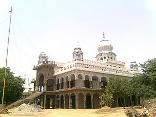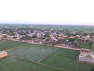
Mansa is a city of Punjab. It is the administrative headquarters of Mansa district and is situated on the Bathinda-Jind-Delhi railway line and also on the Barnala-Sardulgarh-Sirsa state highway.

Mansa district is a district in the state of Punjab, India. The district headquarters is Mansa city. Mansa district was formed on 13 April 1992 from the erst while district of Bathinda. The district has three tehsils: Mansa, Budhlada and Sardulgarh; and five development blocks: Mansa, Budhlada, Sardulgarh, Bhikhi and Jhunir.

Panchkula is a city and district headquarter in the Panchkula district in Haryana, India. It is a satellite town of the state capital Chandigarh. Panchkula is a border city with Punjab, Chandigarh and Himachal Pradesh. The origin of the name Panchkula came from "the place where five irrigation canals meet". It is approximately 4 km (2.5 mi) southeast of Chandigarh, 105 km (65 mi) southwest of Shimla, 44 km (27 mi) from Ambala and 259 km (161 mi) northeast of New Delhi, the national capital. It is a part of the Chandigarh capital region or Greater Chandigarh. The Chandigarh-Mohali-Panchkula metropolitan region collectively forms a Chandigarh Tricity, with a combined population of over two million.

Patiala district is one of the twenty three districts in the state of Punjab in north-west India.
Bhikhi is a municipal committee in Mansa district in the state of Punjab, India.
Sardulgarh is a City in Mansa district in the Indian state of Punjab. Surrounded by cities of Mansa city, Sirsa, Tohana, Bathinda, Fatehabad. It is a Sub-Division (Tehsil) of District Mansa. Its old name was Tadalan or Dhudalan/Dhudhal.
Mansa is a town with municipality and former princely state in Gandhinagar district in the western Indian state of Gujarat. It was the capital of Mansa state, ruled by the Chavda Rajputs.
Bareta is a city and municipal council in the Mansa district in Southern Punjab, India. It is a small town that lies on the NH-148B.

Puadh is a historic region in north India that comprises parts of present-day Punjab, Haryana, Uttar Pradesh, Himachal Pradesh and the U.T. of Chandigarh, India. It has the Sutlej river in its north and covers the regions immediately south of the Ghaggar river. The people of the area are known as Puadhi and speak the Puadhi dialect of Punjabi. The capital cities of Puadh region are Rupnagar, Fatehgarh Sahib, Mohali, Patiala, Sangrur, Mansa Chandigarh, Nalagarh, Panchkula, Baddi, Ambala, Yamunanagar.

Mata Mansa Devi is a Hindu temple dedicated to goddess Mansa Devi, a form of Shakti, in the Panchkula district of the Indian state of Haryana. The temple complex is spread of 100 acres (0.40 km2) of the Shivalik foothills in the village of Bilaspur, near Sector 13 of Chandigarh, and Panchkula, 10 km from Chandi Mandir, another noted Devi shrine in the region, both just outside Chandigarh.

Raipur, located in the Sardulgarh tehsil of Mansa district in Punjab, India, is an old and noted village of the area. The famous Babbar martyr Bhai Gurmel Singh from the village was martyred during an operation in Maujia on 8 September 1991.
Maujia is a village in the tehsil and district of Mansa in Punjab, India. It is a notable village of the area as a huge operation between the Indian Army and Babbar Khalsa members took place here in September, 1991.
Jhunir, sometimes spelled Jhuner, is a town in the Sardulgarh tehsil of Mansa district in Punjab, India. It is also a block of the district.

Lakhmir Wala is a village in the Mansa district of Indian Punjab.
Bire Wala Jattan is a village in Sardulgarh tehsil of Mansa district in Punjab, India. It falls under the development block of Jhunir and the district main city of Mansa is just 21 km away.
Nangal Kalan is one of the biggest villages of Mansa district, Punjab, India. It's 7 kilometres (4.3 mi) away from the city Mansa and 2 kilometres (1.2 mi) away from Mansa-Sirsa Road. The population is Punjabi-speaking and is wedded to the Malwa culture of Punjab.

Chotian is a village in the Sardulgarh tehsil of Mansa district in Punjab, India. Jhunir is the surrounding village.
Jhanduke is a village in the Sardulgarh tehsil of Mansa district in Punjab, India. Jhunir is the surrounding village.
National Highway 148B starts at Kotputli, state of Rajasthan and ends at Bathinda, state of Punjab. The major towns are in succession of distance on this highway: Narnaul, Mahendergarh, Charkhi Dadri, Bhiwani, Hansi, Barwala, Bhimewala Tohana, Moonak, Jakhal, Bareta, Budhlada, Bhikhi, Mansa and Maur. This highway meets with National Highway 54 at Bathinda. The highway is 427 km (265 mi) long and runs all within the states of Haryana, Punjab and Rajasthan.
Kot Dharmu is a Village in Mansa District of Punjab State, India. Population of the village according to 2011 census is 4161.


