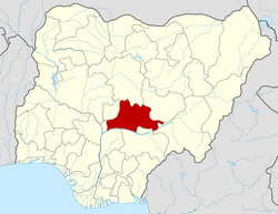
Akwanga

Last updated

Akwanga
Kpange
Mada Kasa
LGA and town
Nickname: 
AK
Motto: 
Mada Sei Gir
Nigeria location map.svg
Red pog.svg
Akwanga
Location in Nigeria
Coordinates: 8°55′0″N8°23′0″E / 8.91667°N 8.38333°E / 8.91667; 8.38333
CountryFlag of Nigeria.svg  Nigeria
State Nasarawa State
HeadquartersAkwanga Town
Time zone UTC+1 (WAT)
Akwanga

Akwanga is a Local Government Area in Nasarawa State, Nigeria. Its headquarters are in the town of Akwanga.

Contents

It has an area of 996 km2 and a population of 513,930 at the 2006 census. The postal code of the area is 960. [1]

Languages

Akwanga is predominantly occupied by the Mada language speaking people, however, [Plateau languages] are spoken in and around Akwanga. Plateau language groups surrounding Akwanga town, listed clockwise, are Koro, Hyamic, Ndunic, Alumic, Ninzic, Eggonic, and Jilic. [2]

Education

Akwanga is considered the center of education in Nasarawa state for its wide array of primary, secondary, and tertiary institutions. Akwanga is home to a famous and well known missionary school like Rishama Comprehensive College, Mada Hills Secondary School, the prestigious Shepherd's International College, Hope Academy Secondary School, Summit Children Academy/Isachar High School, ShanPePe Destiny International Schools, Destiny Kids Academy, Bright Model Academy, Akwanga south Primary school, the private co-educational, Christian boarding school; College of Education; Hills College of Education; NACABS Polytechnic; and School of Health, amongst many others. Akwanga has the highest number of schools in Nasarawa State.

Climate

From June to October, Akwanga enjoys a hot summer, then from June to October, a cool winter, and finally from August to November, a chilly winter. [3]

Related Research Articles

<span class="mw-page-title-main">Aba, Nigeria</span> City in Abia, Nigeria

Aba is a city in southeastern Nigeria and the commercial centre of Abia State. Upon the creation of Abia State in 1991, the old Aba township was divided into two local government areas: Aba South and Aba North. Aba South is the main city centre of Abia State, being located on the Aba River. Aba is made up of many villages such as Aba-Ukwu, Eziukwu-Aba, Obuda-Aba, Umuokpoji-Aba and other villages that have been merged for administrative convenience. Aba was established by the Ngwa clan of the Igbo people in Nigeria as a market town. Later, a military post was placed there by the British colonial administration in 1901. It lies along the west bank of the Aba River and is at the intersection of roads leading to Port Harcourt, Owerri, Umuahia, Ikot Ekpene, and Ikot-Abasi. The city became a collection point for agricultural products following construction of a British-made railway running through it to Port Harcourt. Aba is a major urban settlement and commercial centre in its region, which is surrounded by small villages and towns. The indigenous people of Aba are the Ngwa. Aba is well known for its craftsmen and is the most populous city in southeastern Nigeria. As of 2016, Aba had an estimated population of 2,534,265.

<span class="mw-page-title-main">Plateau State</span> State of Nigeria

Plateau State is the twelfth largest Nigerian state. It is located near the centre of Nigeria and includes a range of hills surrounding the Jos Plateau, its capital, and the entire plateau itself. Plateau State is described as "The Home of Peace and Tourism". With natural formations of rocks, hills and waterfalls, it derives its name from the Jos Plateau and has a population of around 4.7 million people.

<span class="mw-page-title-main">Kaduna State</span> State of Nigeria

Kaduna State is a state in the northwest geopolitical zone of Nigeria. The state capital is its namesake, the city of Kaduna which happened to be the 8th largest city in the country as at 2006. Created in 1967 as North-Central State, which also encompassed the modern Katsina State, Kaduna State achieved its current borders in 1987. Kaduna State is the fourth largest and third most populous state in the country, Kaduna State is nicknamed the Centre of Learning, owing to the presence of numerous educational institutions of importance within the state such as Ahmadu Bello University.

<span class="mw-page-title-main">Nasarawa State</span> State of Nigeria

Nasarawa State is a state in the North Central region of Nigeria, bordered to the east by the states of Taraba and Plateau, to the north by Kaduna State, to the south by the states of Benue and Kogi, and to the west by the Federal Capital Territory. Named for the historic Nasarawa Emirate, the state was formed from the west of Plateau State on 1 October 1996. The state has thirteen local government areas and its capital is Lafia, located in the east of the state, while a key economic centre of the state is the Karu Urban Area—suburbs of Abuja—along the western border with the FCT.

<span class="mw-page-title-main">Lafia</span> Capital city of Nasarawa State, Nigeria

Lafia is a city in Nigeria's North Central region. It is the capital and largest city of Nasarawa State, with a population of 330,712 inhabitants as of the 2006 census.

<span class="mw-page-title-main">Abdullahi Adamu</span> Nigerian politician, Governor of Nasarawa State

Abdullahi Adamu is a Nigerian politician who was the governor of Nasarawa State in Nigeria from 29 May 1999 to 29 May 2007. He is a member and former national chairman of the ruling Party All Progressives Congress (APC).

<span class="mw-page-title-main">Plateau languages</span> Group of Benue–Congo languages of central Nigeria

The forty or so Plateau languages are a tentative group of Benue–Congo languages spoken by 15 million people on the Jos Plateau, Southern Kaduna, Nasarawa State and in adjacent areas in central Nigeria.

Eggon, erroneously referred to as Mada - formerly a Plateau language spoken in central Nigeria. It is one of the major language in Nasarawa State.

Sanga is a Local Government Area in southern Kaduna State, Nigeria. Its headquarters is in the town of Gbantu. The Local Government Council is chaired by Bisallah Malam. It has an area of 1,821 km2 and had a population of 151,485 as at the 2006 census. The postal code of the area is 801.

<span class="mw-page-title-main">Keffi</span> LGA and Town in Nasarawa State, Nigeria

Keffi Local Government Area and also is a traditional or commercial town in Nasarawa north central Nigeria Its headquarters are in the town of Keffi. Keffi is 50 kilometers from Abuja. Nasarawa State university is located in Keffi sitting along Keffi-Akwanga express way.

<span class="mw-page-title-main">Nasarawa, Nasarawa State</span> LGA and Town in Nasarawa State, Nigeria

Nasarawa is a Local Government Area in Nasarawa State, Nigeria. Its headquarters are in the town of Nasarawa, located at 8°32'N 7°42'E, with a population of 30,949. The local government area has an area of 5,704 km2 and a population of 189,835 at the 2006 census. The postal code of the area is 962.

<span class="mw-page-title-main">Wukari</span> LGA and Town in Taraba State, Nigeria

Wukari is a Local Government Area in Taraba State, Nigeria. Its headquarters is in the town of Wukari on the A4 highway. The Donga River flows through the area and the Benue River forms a boundary with Nasarawa State to the northwest. It has an area of 4,308 km2 and a population of 241,546 at the 2006 census. The postal code of the area is 670.

<span class="mw-page-title-main">Iyiola Omisore</span> Nigerian politician (born 1957)

Iyiola Ajani Omisore is a Nigerian businessman, engineer, and politician who served as deputy governor of Osun State from 1999 to 2003. Subsequently, he served as a member of the Nigerian Senate for Osun East from 2003 to 2011. He is a former national secretary of the All Progressives Congress.

Aliyu Akwe Doma was a Nigerian civil servant who became governor of Nasarawa State in May, 2007, standing for the People's Democratic Party (PDP).

Farin Ruwa Falls is a waterfall found in the central region of Nigeria. It is among the highest waterfalls in Nigeria. It is significant among Africa's falls when the total height covered by the waterfall is considered.

The College of Education, Akwanga is a tertiary institution located in Akwanga town in Akwanga Local Government Area of Nasarawa State, in central Nigeria. The college is led by the following: Rev Jonathan Wakili Thani, Provost; Mr Yakubu Ojegba, Registrar; Mrs Lillian Okpede, Bursar and Dr Mohammed as Librarian.

Abdullahi Audu Sule is a Nigerian engineer, businessman and politician who has served as governor of Nasarawa State since 2019. He was elected in the 2019 Governorship election under the platform of the All Progressives Congress (APC).

<span class="mw-page-title-main">Ibrahim Usman Jibril</span> Nigerian traditional ruler

Ibrahim Usman Jibril CON is a Nigerian traditional ruler and administrator. He is the 12th emir of Nasarawa Emirate and was the minister of state for environment between 2015 and 2018 in the President Muhammadu Buhari-led administration.

<span class="mw-page-title-main">New Karshi</span> Town in Nasarawa, Nigeria

New Karshi is a town in Karu Local Government Area of Nasarawa State, Nigeria, founded in the 1980s by Muhammadu Bako II. It is a semi-autonomous local government created out of Karu LGA as Karshi Development area with the administrative secretariat in Uke. Karshi has a local government chairman as its administrative head and a seat in the Nasarawa State House of Assembly. Emir of Karshi Emirate, Alhaji (Dr) Muhammadu Sani Bako III, a first class chief is the traditional head of New Karshi. It has a population of about 30,000 people. The predominant tribes are Gwandara, Gbagyi, Gade, Bassa and Hausa.

<span class="mw-page-title-main">Eggon people</span> Central Nigerian tribe

The Eggon are an Ethnic Group mostly based in North Central Nigeria.

References

  1. "Post Offices- with map of LGA". NIPOST. Archived from the original on 7 October 2009. Retrieved 2009-10-20.
  2. Blench, Roger M. 2018. Nominal affixes and number marking in the Plateau languages of Central Nigeria. In John R. Watters (ed.), East Benue-Congo: Nouns, pronouns, and verbs, 107–172. Berlin: Language Science Press. doi : 10.5281/zenodo.1314325
  3. "Akwanga Climate, Weather By Month, Average Temperature (Nigeria) - Weather Spark". weatherspark.com. Retrieved 2023-09-11.