Doma, Nigeria

Last updated

Doma
LGA and Town
Nigeria location map.svg
Red pog.svg
Doma
Coordinates: 8°23′42″N8°21′38″E / 8.39500°N 8.36056°E / 8.39500; 8.36056
CountryFlag of Nigeria.svg  Nigeria
State Nasarawa State
HeadquartersDoma
Government
  AndomaAhmadu Aliyu Ogah
Area
  Total1,048 sq mi (2,714 km2)
Population
 (2022)
  Total214,600 [1]
Time zone UTC+01:00 (WAT)
Doma, Nigeria

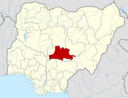
Doma is a Local Government Area in Nasarawa State, Nigeria. Its headquarters are in the town of Doma. Doma LGA houses Special Forces Command, [2] Federal Science and Technical College, [3] Olam Rice Farm [4] and Doma Dam. [5]

Contents

It has an area of 2,714 km2 and had a population of 139,607 in the 2006 census.

The postal code of the area is 950. [6] Odu is the annual festival in Doma local government, Farming is the occupation of most of the Alago people who are the predominant tribe in Doma.

The average temperature of Doma is 30 °C with a wind speed of an average of 12 km/h and a total rain precipitation of 1750 mm per annum [7]

History

The 43rd Andoma of Doma Alhaji (Dr) Ahmadu Aliyu Oga Onawo (OON) (2004- date), seated in his palace in Doma. Andoma of Doma.jpg
The 43rd Andoma of Doma Alhaji (Dr) Ahmadu Aliyu Oga Onawo (OON) (2004- date), seated in his palace in Doma.

The Kingdom of Doma was founded in 1232 by Andoma and lasted until 1901 when it became part of the British Protectorate of northern Nigeria. [8]

Doma/Alago people led by Osabonya Ogoshi Andoma were believed to have moved and settled in other places including Idah in the present-day Kogi State, Apa, Otupka, and Ogyogo at the bank of river Benue in the present-day Benue State, and then in Oba’sidoma in the present-day Keana LGA of Nasarawa State before they finally settled at their present location. [9] The Alago-speaking people of Doma were originally known and referred to as Idoma and migrated from Apa the seat of the ancient Kwararafa Empire. Their popular tale indicated that Doma was founded in the 13th century- around 1232 AD. [10] The general theories and history of Alago migration and settlement are by extension the theories and history of the Jukun/Kwararafa Empire which was the theory and history of constant movement from one settlement to another within the territorial boundary of the defunct Kwararafa Empire and indeed outside the area. [11] This includes the theory of Eastern Migration, early settlement, language classification, and ethnology, the theory of constant warfare, and the theory of the confederacy of the Kwararafa Empire. [12] This explains the relationship that existed between the Jukuns and the Alagos and by extension all the Kwararafa family members.

The Alago people of Doma and their brethren from Keana, Aloshi, Ibi, Obi, Agaza, Alagye, Agbashi, Agwatashi, and Assakio among others were believed to have come from the ancient Kwararafa empire. [13] The migration was said to have taken them to places such as Idah in Kogi State, Ogyogo in Benue State, Obasidoma in Keana LGA, and finally to Doma. Although the movement was in two phases, the first phase was led by the founder of Doma Osabonnya Ogoshi Andoma.

Climatic Condition

Throughout the year, the weather in Doma varies, with March being the hottest month and December the coldest. [14]

The climate in Doma is experiencing a shift in temperature, with warmer years and colder ones, as indicated by the positive trend in the temperature. [15]

Notable people

List of Rulers of Doma

Names and Dates taken from John Stewart's African States and Rulers (2005). [8]

Related Research Articles

<span class="mw-page-title-main">Kogi State</span> State of Nigeria

Kogi State is a state in the North Central region of Nigeria, bordered to the west by the states of Ekiti and Kwara, to the north by the Federal Capital Territory, to the northeast by Nasarawa State, to the northwest by Niger State, to the southwest by the Edo and Ondo states, to the southeast by the states of Anambra and Enugu, and to the east by Benue State. It is the only state in Nigeria to border ten other states. Named for the Hausa word for river (Kogi). Kogi State was formed from parts of Benue State, Niger State, and Kwara State on 27 August 1991. The state is nicknamed the "Confluence State" due to the fact that the confluence of the River Niger and the River Benue occurs next to its capital, Lokoja.

<span class="mw-page-title-main">Benue State</span> State of Nigeria

Benue State is one of the North Central states in Nigeria with a population of about 4,253,641 in 2006 census. The state was created in 1976 among the seven states created at that time. The state derives its name from the Benue River which is the second largest river in Nigeria after the River Niger. The state borders Nasarawa State to the North; Taraba State to the East; Kogi State to the West; Enugu State to the South-West; Ebonyi and Cross-Rivers States to the South; and has an international border with Cameroon to the South-East. It is inhabited predominantly by the Tiv, Idoma,and Igede. Minority ethnic groups in Benue are Etulo, Igbo, Jukun peoples etc. Its capital is Makurdi. Benue is a rich agricultural region; popularly grown crops include: oranges, mangoes, sweet potatoes, cassava, soya bean, guinea corn, flax, yams, sesame, rice, groundnuts, and Palm tree.

Tiv is a Tivoid language spoken in some states in North Central Nigeria, with some speakers in Cameroon. It had over 4.6 million speakers in 2020. The largest population of Tiv speakers are found in Benue state in Nigeria. The language is also widely spoken in the Nigerian states of Plateau, Taraba, Nasarawa, Cross River, Adamawa, Kaduna, and Abuja. It is by far the largest of the Tivoid languages, a group of languages belonging to the Southern Bantoid languages

<span class="mw-page-title-main">Taraba State</span> State of Nigeria

Taraba State is a state in north-eastern Nigeria, named after the Taraba River, which traverses the Southern part of the state. Taraba State capital is Jalingo. Its slogan is Nature's Gift to the Nation. The main ethnic groups are the Mumuye, Mambilla, Jukun, Tiv, Kuteb, Wurkun, Yandang, Ndola, Itchen, Jenjo, Tigun, Jibu and Fulani. The northern part is mainly dominated by the Mumuye, Wurkuns, Yandang, Jenjo, Kona and Fulani. The southern parts are dominated by the Jukun, Chamba, Tiv, Kuteb and Ichen.The central region is mainly occupied by Mambilla, Ndola, Tigun, Jibu, Wurbo, Daka and Fulani. There are 77 distinct ethnic groups, and their languages in the State.

<span class="mw-page-title-main">Nasarawa State</span> State of Nigeria

Nasarawa State is a state in the North Central region of Nigeria, bordered to the east by the states of Taraba and Plateau, to the north by Kaduna State, to the south by the states of Benue and Kogi, and to the west by the Federal Capital Territory. Named for the historic Nasarawa Emirate, the state was formed from the west of Plateau State on 1 October 1996. The state has thirteen local government areas and its capital is Lafia, located in the east of the state, while a key economic centre of the state is the Karu Urban Area—suburbs of Abuja—along the western border with the FCT.

<span class="mw-page-title-main">Idoma people</span> Ethnic group in Nigeria

The Idomas are people that primarily inhabit the lower western areas of Benue State, Nigeria, and some of them can be found in Taraba State, Cross Rivers State, Enugu State, Kogi State and Nasarawa State in Nigeria. The Idoma language is classified in the Akweya subgroup of the Idomoid languages of the Volta–Niger family, which include Igede, Alago, Agatu, Etulo, Ete, Akweya (Akpa) and Yala languages of Benue, Nasarawa, Kogi, Enugu, and Northern Cross River states. The Akweya subgroup is closely related to the Yatye-Akpa sub-group. The bulk of the territory is inland, south of river Benue, some seventy-two kilometres east of its confluence with River Niger. The Idoma tribe are known to be 'warriors' and 'hunters' of class, but hospitable and peace-loving. The greater part of Idoma land remained largely unknown to the West until the 1920s, leaving much of the colourful traditional culture of the Idoma intact. The population of the Idomas is estimated to be about 3.5 million. The Idoma people have a traditional ruler called the Och'Idoma who is the head of the Idoma Area Traditional Council. This was introduced by the British. Each community has its own traditional chief such as the former Ad'Ogbadibo of Orokam, Late Chief D.E Enenche. The Palace of the Och'Idoma is located at Otukpo, Benue State. The present Och'Idoma, HRM, Elaigwu Odogbo John, the 5th Och'Idoma of the Idoma People was installed on the 30th of June, 2022 following the passing of his Predecessor HRH Agabaidu Elias Ikoyi Obekpa who ruled from 1996 to October 2021. Past Och'Idomas also include: HRH, Agabaidu Edwin Ogbu, who reigned from 1996 to 1997, HRH, Abraham Ajene Okpabi of Igede descent who ruled from 1960 to 1995 and HRH, Agabaidu Ogiri Oko whose reign took place between 1948 and 1959.

<span class="mw-page-title-main">Local government areas of Nigeria</span> Third-level administrative division of Nigeria

Nigeria has 774 local government areas (LGAs), each administered by a local government council consisting of a chairman, who is the chief executive, and other elected members, who are referred to as councillors. Each LGA is further subdivided into a minimum of ten and a maximum of twenty wards. A ward is administered to by a councillor, who reports directly to the LGA chairman. The councillors fall under the legislative arm of the local government, the third tier of government in Nigeria, below the state governments and the federal government.

The Ebira people are an ethnic-linguistic group of central Nigeria. Most Ebira people are from Kogi State, Nasarawa State. Their language is usually classified as a Nupoid variety within the Benue-Congo branch of the Niger-Congo language family. Until the separation of Kogi State from Kwara State, Okene was seen as the administrative center of the Ebira-speaking people in Kogi state, located not far from the Niger-Benue confluence. Since the formation of the state, the Ebira Ta'o people are predominantly found in five local governments in Kogi state, namely Adavi, Ajaokuta, Okehi, and Okene. They are also found in large numbers located in the Federal Capital Territory, and Nasarawa in Toto LGA. Also, the Eganyi are found in Ajaokuta LGA. And the Etuno can be found in Igarra town of Amagongo, Okehi and Okene each with their administrative headquarters. Ebira Koto is found in Kogi and Koton Karfe LGA, Bassa LGA, Lokoja in Kogi and Abaji LGA in the Federal Capital Territory Akoko-Edo LGA, Edo state.

<span class="mw-page-title-main">Jukun people (West Africa)</span> West African ethno-linguistic group

Jukun are an ethno-linguistic group or ethnic nation in West Africa. The Jukun are traditionally located in Taraba, Benue, Nasarawa, Plateau, Adamawa, Bauchi and Gombe States in Nigeria and parts of northwestern Cameroon. They are descendants of the people of Kwararafa. Most of the tribes in the north central of Nigeria trace their origin to the Jukun people and are related in one way or the other to the Jukuns. Until the coming of both Christianity and Islam, the Jukun people were followers of their own traditional religions. Most of the tribes, Alago, Agatu, Rendere, Goemai in Shendam, and others left Kwararafa when it disintegrated as a result of a power tussle. The Jukuns are divided into two major groups; the Jukun Wanu and Jukun Wapa. The Jukun Wanu are fishermen residing along the banks of the river Benue and Niger where they run through Taraba State, Benue State and Nasarawa State. The Wukari Federation, headed by the Aku Uka of Wukari, is now the main centre of the Jukun people.

<span class="mw-page-title-main">Kwararafa</span> Hausa multi ethnic state from 1500 to 1840

Kororofa was a multiethnic state and/or confederacy centered along the Benue River valley in what is today central Nigeria. It was southwest of the Bornu Empire and south of the Hausa States. They rose to prominence before 1500, were in conflict with their more powerful neighbours in the 17th century, and reduced to a small tribute state by the 18th century. It is believed that Kwararafa was either a confederacy conquest state, led by the modern Jukun people or perhaps a collective name given by their Muslim foes for a number of pagan peoples to their south.

Keana is a town and Local Government Area in Nasarawa State, North Central, Nigeria. Its headquarters are in the town of Keana. It has an area of 1,048.1 km2 and a population of about 80,000. It is home to Federal Government Girls College, Keana.

<span class="mw-page-title-main">Wukari</span> LGA and Town in Taraba State, Nigeria

Wukari is a Local Government Area in Taraba State, Nigeria. Its headquarters is in the town of Wukari on the A4 highway. The Donga River flows through the area and the Benue River forms a boundary with Nasarawa State to the northwest. It has an area of 4,308 km2 and a population of 241,546 at the 2006 census. The postal code of the area is 670.

Aliyu Akwe Doma was a Nigerian civil servant who became governor of Nasarawa State in May, 2007, standing for the People's Democratic Party (PDP).

The Wukari Federation is a traditional state in Nigeria, a successor to the Kwararafa state of the Jukun people. The state is based in the town of Wukari in Taraba State, in the south of the Benue River basin. The ruler takes the title "Aku Uka".

Alago, or Idoma Nokwu, is an Idomoid language spoken by the Sub-Saharan peoples of Nigeria. The alago people were originally one with the Idoma people of mordern day Benue state in Nigeria. However, the Alago people are believed to have broken up with their Idoma counterpart around 1200 AD.

Events in the year 2010 in Nigeria.

Usman Danjuma Shiddi is a Nigerian politician and legislator currently representing the Ibi/Wukari Federal Constituency of Taraba State at the Federal House of Representatives in Nigerian National Assembly. In 2019 he won the House of Representative seat with 39,312 votes defeating his closest rival, Yakubu Aliyara of Action Alliance (AA) who got 22,147 votes. Shiddi is the Chairman House Committee on Internal Security of the 9th Nigeria House of Representative Assembly and in 2020 defected to the All Progressives Congress.

The Nwonyo Fishing Festival is a festival celebrated by the Ibi people in Taraba State, Nigeria. The lake is located 5 kilometres North of Ibi community, it is an annually celebrated festival where Ibi and its neighboring community comes together to fish and re-unite. The lake is said to be the largest in west Africa as it run 15 kilometres to the Benue River. The name Nwonyo means Hide-out for huge and dangerous aquatic Animals such as Crocodiles, Snakes, Hippopotamus and many more.

The 2011 Nigerian House of Representatives elections in Nasarawa State was held on April 9, 2011, to elect members of the House of Representatives to represent Nasarawa State, Nigeria.

Mohammed Ogoshi Onawo is a Nigerian politician, a businessman, a philanthropist and a member of the 10th Senate from Nasarawa South Senatorial District on the ticket of the People's Democratic Party (PDP). He was a member of the Nasarawa State House of Assembly from 2003 to 2011 and the Speaker Nasarawa State House Of Assembly from 2003 to 2007. He was also a member of the 7th and 8th National Assembly - House of Representatives. I'll Not Contest Against Gov. Sule In 2023– Ogoshi-Onawo – Independent Newspaper Nigeria |url=https://independent.ng/nasarawa-ill-not-contest-against-gov-sule-in-2023-ogoshi-onawo/ |access-date=2023-04-24 |website=independent.ng}}</ref>

References

  1. "Doma". citypopulation.de. Retrieved 2023-09-12.
  2. Nigeria Army 4
  3. "Federal Science and Technical College Doma".
  4. "Doma Dam as Nasarawa's Untapped Potential". 14 August 2022.
  5. "Post Offices- with map of LGA". NIPOST. Archived from the original on 2009-10-07. Retrieved 2009-10-20.
  6. "Doma Local Government Area". www.manpower.com.ng. Retrieved 2023-09-10.
  7. 1 2 Stewart, John (2005). African States and Rulers. London: McFarland. p. 74. ISBN   0-7864-2562-8.
  8. IBRAHIM, Ado Ahmad (2022). "Interrogating the Traditional Methods of Crime Control of the Alago Ethnic Group". Wukari International Studies Journal. 6 (2): 2.
  9. "Doma, Nigeria", Wikipedia, 2023-05-27, retrieved 2023-09-10
  10. Yaro, Kpendwa Daudu (2018). "COLONIAL ECONOMY OF IBI AND WUKARI DIVISIONS, 1900-1960". Department of History, Faculty of Arts, Ahmadu Bello University, Zaria, Nigeria.
  11. Mohammed, Atose (2005). "Origin of Kwararafa Kingdom". Academia.
  12. IPROJECT, Final Year Research Project Topics & Materials In PDF & Doc | iproject from. "MIGRATION,OCCUPATION & SETTLEMENT OF THE ALAGBO PEOPLE OF NASARAWA ST..." iproject.com.ng. Retrieved 2023-09-10.
  13. "Doma Climate, Weather By Month, Average Temperature (Nigeria) - Weather Spark". weatherspark.com. Retrieved 2023-09-11.
  14. "Climate Change Doma". meteoblue. Retrieved 2023-10-21.