Kokona | |
|---|---|
LGA and town | |
 Interactive map of Kokona | |
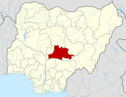
 Kokona Location in Nigeria | |
| Coordinates: 9°0′0″N8°03′0″E / 9.00000°N 8.05000°E | |
| Country | |
| State | Nasarawa State |
| Headquarters | Kokona Town |
| Government | |
| • Abaga Toni | Lawrence Sylvester Ayih |
| Time zone | UTC+1 (WAT) |
Kokona is a Local Government Area in Nasarawa State, Nigeria. Its headquarters are in the town of Garaku.
It has an area of 1,844 km2 and a population of 109,749 at the 2006 census.
The postal code of the area is 961. [1]
Kokona local government area is home to the Bassa people and other tribes.