Kathgodam is a suburb of Haldwani city in the Nainital district of Uttarakhand state of India. It used to be a part of the twin township of Haldwani-Kathgodam, and is immediately north of Haldwani. It is one of the important collection centres for forest products obtained from Kumaon Himalayas.

Kollur is a village in the southern state of Karnataka, India. It is located in the Byndoor taluk of Udupi district in Karnataka.
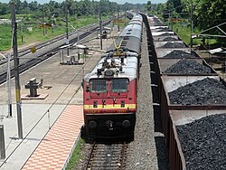
Tirodi is a census town in Balaghat district in the Indian state of Madhya Pradesh.

Unchahar is a town and nagar panchayat in Raebareli district in the Indian state of Uttar Pradesh. It serves as the headquarters of a tehsil as well as a community development block. It is located on Lucknow Allahabad Highway, 115 km from Lucknow, 85 km from Allahabad. The place is well connected by rail and roads to nearby cities of Kanpur, Lucknow, and Allahabad. Unchahar is also a constituency of Uttar Pradesh Legislative assembly.
Kabbur is a town in the southern state of Karnataka, India. It is located in the Chikodi taluk of Belgaum district in Karnataka.

Gundlapochampalle or Gundla Pochampalli is a village in Medchal mandal of Rangareddi district, Telangana, India.

Rampurwa is a village situated in Mehsi, East Champaran District in the Indian state of Bihar. The village is commonly known as Rampurwa among the localities. It lies in the Mirjapur Panchayat region. It is situated at the bank of river Burhi Gandak River on whose bank the village has flourished. It is well connected by road and railways. The nearest city Kaswa Mehsi in Mehsi, which is 2 km from the village. The nearest railway station is Mehsi railway station, which is around 5 km from the village.
Mathur is a residential area located north of Chennai, a metropolitan city in Tamil Nadu, India. Mathur is administered by the Greater Chennai Corporation and belongs to Madhavaram taluk of Chennai district.

Vizianagaram railway station is an Indian railway station located in the Indian state of Andhra Pradesh; it serves Vizianagaram city in Vizianagaram district. It is one of the important railway stations on Howrah–Chennai main line, serving as the point where links from Raipur and Jharsuguda via Titlagarh connect to the main line. It is administered under South Coast Railway zone.
Manwath Road is a village in Manwath taluka of Parbhani district of Indian state of Maharashtra. Village is mainly known for being a major railway station on Nanded-Aurangabad rail route. Station code of Manwath road is MVO. It is 8 km away from taluka headquarter Manwath.

Debipur is a village located at Memari I block in Purba Bardhaman district. People called Debipur R.S. because there is a Railway Station. It is under Memari police station. Nearest railway station is Debipur railway station, which is under Eastern Railway and is a part of Kolkata Suburban Railway system. Debipur Railway Station is located in Alipur. Nearest towns near Debipur are Memari, Boinchi. Debipur R.S is a Post Office of many other villages like Alipur, Debipur R.S., Mobarakpur. There is two High School and many primary schools
Sheakhala is a village and a gram panchayat in Chanditala I community development block in Srirampore subdivision of Hooghly district in the state of West Bengal, India. It is under Chanditala police station.

Krishnarampur (কৃষ্ণরামপুর) is a village and a gram panchayat in Chanditala I community development block in Srirampore subdivision of Hooghly district in the state of West Bengal, India. It is under Chanditala police station.
Aniya is a village and a gram panchayat in Chanditala I community development block of Srirampore subdivision in Hooghly district in West Bengal, India.
Madhabpur is a village in Chanditala II community development block of Srirampore subdivision in Hooghly district in the Indian state of West Bengal.
Ashaur is a medium size village in Phillaur tehsil of Jalandhar District of Punjab State, India. It is situated on Phillaur Nawanshahr Road and located 3.9 km from Nagar, 10 km from postal head office in Phillaur, 53 km from Jalandhar and 117 km from state capital Chandigarh. The village is administrated by a sarpanch who is an elected representative of village as per Panchayati raj (India).
Bainapur is a small size village in Phillaur tehsil of Jalandhar district of Punjab State, India. It is located 25 km away from Phillaur, 5.8 km from Nurmahal, 27.7 km from district headquarter Jalandhar and 147 km from state capital Chandigarh. The village is administrated by a sarpanch who is an elected representative of village as per Panchayati raj (India).
Kutbewal is a village in Jalandhar district of Punjab State, India. It is located 4 km away from postal head office in Goraya, 14.2 km from Nurmahal, 40.4 km from district headquarter Jalandhar and 122 km from state capital Chandigarh. The village is administrated by a sarpanch, who is an elected representative.
Thammanwal is a village in Jalandhar district of Punjab State, India. It is located 2.5 km from Mao Sahib, 12.9 km from Phillaur, 40.6 km from district headquarter Jalandhar and 133 km from state capital Chandigarh. The village is administrated by a sarpanch who is an elected representative of village as per Panchayati raj (India). Roshan Kainth hometown
Ekara is a small village in Hajipur Tehsil/Block in Vaishali District in Indian state of Bihar, India. It comes under Ekara Panchayat. It belongs to Tirhut Division. It is located 9 km towards North from District headquarters Hajipur. As per 2009 stats, Thathan Buzurg is the gram panchayat of Ekara village. And 23 km from State capital Patna. Sonpur, Hajipur, Lalganj are the nearby Cities to Ekara. This Place is in the border of the Vaishali District and Saran District. Saran District Sonpur is west towards this place. Also it is in the Border of other district Patna.