
East Dorset was a local government district in Dorset, England. Its council met in Wimborne Minster between 2016 and 2019.
New Forest is a local government district in Hampshire, England. Its council is based in Lyndhurst, although the largest town is Totton. The district also includes the towns of Fordingbridge, Lymington, New Milton and Ringwood. The district is named after and covers most of the New Forest National Park, which occupies much of the central part of the district. The main urban areas are around the periphery of the forest. The district has a coastline onto the Solent to the south and Southampton Water to the east.
Cranborne is a village in East Dorset, England. At the 2011 census, the parish had a population of 779, remaining unchanged from 2001.

Allington is a neighbourhood of Bridport in Dorset, England, immediately north-west of Bridport town centre on the west bank of the River Brit. Formerly a separate village and civil parish, Allington and Bridport had grown to be contiguous by the end of the 19th century.

Chickerell is a town and parish in Dorset, England. In the 2011 census the parish and the electoral ward had a population of 5,515.

Colehill is a parish neighbouring Wimborne Minster, in Dorset, England. It had a population of 7,000 in 2001, which decreased to 6,927 people at the 2011 census.

Fontmell Magna is a village and civil parish in Dorset, England. It is situated in the Blackmore Vale, close to the chalk hills of Cranborne Chase, on the A350 road five miles south of Shaftesbury and eight miles north of Blandford Forum. In the 2011 census the parish had a population of 734.

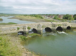
Hurn is a village and civil parish in the Bournemouth, Christchurch and Poole district of Dorset, England. It is situated between the River Stour and River Avon 3 miles (5 km) north-west of Christchurch and 5 miles (8 km) north-east of Bournemouth town centre. In 2001, the village had a population of 468.

Loders is a village and civil parish in the English county of Dorset. It lies 2 miles (3.2 km) north-east of the town of Bridport. It is a linear village, sited in the valley of the small River Asker, between Waddon Hill and Boarsbarrow Hill. In the 2011 census the parish had a population of 518.

Lydlinch is a village and civil parish in the Blackmore Vale in north Dorset, England, about three miles west of Sturminster Newton. The village is sited on Oxford clay close to the small River Lydden. The parish – which includes the village of King's Stag to the south and Stock Gaylard House to the west – is bounded by the Lydden to the east and its tributary, the Caundle Brook, to the north.

Pimperne is a village and civil parish in north Dorset, England, situated on Cranborne Chase two miles northeast of the town of Blandford Forum. At the 2011 census the civil parish had 478 households and a population of 1109.

Sixpenny Handley or Handley is a village and former civil parish, now in the parish of Sixpenny Handley and Pentridge, in north east Dorset, England, situated on Cranborne Chase ten miles (16 km) north east of Blandford Forum. In the 2011 census the parish had a population of 1,233. The civil parish was abolished on 1 April 2015 and merged with Pentridge to form Sixpenny Handley and Pentridge.

Tarrant Keyneston is a village and civil parish in Dorset, England. It is situated in the Tarrant Valley, five miles southeast of Blandford Forum. In the 2011 census the parish had 152 dwellings, 145 households and a population of 310.
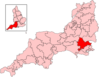
North Dorset is a constituency represented in the House of Commons of the UK Parliament since 2015 by Simon Hoare of the Conservative Party.

Broadway is a village and civil parish in Somerset, England, situated 3 miles (4.8 km) west of Ilminster and 5 miles (8.0 km) north of Chard. The parish has a population of 830 in 2021, up from 740 in 2011. The parish includes the nearby hamlet of Hare.

Askerswell is a small village and civil parish in the county of Dorset in southwest England. It is sited on the small River Asker. It lies 11 miles (18 km) west of the county town Dorchester. The parish has an area of 1,724 acres and in the northeast includes the western slopes of Eggardon Hill, including part of the Iron Age hill fort close to its summit. In the 2011 census the civil parish had a population of 154.
Trudoxhill is a village and civil parish near Nunney in Somerset, England.
Bull Hill, Dorset, Daggons and Broxhill are adjoining hamlets notable for planted woodland and tree cultivation south of Cranborne Chase and West Wiltshire Downs AONB in Dorset, England. The nearest town is Fordingbridge, about 3 miles (4.8 km) ENE. They are primarily in the civil parish of Alderholt, though some of Bull Hill is in the parishes of Damerham in a north-west projection of Hampshire. The three places have indistinct borders as is normal for hamlets.

