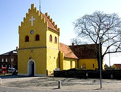
Allinge-Sandvig

Last updated

Allinge-Sandvig
Town
Havnegade, Allinge 2012.jpg
Road from Allinge Harbour
Coat of arms of Allinge-Sandvig.svg
Location map Bornholm.png
Red pog.svg
Allinge-Sandvig
Location on Bornholm
Coordinates: 55°16′40″N14°48′5″E / 55.27778°N 14.80139°E / 55.27778; 14.80139
Country Denmark
Region Capital (Hovedstaden)
Municipality Bornholm
Area
  Urban
0.69 sq mi (1.78 km2)
Population
 (2023)
   Urban
1,473
  Urban density2,100/sq mi (830/km2)
Time zone UTC+1 (CET)
  Summer (DST) UTC+2 (CEST)

Allinge-Sandvig is a small town on the northern coast of the Baltic island of Bornholm, Denmark. Its population is 1,473 (1 January 2023). [1] It was part of the former municipality Allinge-Gudhjem. Sandvig is the northernmost part of the town.

Contents

History

Prior to Allinge and Sandvig becoming urban areas, people in the Bronze Age lived there and made rock carvings at Madsebakke. [2] Not all carvings of ships, suns, and footprints have survived, however. Late in the 19th century, stone quarries flourished in the area and some rock carvings were blown up between 1885 and 1902. [3]

Allinge and Sandvig were two separate towns, the former formed near the natural harbour on the northwestern coast, [4] while Sandvig has been a small fishing village, whose origins can be traced to the Middle Ages, its name derived from a sandy cove on the coast. [4] The port of Allinge dates from 1862, while that of Sandvig from 1831-33.

Hammershus fortress

The Hammershus fortress, Northern Europe's largest medieval fortification dating from 13th century is located northwest of Allinge, near the Hammeren promontory, the northernmost point on the island. [5]

16th century church in Allinge Allinge kirke.jpg
16th century church in Allinge
Allinge (aerial view) Luftbild Allinge.jpg
Allinge (aerial view)
Sandvig (aerial view) Luftbild Sandvig.jpg
Sandvig (aerial view)

Allinge Church

Allinge Church stands at the centre of Allinge on a hill some 11 metres above sealevel. Initially just a small granite longhouse from the around the 14th century, in 1892 it was completely rebuilt in the Neogothic style. [6] [7]

55°16′40″N14°48′05″E / 55.27778°N 14.80139°E / 55.27778; 14.80139

Related Research Articles

<span class="mw-page-title-main">Bornholm</span> Danish island

Bornholm is a Danish island in the Baltic Sea, to the east of the rest of Denmark, south of Sweden, northeast of Germany and north of Poland.

<span class="mw-page-title-main">Hasle, Bornholm</span> Town in Capital, Denmark

Hasle is a town and a former municipality on the west coast of the Baltic island of Bornholm, Denmark. Its population is 1,638 The former municipality covered an area of 115 km2 (44 sq mi), and had a total population of 6,382. It is now included in the municipality of Bornholm. With its pleasant setting, smokehouses, galleries and harbour, the town attracts many tourists.

<span class="mw-page-title-main">Nexø</span> Town in Capital, Denmark

Nexø, sometimes spelled Neksø, is a town on the east coast of the Baltic island of Bornholm, Denmark. With a population of 3,674, it is the second largest town, as well as the largest fishing port on the island. Fishing was previously the mainstay of the town's economy. Nexø is also the site of a distillery and a mustard factory. The town is also a port of call for the passenger ferries linking Bornholm with Kołobrzeg in Poland. Dueodde, the largest beach on Bornholm, is located south of Nexø, in the southeastern corner of the island.

<span class="mw-page-title-main">Rønne</span> Town in Capital Region of Denmark, Denmark

Rønne is the largest town on the Danish island of Bornholm in the Baltic Sea. It has a population of 13,798. It was a municipality in its own right from 1970 until 2002, when Bornholm was a county. It has an area of 29.11 square kilometres, and is the administrative centre of the Bornholm municipality. As of 2018 11,539 inhabitants live in Rønne Parish, which is a narrow piece of land on the westernmost of the island and stretching north and southward comprising around a third of the area of the former municipality. Knudsker Parish made up the rest of the former municipality. Not all inhabitants of either Rønne or Knudsker (400-7553) parishes live in the city of Rønne.

<span class="mw-page-title-main">Sakskøbing</span> Town in Region Sjælland, Denmark

Sakskøbing, previously spelled Sakskjøbing, is a town on the island of Lolland in south Denmark. It has a population of 4,590. Until 1 January 2007 it was the seat of the former Sakskøbing Municipality, and is now situated in Guldborgsund Municipality in Region Sjælland.

<span class="mw-page-title-main">Svaneke</span> Town in Capital, Denmark

Svaneke is a small town on the eastern coast of the Baltic island of Bornholm, Denmark. It lies mainly in Svaneke parish and partly in Ibsker parish.

<span class="mw-page-title-main">Gudhjem</span> Village in Capital, Denmark

Gudhjem is a small town and fishing port on the northern coast of the Baltic island of Bornholm, Denmark. Its population is 736.

<span class="mw-page-title-main">Aarsdale</span> Village in Capital, Denmark

Aarsdale is a village on the eastern coast of the Baltic island of Bornholm, Denmark. Located between Svaneke and Nexø, it has a population of 298. Once a prosperous fishing village, its economy now relies mainly on tourism thanks to its half-timbered houses, its harbour and its windmill.

<span class="mw-page-title-main">Tejn</span> Town in Capital, Denmark

Tejn is a harbour town on the north-eastern coast of the Danish island of Bornholm, 5 km (3.1 mi) south of Allinge-Sandvig. As of 1 January 2023, it has a population of 824. Initially a fishing village, it grew considerably during the 20th century as the harbour was enlarged on several occasions. The local fishing industry reached its peak in the 1970s and 1980s but has since decreased, with negative implications for the town's activities.

<span class="mw-page-title-main">Klemensker</span> Village in Capital, Denmark

Klemensker is a village in the north-western part of the Danish island of Bornholm. With a population of 607, it is located on a crossroads 13 km north-east of Rønne, 7 km east of the coastal town Hasle and 12 km south of Allinge. It is known for its cheese production.

<span class="mw-page-title-main">Svaneke Church</span>

Svaneke Church is located in the small town of Svaneke on the Danish island of Bornholm. It stands above the harbour at a height of 18 metres on the site of a small chapel which appears to have existed for quite some time before the town received its charter in the 16th century. The church was expanded over the years, the tower and spire being completed in 1789. In 1881, virtually the whole building was rebuilt by architect Mathias Bidstrup of Rønne, leaving only the tower and a small section of the south wall.

<span class="mw-page-title-main">Nyker</span> Town in Capital, Denmark

Nyker is a small town on Bornholm with a population of 712. It is located 7.2 kilometres (4.5 mi) by road northeast of Rønne.

<span class="mw-page-title-main">Sankt Ols Kirke</span>

Sankt Ols Kirke, also known as Olsker Church, is a 12th-century round church located in the village of Olsker, 4 km (2.5 mi) south of Allinge on the Danish island of Bornholm. Built in the Romanesque style and reaching three storeys high, it has from the beginning consisted of a round nave, a choir and an apse.

<span class="mw-page-title-main">Allinge Church</span>

Allinge Church is the parish church of Allinge-Sandvig on the Danish island of Bornholm. It stands at the centre of Allinge on a hill some 11 metres above sealevel. Initially just a small granite longhouse from the around the 14th century, in 1892 it was completely rebuilt in the Neogothic style.

<span class="mw-page-title-main">Rø</span> Village in Capital Region of Denmark, Denmark

is a small village on the Danish island of Bornholm, 2 km from the north coast and 7 km west of Gudhjem. The Rønne–Allinge railway (1913–1953) brought prosperity to the village leaving the old station in the village. The Bornholm Art Museum is close to Rø as are the scenic Sanctuary Rocks.

<span class="mw-page-title-main">Hasle Church, Bornholm</span>

Hasle Church is the parish church of Hasle, a port on the western coast of the Danish island of Bornholm. It is located on a hill to the east of the town overlooking the harbour.

<span class="mw-page-title-main">Vestermarie Church</span>

Vestermarie Church is located in the little village of Vestermarie some 8 km east of Rønne on the Danish island of Bornholm. The present Neo-Romanesque church replaces a now demolished 14th-century building.

<span class="mw-page-title-main">Hammeren</span> Promontory on Bornholm, Denmark.

Hammeren is a protected area and promontory in Denmark on the northernmost point of Bornholm island. It projects into Sæne Bugt bay in the Baltic Sea. The area includes Hammersø, the largest lake on the island and the only tarn in Denmark, and a hill, 276 feet (84 m) in height, named Stejlebjerg. It is steep to the southwest but slopes gradually to the northeast, and is separated from the rest of the land by a valley.

<span class="mw-page-title-main">Sorthat-Muleby</span> Village in Capital, Denmark

Sorthat-Muleby is a village in the southwest of the Danish island of Bornholm, 6 kilometres (3.7 mi) north of Rønne and 4 kilometres (2.5 mi) south of Hasle. Muleby to the north and Sorthat to the south now form a single urban area. As of 2023, it has a population of 496.

<span class="mw-page-title-main">Rock art in Denmark</span> Rock art

Rock art in Denmark differs significantly from that of the Scandinavian peninsula. Carvings are smaller, focused on agriculture, rarely figural. Some examples are engraved on megaliths or cists, but most on small glacial erratics. Many of these have been placed in museums or incorporated into churches. A few have been left in situ, like the two stones at Mandbjerghøj.

References

  1. BY3: Population 1st January by urban areas, area and population density The Mobile Statbank from Statistics Denmark
  2. "Danmarks største helleristning". Bornholms Museer. Retrieved 3 February 2013.
  3. "Ødelagte helleristninger < Alle helleristninger". Bornholms Museer. Retrieved 3 February 2013.
  4. 1 2 Bornholm.info [ permanent dead link ]
  5. "bornholm.info: Hammerknuden". archive.is. 19 June 2007. Archived from the original on 19 June 2007. Retrieved 27 May 2021.
  6. "Allinge Church", HomeOfOurFathers.com. Retrieved 11 July 2012.
  7. Otto Norn, C. G. Schultz, Erik Skov, "Allinge Kirke: Bornholms Nørre Herred", Danmarks Kirker, Bornholm, Nationalmuseet, Gad, 1954, pp. 84–94. (in Danish)