Ambatoriha or Ambatoria is a town and commune (Malagasy: kaominina) in Madagascar. It belongs to the district of Bealanana, which is a part of Sofia Region. The population of the commune was estimated to be approximately 9,000 in 2001 commune census.[2]
Only primary schooling is available. The majority 96% of the population of the commune are farmers. The most important crop is rice, while other important products are peanuts, beans, maize and cassava. Services provide employment for 3% of the population. Additionally fishing employs 1% of the population.[2]
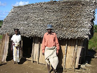
Bobasakoa is a municipality in Madagascar. It belongs to the district of Antsiranana II, which is a part of Diana Region. According to 2001 census the population of Bobasakoa was 6,309.
Analamaho is a town and commune in northern Madagascar. It belongs to the district of Sambava, which is a part of Sava Region. The population of the commune was estimated to be approximately 6,000 in 2001 commune census.
Ambodivoara is a town and commune in northern Madagascar. It belongs to the district of Sambava, which is a part of Sava Region. The population of the commune was estimated to be approximately 10,000 in 2001 commune census.
Antsahambaharo or Antsambaharo is a town and commune in northern Madagascar. It belongs to the district of Sambava, which is a part of Sava Region. The population of the commune was estimated to be approximately 11,000 in 2001 commune census.
Ambalakirajy is a town and commune in Madagascar. It belongs to the district of Mandritsara, which is a part of Sofia Region. The population of the commune was estimated to be approximately 20,000 in 2001 commune census.
Antsirabe Afovoany is a town and commune in Madagascar. It belongs to the district of Mandritsara, which is a part of Sofia Region. The population of the commune was estimated to be approximately 13,000 in 2001 commune census.
Andohajango is a town or commune in Madagascar. It is in the district of Mandritsara, which is a part of Sofia Region. The population of the commune was estimated at approximately 13,000 in the 2001 commune census.
Tsaratanana is a town and commune in Madagascar. It belongs to the district of Mandritsara, which is a part of Sofia Region. The population of the commune was estimated to be approximately 6,000 in the 2001 commune census.
Bemaitso is a town and commune in Madagascar. It belongs to the district of Andilamena, which is a part of Alaotra-Mangoro Region. The population of the commune was estimated to be approximately 8,000 in 2001 commune census.
Ambodimangavalo is a town and commune in Madagascar. It belongs to the district of Vavatenina, which is a part of the Analanjirofo Region. The population of the commune was estimated to be approximately 11,000 in the 2001 census.
Amboropotsy is a town and commune in southwestern Madagascar. It belongs to the district of Ampanihy, which is a part of Atsimo-Andrefana Region. The population of the commune was estimated to be approximately 13,000 in 2001 commune census.
Lazarivo is a town and commune in southwest Madagascar. It belongs to the district of Betioky Sud, which is a part of Atsimo-Andrefana Region. The population of the commune was estimated to be approximately 17,000 in 2001 commune census.
Vohitsara is a town and commune in Madagascar. It belongs to the district of Amparafaravola, which is a part of the Alaotra-Mangoro Region. The population of the commune was estimated to be approximately 5,000 in the 2001 commune census.
Ambohimandroso is a town and commune in Madagascar. It belongs to the district of Ambalavao, which is a part of Haute Matsiatra Region. The population of the commune was estimated to be approximately 12,000 in 2001 commune census.
Ambanisarike is a town and commune in Madagascar. It belongs to the district of Ambovombe, which is a part of Androy Region. The population of the commune was estimated to be approximately 8,000 in 2001 commune census.
Ambahatrazo is a town and commune in Madagascar. It belongs to the district of Manakara Atsimo, which is a part of Vatovavy-Fitovinany Region. The population of the commune was estimated to be approximately 10,000 in 2001 commune census.
Mizilo Gara is a town and commune in Madagascar. It belongs to the district of Manakara, which is a part of Vatovavy-Fitovinany Region. The population of the commune was estimated to be approximately 8,000 in 2001 commune census.
Ambila is a rural municipality in Madagascar. It belongs to the district of Manakara, which is a part of Fitovinany. The population of the commune was estimated to be approximately 17,000 in 2001 commune census.
Ampasipotsy is a town and commune in Madagascar. It belongs to the district of Manakara, which is a part of Vatovavy-Fitovinany Region. The population of the commune was estimated to be approximately 6,000 in 2001 commune census.
Ianabinda is a town and commune in Madagascar. It belongs to the district of Betroka, which is a part of Anosy Region.
This page is based on this Wikipedia article Text is available under the CC BY-SA 4.0 license; additional terms may apply. Images, videos and audio are available under their respective licenses.