Ambin group

Last updated
Ambin group
Gruppo d'Ambin / Groupe d'Ambin
Valle di Susa-Rocciamelone-Ambin.jpg
Ambin group seen from Roccasella
Highest point
Peak Rognosa d'Etiache
Elevation 3,382 m (11,096 ft)
Coordinates 45°08′07″N6°50′06″E / 45.13528°N 6.83500°E / 45.13528; 6.83500
Geography
Countries Italy and France
Regione, Région Piedmont and Rhône-Alpes
Provincia, Département Turin and Savoie
Parent range Cottian Alps

The Ambin group (Groupe d'Ambin in French, Gruppo d'Ambin in Italian) is a sub-range of the Cottian Alps located on the French-Italian border.

Contents

Geography

Administratively the range is divided between the Italian provincia di Torino (southern slopes) and the French département de la Savoie (northern slopes).

Borders

The borders of Ambin group are (clockwise):

Notable summits

Mont d'Ambin (right) and Denti d'Ambin (left) Rocca d'Ambin e Denti d'Ambin.JPG
Mont d'Ambin (right) and Denti d'Ambin (left)
NamemetresNamemetres
Punta Sommeiller 3,333 Rognosa d'Etiache 3,382
Mont d'Ambin 3,378Dents d'Ambin3,372
Monte Niblè3,365Punta Ferrand3,348
Mont Giusalet3,313Cima del Vallonetto3,217
Signal du Petit Mont Cenis3,162Punta Galambra3,122
Gros Peyron3,047Monte Seguret2,962
Mont Malamot 2,917Monte Jafferau2,805
La Pointe du Notaire3,269Le Petit Vallon3,236
Pointe de Bellecombe 2,755 Mont Froid 2,822

Mountain huts

Refuge d'Ambin Refuge ambin sfondo signal petit mt cenis.jpg
Refuge d'Ambin

Bibliography

Maps

Related Research Articles

<span class="mw-page-title-main">Cottian Alps</span> Mountain range on the France–Italy border

The Cottian Alps are a mountain range in the southwestern part of the Alps. They form the border between France and Italy (Piedmont). The Fréjus Road Tunnel and Fréjus Rail Tunnel between Modane and Susa are important transportation arteries between France and Italy (Turin).

<span class="mw-page-title-main">Turin–Modane railway</span>

The Turin–Modane railway is the international rail connection from Turin, Italy to Modane, France. It passes through the Susa Valley and the Fréjus Rail Tunnel. Together with the French Culoz–Modane railway it is often called "Fréjus Railway" or "Mont Cenis Railway".

<span class="mw-page-title-main">Mont Blanc de Courmayeur</span> Point on the south-east ridge of Mont Blanc

Mont Blanc de Courmayeur is a point on the south-east ridge of Mont Blanc that forms the peak of the massive south-east face of the mountain. It is connected to the main summit via the Col Major.

<span class="mw-page-title-main">Grivola</span> Mountain in the Graian Alps in Italy

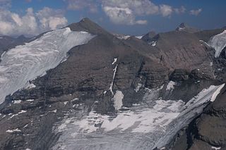
The Grivola is a mountain in the Graian Alps in Italy. It lies between the Valsavarenche and the Cogne Valley.

<span class="mw-page-title-main">Mont d'Ambin</span> Mountain in the Cottian Alps on the French-Italian border

Mont d'Ambin or Rocca d'Ambin is a mountain on the border of Savoie, France and of the Province of Turin, Italy. It lies in the Ambin group of the Cottian Alps. On the Italian side, it commands the view of the Val di Susa. It has an elevation of 3,378 metres (11,083 ft) above sea level. The Mont d'Ambin base tunnel of the Lyon–Turin rail link is being dug at its base.

<span class="mw-page-title-main">Aiguille de Scolette</span> Mountain in Italy

Aiguille de Scolette or Pierre Menue is a mountain of Savoie (F) and of the province of Turin (I). It lies in the Cottian Alps and has an elevation of 3,506 metres above sea level.

<span class="mw-page-title-main">Pointe de Paumont</span> Mountain in Italy

Pointe de Paumont or Cima del Vallone is a mountain of Savoie, France and of the Province of Turin, Italy. It lies in the Cottian Alps range. It has an elevation of 3,171 metres above sea level.

<span class="mw-page-title-main">Punta Bagnà</span> Mountain in Italy

Punta Bagnà or Cime du Grand Vallon is a mountain of Savoie, France and of the Province of Turin, Italy. It lies in the Cottian Alps range. It has an elevation of 3,129 metres above sea level.

<span class="mw-page-title-main">Punta Sommeiller</span> Mountain in Italy

Punta Sommeiller or Pointe Sommeiller is a mountain of the Province of Turin, Italy and of Savoie, France. It lies in the Cottian Alps range. It has an elevation of 3,333 metres (10,935 ft) above sea level.

<span class="mw-page-title-main">Rognosa d'Etiache</span> Mountain in Italy

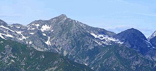
Rognosa d'Etiache or Rognosa d'Étache is a mountain in the Cottian Alps on the border of Turin, Italy, and Savoie, France. It has an elevation of 3,382 metres above sea level.

<span class="mw-page-title-main">Col d'Étache</span>

Col d'Étache in French,, is a pedestrian pass across the Cottian Alps. It connects Susa Valley and Maurienne.

<span class="mw-page-title-main">Monte Cresto</span> Mountain in Italy

Monte Cresto (2,548 m) is the third highest peak of the Province of Biella after Monte Mars (2,600 m) and Monte Bo (2,556 m).

<span class="mw-page-title-main">Mont Giusalet</span>

Mont Giusalet is a mountain in the Ambin group of the Cottian Alps in Savoie, France, near the Italian border.

<span class="mw-page-title-main">Mongioia</span> Mountain in Italy

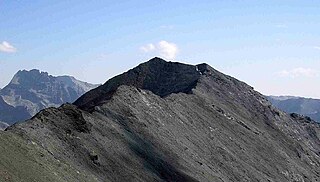
The Cima Mongioia or simply Mongioia or Bric de Rubren is a 3,340 metres high mountain of the Cottian Alps.

<span class="mw-page-title-main">Punta Nera</span> Mountain in Italy

The Punta Nera is a mountain of Savoie (France) and of the Province of Turin (Italy). It lies in the Cottian Alps range. It has an elevation of 3,047 metres above sea level.

<span class="mw-page-title-main">Cime de Missun</span> Mountain in Italy

The Cime de Mussun (French) or Cima Missun (Italian) is a mountain of the Ligurian Alps.

<span class="mw-page-title-main">Signal du Petit Mont-Cenis</span> Mountain in France

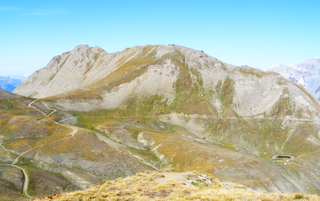
The Signal du Petit Mont-Cenis is a 3,162 m high mountain of the Cottian Alps.

<span class="mw-page-title-main">Monte Mucrone</span> Mountain in Italy

Monte Mucrone is an Alpine mountain of Piedmont.

<span class="mw-page-title-main">Pointe de Bellecombe</span> Mountain in France

The Pointe de Bellecombe is a 2,775 m high mountain of the northern Cottian Alps.

<span class="mw-page-title-main">Mont Froid</span> Mountain in France

The Mont Froid is a 2,822 m high mountain of the northern Cottian Alps.

References