Mont Froid

Last updated
Mont Froid
Mont Froid S face.png
South face
Highest point
Elevation 2,822 m (9,259 ft) [1]
Prominence 184 m (604 ft) [2] [3]
Isolation 2.47 km (1.53 mi)  OOjs UI icon edit-ltr-progressive.svg
Coordinates 45°14′15″N6°50′34″E / 45.2374425°N 6.8428755°E / 45.2374425; 6.8428755
Geography
Alps location map.png
Red triangle with thick white border.svg
Mont Froid
Location in the Alps
Location Savoie (France)
Parent range Cottian Alps
Climbing
Easiest route hiking

The Mont Froid is a 2,822 m high mountain of the northern Cottian Alps.

Contents

Geography

Fort ruins with, in the background, the Moun Froid summit Fort of Mont Froid 03.png
Fort ruins with, in the background, the Moun Froid summit

The mountain is located in the French departement of Savoie (Auvergne-Rhône-Alpes), near the Italian border. It lies close to the main chain of the Alps, to which is connected by a brief ridge starting fom a 2,719 metres high minor summit. [4] From there the main ridge follows eastwards with the Col de Sollières (2,639 m) and Signal du Petit Mont-Cenis, while southwards it continues with Col de Bellecombe (2,475 m) and Pointe de Bellecombe. [1] The Mont Froid, according to the French Alps classification, is part of the Massif des Cerces, while for the SOIUSA (International Standardized Mountain Subdivision of the Alps) it belongs to the Northern Cottian Alps. [5]

Geology

The Mont Froid is mainly made of blackish schists with an underlying basement of gypsum. [6]

History

On the mountain, which thanks to its locations can control a large part of the Moncenisio plateau and Maurienne valley floor, was built at the end of the 19th century [7] a large fortress (Ouvrage du Mont-Froid). The area was later included in the ligne Maginot fortifications, and during the II World War saw some fights facing the chasseurs alpins (French Army) and the German mountain troops. [8]

Nowadays Mont Froid is still used by the French Army for military exercise, mainly in winter, to train mountain troops to high-mountain survival techniques. [9]

Access to the summit

Summit cross Mont Froid summit cross.png
Summit cross

The summit can be reached on foot starting from the refuge du Petit Mont Cenis. The itinerary doesn't require alpinistic skills but some hiking experience and is quite popular among hikers also because its historical interest. [10] The ascent to Mont Froid can be easily combined with the neioghbouring Pointe de Bellecombe. [9]

Mountain huts

Related Research Articles

<span class="mw-page-title-main">Rocciamelone</span> Mountain in Italy

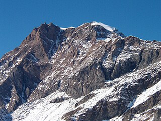
Rocciamelone is a 3,538 m high mountain in Piedmont, Italy, near the border between Italy and France.

<span class="mw-page-title-main">Rocca la Meja</span> Mountain in Italy

Rocca la Meja is a mountain in the Cottian Alps, in the comune of Canosio, Piedmont, northern Italy. It has an altitude of 2,831 m and it is located in the Maira Valley.

<span class="mw-page-title-main">Mont Bégo</span>

Mont Bégo is a mountain in the Mercantour massif of the Maritime Alps, in southern France, with an elevation of 2,872 metres (9,423 ft). It is included in the Vallée des Merveilles.

<span class="mw-page-title-main">Monte Granero</span> Mountain in Italy

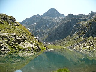
Monte Granero is a peak in the Cottian Alps, in western Piedmont, northern Italy. It has an elevation of 3,170 m. It is located between the Val Pellice and the Valle Po, not far from the boundary with France.

<span class="mw-page-title-main">Monte Meidassa</span> Mountain in Italy

Monte Meidassa is a peak in the Cottian Alps, in western Piedmont, northern Italy. The slightly higher Monte Granero is located nearby.

<span class="mw-page-title-main">Pointe de Paumont</span> Mountain in Italy

Pointe de Paumont or Cima del Vallone is a mountain of Savoie, France and of the Province of Turin, Italy. It lies in the Cottian Alps range. It has an elevation of 3,171 metres above sea level.

<span class="mw-page-title-main">Punta Bagnà</span> Mountain in Italy

Punta Bagnà or Cime du Grand Vallon is a mountain of Savoie, France and of the Province of Turin, Italy. It lies in the Cottian Alps range. It has an elevation of 3,129 metres above sea level.

<span class="mw-page-title-main">Punta Sommeiller</span> Mountain in Italy

Punta Sommeiller or Pointe Sommeiller is a mountain of the Province of Turin, Italy and of Savoie, France. It lies in the Cottian Alps range. It has an elevation of 3,333 metres (10,935 ft) above sea level.

<span class="mw-page-title-main">Rognosa d'Etiache</span> Mountain in Italy

Rognosa d'Etiache or Rognosa d'Étache is a mountain in the Cottian Alps on the border of Turin, Italy, and Savoie, France. It has an elevation of 3,382 metres above sea level.

The Colle della Croce (Italian) or Col Lacroix is a pedestrian pass of the Cottian Alps.

<span class="mw-page-title-main">Punta Ramiere</span> Mountain in Italy

The Punta Ramiere or Bric Froid is a mountain in the Cottian Alps belonging to the department of Hautes-Alpes (FR) and the province of Turin (IT). It's the highest peak of the long stretch of the Po/Rhone water divide starting from the Aiguille de Scolette (north) and ending with the Monviso group (south).

<span class="mw-page-title-main">Punta Marguareis</span> Mountain in Italy

The Punta Marguareis (It) or Pointe Marguareis (Fr) is a mountain in the Ligurian Alps, on the boundary between Italy and France; It is the highest peak of the Ligurian Alps.

<span class="mw-page-title-main">Punta Merciantaira</span> Mountain in Italy

The Punta Merciantaira or Grand Glaiza is a 3,293 metres high mountain of the Cottian Alps.

<span class="mw-page-title-main">Grand Queyron</span> Mountain in Italy

The Gran Queyron or Grand Queyron is a 3,060 metres high mountain of the Cottian Alps.

<span class="mw-page-title-main">Punta Nera</span> Mountain in Italy

The Punta Nera is a mountain of Savoie (France) and of the Province of Turin (Italy). It lies in the Cottian Alps range. It has an elevation of 3,047 metres above sea level.

<span class="mw-page-title-main">Pointe Rochers Charniers</span> Mountain in France

The Pointe Rochers Charniers is a mountain of the Cottian Alps at an elevation of 3,063 metres above sea level, located in France.

<span class="mw-page-title-main">Monte Bertrand</span> Mountain in Italy

Monte Bertrand (Italian) or Mont Bertrand (French) is a mountain located on the French-Italian border between Piemonte and Provence-Alpes-Côte d'Azur.

<span class="mw-page-title-main">Cime de Missun</span> Mountain in Italy

The Cime de Mussun (French) or Cima Missun (Italian) is a mountain of the Ligurian Alps.

<span class="mw-page-title-main">Signal du Petit Mont-Cenis</span> Mountain in France

The Signal du Petit Mont-Cenis is a 3,162 m high mountain of the Cottian Alps.

<span class="mw-page-title-main">Pointe de Bellecombe</span> Mountain in France

The Pointe de Bellecombe is a 2,775 m high mountain of the northern Cottian Alps.

References

  1. 1 2 "Géoportail" (in French). IGN . Retrieved 2022-01-15.
  2. key col: Col de Sollières (2,639 m)
  3. "Mont Froid, France". peakbagger.com. Retrieved 2022-01-22.
  4. Aruga, Losana, Re 1985 , p. 370-371.
  5. Marazzi, Sergio (2005). Atlante Orografico delle Alpi. SOIUSA (in Italian). Priuli & Verlucca. p. 90. ISBN   978-88-8068-273-8.
  6. Boell, Jacques (1962). "La tragédie du Mont-Froid". Eclaireurs-skieurs au combat (in French). p. 219.{{cite book}}: Unknown parameter |agency= ignored (help)
  7. AA.VV. (1976). Travaux (in French). Société d'histoire et d'archéologie de Maurienne. p. 233. Retrieved 2022-01-22.
  8. Revue Historique Des Armées – ed. 198–201 (in French). Ministère des armées. 1995. p. 138. Retrieved 2020-02-10.
  9. 1 2 Hodges, Andy (2012). "Route 7. Mont Froid". Mountain Adventures in the Maurienne. Cicerone Press. pp. 59–62. ISBN   9781849657556 . Retrieved 2021-01-10.
  10. igi02_to (2020-09-04). "Froid (Mont) dal Refuge du Petit Mont Cenis" (in Italian). gulliver.it. Retrieved 2021-01-10.{{cite web}}: CS1 maint: numeric names: authors list (link)
  11. "Refuge le Petit Mont Cenis". Haute Maurienne Vanoise. Retrieved 2022-01-22.

Bibliography

Maps