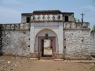
Andoorkonam

Last updated

Andoorkonam
Village
India Kerala location map.svg
Red pog.svg
Andoorkonam
Location in India
India location map.svg
Red pog.svg
Andoorkonam
Andoorkonam (India)
Coordinates: 8°35′49″N76°51′59″E / 8.59694°N 76.86639°E / 8.59694; 76.86639
CountryFlag of India.svg  India
State Kerala
District Thiruvananthapuram
Taluk Thiruvananthapuram
Population
 (2001)
  Total14,736
Time zone UTC+5:30 (IST)
Vehicle Code RangeKL-22,KL-01

Andoorkonam is an area in Trivandrum city in the Indian state of Kerala. [1]

Contents

It is located approximately 20 km from the Thiruvananthapuram city. Andoorkonam is noted for its reserves of Kaolinite (china clay). [2] The temple of Sree Ramadasa Ashram is nearby. [2]

Demographics

As of the 2001 Indian census, Andoorkonam had a population of 14,736 with 7,147 males and 7,589 females. [1]

Culture

Trijyotipuram Mahavishnu temple with the presence of Trimurti, is situated in this place.

Maruppancodu Devi temple and the Kudamuttom Jama-ath are also situated here.

Velloor Muslim Jama-ath and Kottuppa (R) Mah-lara are situated nearby Pallippuram, AndoorKonam.

Panimoola Devi temple is situated nearly 1.5km away from Andoorkonam junction

Facilities

The CommunityHealthCentre (CHC) at Andoorkonam junction is the main health care facility in this Village.

A Govt. HomeoDispensary is also functioning in Andoorkonam Panchayath. It was upgraded to Govt.Model Homoeo Dispensary in December 2018.

AndoorkonamLPSchool is a much sought after institution which has helped in the educational uplifting of the people of this village.

The AKGSamskarikasamithy and the RepublicLibrary contribute a lot in various cultural, sports and educational activities.

SitharaArts & Sports club is a social service organization that promotes cultural development. AllBrothersartsandsports club is also functioning here very effectively.

ChirakkakamClinicalServices (CCS) is the Private Hospital at Andoorkonam junction functioning since 2008.

Geography

The village is surrounded by Pallippuram to the north, Vembayam to the east, Vavara Ambalam to the west and Kazhakoottam to the south. [2]

Related Research Articles

<span class="mw-page-title-main">Vithura</span> Town in Kerala, India

Vithura, also known as the Hill City Of Trivandrum, is located 36 km from Thiruvananthapuram capital of the Kerala state in India. Vithura is the culmination of the crossroads to many tourist, cultural, and religious centres. Surrounded by the Western Ghats (Sahyadris), Vithura is a tourist spot. The village has a good climate year-round. The Indian Institute of Science Education and Research, Thiruvananthapuram campus is situated here.

Edathala is a gram panchayat near Aluva town. It is also a village in Aluva taluk of Ernakulam district, in the state of Kerala, India.

Kaniyapuram is a residential and IT industrial area of Thiruvananthapuram metropolitan area of Trivandrum city around 14 kilometres (8.7 mi) from Thiruvananthapuram, Kerala, India. The main centre of Kaniyapuram area is located in NH-66 in between Kazhakkoottam and Pallippuram CRPF Base. The Kaniyapuram locality is a vast area and expands to; Andoorkonam in the East, Parvathy Puthanar in the West, Vetturoad in the South and Pallippuram in the North. The Kaniyapuram town belongs to the Andoorkonam Panchayat, although Andoorkonam still remains a village 3 kilometres (1.9 mi) to the east.The main town in Kaniyapuram is Alummoodu junction.

Munirabad, also called Huligi, is a Town in the Koppal district in the Indian state of Karnataka.

Pakalkuri is a charming village situated in the eastern part of Varkala Taluk in Thiruvananthapuram District in Kerala, India. It is situated 20 km east of Varkala Town on the banks of the river Ithikkara and well known for its serene beauty and landscape. The river Ithikkara, which originates from the Western Ghats, separates Thiruvananthapuram and Kollam Districts at Pakalkuri in its meandering to the Arabian sea.

Pallippad is a village near Haripad in Alappuzha district in the Indian state of Kerala. The name Pallippad is believed to be derived from Buddhist terminology.The famous River Achankovil Aar passes by Pallippad before it reaches Veeyapuram. The village has abundant water resources, small lakes, and water paths that connect to Alappuzha.

<span class="mw-page-title-main">Thaikattussery</span> Village in Kerala, India

Thycattusserry is a village in the Cherthala taluk of the Alappuzha district in the Indian state of Kerala.

Vallikunnam is a village in Mavelikara taluk of Alappuzha district in the Indian state of Kerala.

<span class="mw-page-title-main">Venmony</span> Village in Kerala, India

Venmony is a village in Chengannur taluk of Alappuzha district of Central Travancore area in Kerala state, India. Venmoney is 18 km south of Thiruvalla, 11 km east of Mavelikkara and 9 km northwest of Pandalam. 12 km from Chengannur. It is located 55 km towards East from District headquarters Alappuzha. 107 km from State capital Thiruvananthapuram and 138 km from Cochin International Airport. The village is on the border of the Alappuzha District and Pathanamthitta District. The Achenkovil river flows on its southern boundary and is spanned by the Pulakadavu bridge.

Poothakkulam, also known as Bhoothakkulam, is a village in Kollam district in the state of Kerala, India. The village is located 3.9 km away from Paravur, 11.4 km from Varkala and 23 km from Kollam. In 2011, it had a population of 628,451 residents. The village covers an area of 16.56 km2.

Vazhoor is a town in Kottayam district in the state of Kerala, India.It is a village, panchayat and block with headquarters at Kodungoor on NH183. Basically an agrarian community inhabits this part, whose income depends on rubber cultivation

Kavumbhagom, also spelled Kavumbhagam, is a ward and a census village in Thiruvalla municipality, in the Pathanamthitta district of Kerala, India. The village has a population of 6644 as of 2011. Kavumbhagom is an important junction serving as a major road route connecting Changanasserry, Thiruvalla, Chathenkary, and Mavelikkara. The Thiruvalla Sree Vallabha temple, after which the town of Thiruvalla has been named, is located in Kavumbhagom.

<span class="mw-page-title-main">Kondazhy</span> Village in Kerala, India

Kondazhy is a Grama Panchayat & village in Thrissur district in the state of Kerala, India.

Huvina Hipparagi also Huvin Hipparagi is a Town in the southern state of Karnataka, India. It is located in the Basavana Bagevadi taluk of Vijayapura district in Karnataka.

Vadaseri South is a major village in the Orathanadu taluk of Thanjavur district in the Indian state of Tamil Nadu. Vadaseri comes under the Orathanadu constituency which elects a member to the Tamil Nadu Legislative Assembly once every five years and it is a part of the Thanjavur which elects its Member of Parliament (MP) once in five years. The village is administered by the Vadaseri panchayat, which covers an area of 12.2826 km2 (4.7423 sq mi). As of 2011, the village had a population of 4,810. Most of the population belongs to the Agamudaiyar-Thevar Community who maintain strong cultural and social bindings.The village is a part of the fertile Cauvery delta region and agriculture is the major occupation. Roadways and railways are the major mode of transportation to Vadaseri, the nearest railway stations are Mannargudi and Pattukkottai and the nearest international airport is Tiruchirapalli Airport, located 100 km (62 mi) away from the village, in the city of Tiruchirappalli.

<span class="mw-page-title-main">Muttom, Thodupuzha</span> Gram Panchayat in Kerala, India

Muttom is a rural area in Idukki district in the Indian state of Kerala. This place is 66 km away from Cochin. Geographically this place is part of Midland or Idanad region of Kerala.

<span class="mw-page-title-main">Punthalathazham</span> Neighbourhood in Kollam, Kerala, India

Punthalathazham is a landlocked neighbourhood of the city of Kollam in the Indian state of Kerala. It is located around six kilometres east of the core Kollam (Quilon) city towards Kannanalloor . This place has a little geographical importance and serves as the tail boundary of Kollam Municipal Corporation. Inhabitants belong to working and middle classes.

Babalad or Muttyna Babalad is a village in the southern state of Karnataka, India. It is located in Bijapur taluk of Bijapur district, Karnataka. It is nearly 25 km from the district headquarters, Bijapur. It's one of several small villages near Bijapur.

Educational organizations in Cherthala, Kerala, India include multiple primary, secondary and tertiary institutions.

<span class="mw-page-title-main">Bargaon, Odisha</span> Village in Odisha, India

Bargaon or Baragan is a village under Khariar Tahasil in Nuapada district of Odisha state in India. It is situated 10 km away from sub-district headquarters Khariar and 63 km towards south from district headquarters Nuapada. The word "Bargaon" is composed of two words, "Bara" means 'Divine' and "gaan" means 'village'. On the 150th birth anniversary of Mahatma Gandhi, the village was recognised as "Lok Kala Gram" of Nuapada district by the Dept. Of Language, Literature, and Culture, Government of Odisha.

References

  1. 1 2 "Census of India : Villages with population 5000 & above". Registrar General & Census Commissioner, India. Archived from the original on 8 December 2008. Retrieved 10 December 2008.
  2. 1 2 3 "Andoorkonam". India9.com. Retrieved 15 December 2008.