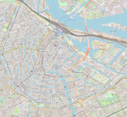
Location | Amsterdam |
---|---|
Postal code | 1016 |
Coordinates | 52°22′42″N4°53′00″E / 52.378415°N 4.883358°E Coordinates: 52°22′42″N4°53′00″E / 52.378415°N 4.883358°E |
The Anjeliersgracht (Carnation Canal) is a former canal in the Jordaan neighborhood of Amsterdam. After being backfilled in 1861, it is now Westerstraat.
Anjeliersgracht is located between Marnixstraat and Noordermarkt. [1] The canal led from Prinsengracht just south of Noorderkerk to Lijnbaansgracht. Anjeliersstraat runs parallel to the former Anjeliersgracht, today's Westerstraat.
Anjeliersgracht was dug in the 17th century. [1] Houses started to be built along the canal in 1650. Due to the damp, sandy soil, some of the historic buildings suffer from subsidence.
A distillery for liqueurs, bitters and elixirs was founded on the Anjeliersgracht in 1684 by Jacob Bols, nephew of Lucas Bols. [2] The company had a house, yard, distillery and store. The neighborhood around the "Rinsche Anijsvat" distillery held artisanal companies, distilleries, beer brewers and ship's bakeries. [3] The company became the property of Frederik van Zuylekom in 1754, and in the 19th century was merged with Levert & Co. to become Van Zuylekom, Levert & Co. The company was still at Westerstraat 176–180 after the canal was drained. [2] By 1750 the Noordermarkt near the north of the canal was a popular weekly market. In 1845 it was placed under the municipal administration and stallholders now had to pay rent.
In the mid-19th century Jan Schenkman, author of the children's book Sint Nicolaas en zijn knecht (1850), was the head of a school on the Anjeliersgracht, by then one of the dirtiest canals in Amsterdam. People used it to dispose of garbage and human excrement, and the canal smelled strongly. The school had a high ceiling so the children would avoid infection from diseases such as typhus, cholera and malaria, which were thought to spread through bad vapors. [4]
The Jordaan was Amsterdam's poorest and most densely populated neighborhood. It began to be cleaned up in the mid-19th century by philanthropic construction companies that demolished shacks and built new houses for workers. [3] Anjeliersgracht was drained in 1861, as were many other Amsterdam canals at the time, and in 1862 it was renamed Westerstraat. The reasons for conversion to a street were the poor water quality and the need to handle increasing road traffic. [1] The new Westerstraat, the pride of the city, was the widest street in Amsterdam. [5]
The canal has given its name to the Anjeliersgracht (1990), a cargo ship, and the Anjeliersgracht (2009), an inland tanker.
The Noordermarkt is a square in the Jordaan neighborhood of Amsterdam in the Netherlands. The square is dominated by the 17th-Century Noorderkerk church, and is lined by cafés and restaurants. Markets are held on the square every Monday. On Saturdays, a popular organic farmer's market is held on the square. On Mondays a market is also held in the adjacent Westerstraat street.
Amsterdam, capital of the Netherlands, has more than 100 kilometers (62 mi) of grachten (canals), about 90 islands and 1,500 bridges. The three main canals, dug in the 17th century during the Dutch Golden Age, form concentric belts around the city, known as the Grachtengordel. Alongside the main canals are 1550 monumental buildings. The 17th-century canal ring area, including the Prinsengracht, Keizersgracht, Herengracht and Jordaan, were listed as UNESCO World Heritage Site in 2010, contributing to Amsterdam's fame as the "Venice of the North".
De Negen Straatjes is a neighbourhood of Amsterdam, Netherlands located in the Grachtengordel, a UNESCO World Heritage Site.
The Brouwersgracht is a canal in Amsterdam that connects the Singel with the Singelgracht. The canal marks the northwestern border of the Grachtengordel. Between the Prinsengracht and the Singelgracht the Brouwersgracht forms the northern border of the Jordaan neighborhood.
"Aan de Amsterdamse grachten" is a Dutch song by Pieter Goemans. It was written in 1949 but not recorded until 1956, and many times more since then. It is one of the standard songs celebrating the city of Amsterdam, and one of the best-known and most popular songs in the Netherlands.
Lijnbaansgracht is a partly filled-in canal in Amsterdam which bends beyond the boundary of the center, Amsterdam-Centrum. The canal runs parallel to the Singelgracht, between the Brouwersgracht and the Reguliersgracht.
The Egelantiersgracht in Amsterdam is a canal in the Jordaan neighbourhood in the Amsterdam-Centrum borough. The canal lies between the Prinsengracht and the Lijnbaansgracht.
The Rozengracht is a street in the Jordaan neighbourhood of Amsterdam. It runs between the Prinsengracht at the Westermarkt and the Singel canal at De Clercqstraat. The name means "Rose canal".
The Passeerdersgracht is a short canal in Amsterdam, the Netherlands, that connects the Prinsengracht with the Lijnbaansgracht. The canal is the southernmost in the Jordaan neighbourhood and borders the west part of the Grachtengordel.
The Bloemgracht is a canal in the Jordaan district of Amsterdam, the Netherlands. It connects the Prinsengracht with the Lijnbaansgracht and runs between and parallel to Nieuwe Leliestraat and Bloemstraat in the Amsterdam-Centrum district. The canal is named after the bulwark "de Bloem", later called "Rijkeroord". From 1614 a windmill was located here, but it was moved to Haarlemmerweg in 1878.
The Leidsegracht is a canal in Amsterdam, the Netherlands. It is a cross-canal in Amsterdam-Center that connects Herengracht, Keizersgracht, Prinsengracht and Lijnbaansgracht and flows into the Singelgracht at Marnixstraat.
The Looiersgracht is a short canal in Amsterdam, between Prinsengracht and Lijnbaansgracht in the Jordaan neighborhood of the Amsterdam-Centrum district. The Looiersgracht borders the Grachtengordel. The Oude Looiersstraat runs parallel to the canal, and the Eerste, Tweede and Derde Looiersdwarsstraat are side streets entering the north side.
The Leliegracht is a canal in Amsterdam, the Netherlands, between Herengracht and Prinsengracht. The canal lies within the western Grachtengordel in the Jordaan neighborhood of the Amsterdam-Centrum district.
The Elandsgracht is a street and former canal in Amsterdam, the Netherlands. It runs between the Prinsengracht and the Singelgracht in the Jordaan neighborhood of the Amsterdam-Centrum district. Bridge 169 over the Singelgracht and Bridge 107 over the Lijnbaansgracht connect the Elandsgracht in the direction of the Kinkerstraat. The Elandsgracht is in the west of the Grachtengordel. The Elandsstraat runs parallel to the Elandsgracht. There are houses, shops, cafés and restaurants on the former canal, with parking spaces in the middle.
The Leprozengracht was a canal in Amsterdam that defined one side of the Vlooyenburg island. Leprozengracht and the connected Houtgracht canal were filled in 1882 to form the Waterlooplein.
The Houtgracht was a canal in Amsterdam that defined one side of Vlooyenburg island. Houtgracht and the connected Leprozengracht canal were filled in 1882 to form the Waterlooplein.
The Vijzelgracht is a street and former canal in Amsterdam. The Vijzelgracht is adjacent to the Grachtengordel and is an extension of one of the most important city radii for public transport and normal traffic. This through route leads via Vijzelstraat, Rokin, Dam Square and Damrak to Central Station. To the south of Vijzelgracht, the Nieuwe Vijzelstraat connects to Weteringschans.
The Lindengracht is a street and former canal in Amsterdam. It is in the Jordaan neighborhood of the Centrum district just west of the canal belt. The canal was back-filled in 1895. It connected the Brouwersgracht with the Lijnbaansgracht. The Eerste Lindendwarsstraat and Tweede Lindendwarsstraat are side streets. Lindenstraat runs parallel to the Lindengracht.
The Goudsbloemgracht was a street and former canal in Amsterdam, in the Jordaan neighborhood of the Centrum district. After the canal was backfilled in 1857 the street was renamed Willemsstraat.
The Westerstraat is a major street in the Jordaan, a neighborhood of Amsterdam, in the Netherlands. The street was created by the filling in of the Anjeliersgracht. It runs from the Noordermarkt to the Marnixstraat. Besides residential homes and shops, including a supermarket, there are restaurants and cafes.