History
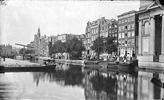
The Vijzelgracht dates from the time of the major expansion of Amsterdam in 1658. A 1737 map of Amsterdam by Gerrit de Broen shows the canal starting from the Baan Graft (Lijnbaansgracht) just east of the Molen de Weetering (Wetering Mill) on the city wall ramparts. The short canal ran north to Prince Graft (Prinsengracht). The street to the east of the canal (Vijzelstraat) continued north to the Cingel (Singel) just past the point where the Amstel split into the Singel and the Rokin. The canal and street are most likely named for the 17th-century residents Cornelis and Jan Vijselaar, although the name was only made official in 1874.
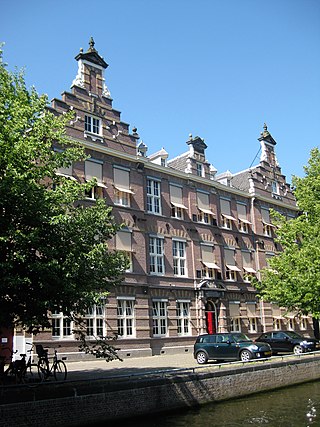
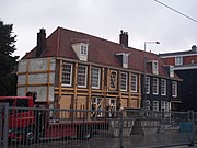
The canal is shown on the 1662 map by Daniël Stalpaert, with some houses already built along the streets leading to the east and west. The area around the Vijzelsgracht in the 1670s was called "Noortse Bosch". Many of the small houses were built for wool combers, spinners and weavers. The city wanted to stimulate the textile industry, and made the land available to the Burgerweeshuis, Gasthuizen and Leprozenhuis. These charities built the houses and used the rent to feed and clothe their orphans and lepers. Weaver houses were also built in the adjacent Noorderstraatand Weteringbuurt, (formerly called 'Het Vlakke Veld'). In total, the neighborhood had more than 200 weaver houses at that time.
In the 17th century, on the corner with Vijzelgracht and Lijnbaansgracht, the "city street maker's yard" was surrounded by water. During the late 19th and the first half of the 20th century the buildings of the flour and bread factory "Holland" were located here. In 1933 it was decided to back-fill the canal.
Since 1883 horse trams have been driving through Vijzelstraat and Vijzelgracht. The electric tram appeared in 1904. Since then line 4 has been driving this route. Line 16 was added in 1913. Vijzelstraat was widened in 1917 and 1926, after which there was room for two new tram lines: line 24 in 1929 and a year later line 25. The route of line 4 was shifted to Utrechtsestraat in 1948. Since the lifting of tram line 25 in December 2013 and tram line 16 on July 22, 2018, only tram line 24 runs through the Nieuwe Vijzelstraat, Vijzelgracht and Vijzelstraat.
Construction of the North / South line
Work was carried out on the North / South metro line (Noord / Zuidlijn) between 2002 and 2018, and Vijzelgracht metro station is now located under Vijzelgracht. A number of residents of the Vijzelgracht suggested digging the canal again. The street was already open for construction of the station, it was argued, so the historic appearance of the canal could be restored immediately. The neighborhood committee "Vijzelgracht - Entree met Kracht" was set up by enthusiastic local residents. The Amsterdam-Centrum District Council also initially expressed a positive opinion on the return of the water. However, the Amsterdam City Council rejected the plan in April 2006, since it would be too expensive. [6]
Construction of the Noord / Zuidlijn on the Vijzelgracht led to major problems. In October 2004, the first subsidence occurred near the Vijzelgracht when seven buildings sagged about 2.5 centimetres (0.98 in). On 19 June 2008, four monumental buildings (weaver houses) sagged 15 centimetres (5.9 in) due to a leak in the deep wall. The work was stopped on 23 June. [7] Work on Vijzelgracht was resumed on 9 September 2008. The municipality and the project office had investigated and thought it was safe to continue working. However, the next day (10 September), buildings on Vijzelgracht began to sag again. This time, six buildings sagged as much as 23 centimetres (9.1 in) within a few hours. The cause was again a leak in a deep wall. [8] The residents were accommodated in hotels. [9]
In January 2009, a driver who supplied concrete for the sheet piles at Vijzelgracht station reported to the press that concrete had been used that was already hours past its shelf life. As a result, the quality of the concrete was poor and the walls brittle. In 2008, the Deltares research agency hired by the municipality of Amsterdam found 114 weak spots and a hole in the concrete sheet piles of the Vijzelgracht. According to Deltares, those weak spots were caused, among other things, by the use of bad and polluted concrete and poor reinforcement. [10]

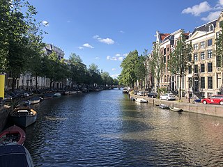
The Prinsengracht is a 3.2-kilometer (2.0 mi)-long canal that runs parallel to the Keizersgracht in the center of Amsterdam. The canal, named after the Prince of Orange, is the fourth of the four main canals belonging to the canal belt.
The Keizersgracht is a canal in Amsterdam, the Netherlands. It is the second of the three main Amsterdam canals that together form the Grachtengordel, or canal belt, and lies between the inner Herengracht and outer Prinsengracht.

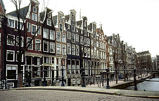
Amsterdam, capital of the Netherlands, has more than 100 kilometers (62 mi) of grachten (canals), about 90 islands and 1,500 bridges. The three main canals, dug in the 17th century during the Dutch Golden Age, form concentric belts around the city, known as the Grachtengordel. Alongside the main canals are 1550 monumental buildings. The 17th-century canal ring area, including the Prinsengracht, Keizersgracht, Herengracht and Jordaan, were listed as UNESCO World Heritage Site in 2010, contributing to Amsterdam's fame as the "Venice of the North".
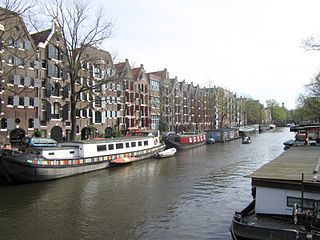
The Brouwersgracht is a canal in Amsterdam that connects the Singel with the Singelgracht. The canal marks the northwestern border of the Grachtengordel. Between the Prinsengracht and the Singelgracht the Brouwersgracht forms the northern border of the Jordaan neighborhood.

The Walloon Church is a Protestant church building in Amsterdam, along the southern stretch of the Oudezijds Achterburgwal canal. The building dates to the late 15th century and has been in use as a Walloon church since 1586. The church was also known as the Franse Kerk, Walenkerk, Oude Walenkerk, or Oude Waalse Kerk.

Vijzelgracht metro station is a station on the Route 52 of the Amsterdam Metro in Amsterdam, Netherlands. It was opened on 22 July 2018.
The Egelantiersgracht in Amsterdam is a canal in the Jordaan neighbourhood in the Amsterdam-Centrum borough. The canal lies between the Prinsengracht and the Lijnbaansgracht.

The Rozengracht is a street in the Jordaan neighbourhood of Amsterdam. It runs between the Prinsengracht at the Westermarkt and the Singel canal at De Clercqstraat. The name means "Rose canal".
The Nieuwe Herengracht is a canal in Centrum district of Amsterdam. The canal is an extension of the Herengracht that runs between the Amstel and the Scharrebiersluis (lock) leading to the Schippersgracht from the Entrepotdok. It is in the Plantage neighborhood in the eastern part of the Grachtengordel.
The Nieuwe Prinsengracht is a canal in the Plantage neighborhood of Amsterdam, an extension of the Prinsengracht in the eastern Grachtengordel.
The Leidsegracht is a canal in Amsterdam, the Netherlands. It is a cross-canal in Amsterdam-Center that connects Herengracht, Keizersgracht, Prinsengracht and Lijnbaansgracht and flows into the Singelgracht at Marnixstraat.

The Looiersgracht is a short canal in Amsterdam, between Prinsengracht and Lijnbaansgracht in the Jordaan neighborhood of the Amsterdam-Centrum district. The Looiersgracht borders the Grachtengordel. The Oude Looiersstraat runs parallel to the canal, and the Eerste, Tweede and Derde Looiersdwarsstraat are side streets entering the north side.

The Leliegracht is a canal in Amsterdam, the Netherlands, between Herengracht and Prinsengracht. The canal lies within the western Grachtengordel in the Jordaan neighborhood of the Amsterdam-Centrum district.
The Geldersekade is a canal and a street in Amsterdam that connects the Nieuwmarkt with the Prins Hendrikkade. The Geldersekade is in the easternmost part of De Wallen, the red light district, and borders Chinatown.

The Zoutkeetsgracht is a canal to the west of the center of Amsterdam.

The Plantage Muidergracht is a canal and street in the Plantage neighborhood of Amsterdam. On and along the Plantage Muidergracht, near Roeterseiland, are some of the buildings of the University of Amsterdam, originally built for courses or subfaculties of physics, chemistry, biology, environmental science and mathematics, but now used by other faculties.
The Schippersgracht is a canal and street in the Centrum district of Amsterdam that runs from the Rapenburgerplein to the Prins Hendrikkade.

The Elandsgracht is a street and former canal in Amsterdam, the Netherlands. It runs between the Prinsengracht and the Singelgracht in the Jordaan neighborhood of the Amsterdam-Centrum district. Bridge 169 over the Singelgracht and Bridge 107 over the Lijnbaansgracht connect the Elandsgracht in the direction of the Kinkerstraat. The Elandsgracht is in the west of the Grachtengordel. The Elandsstraat runs parallel to the Elandsgracht. There are houses, shops, cafés and restaurants on the former canal, with parking spaces in the middle.
The Houtgracht was a canal in Amsterdam that defined one side of Vlooyenburg island. Houtgracht and the connected Leprozengracht canal were filled in 1882 to form the Waterlooplein.

The Anjeliersgracht is a former canal in the Jordaan neighborhood of Amsterdam. After being backfilled in 1861, it is now Westerstraat.


.jpg)