Martelaarsgracht

Last updated
Martelaarsgracht
Martelaarsgracht.jpg
The Martelaarsgracht looking towards Nieuwezijds Voorburgwal
Amsterdam centre map.png
Red pog.svg
Location Amsterdam
Postal code1012
Coordinates 52°22′40″N4°53′47″E / 52.377889°N 4.896344°E / 52.377889; 4.896344 Coordinates: 52°22′40″N4°53′47″E / 52.377889°N 4.896344°E / 52.377889; 4.896344
West endNieuwezijds Voorburgwal
To Prins Hendrikkade
The Martelaarsgracht with Oude Haarlemmersluis ; circa 1670. Painting by Jan van der Heyden The Martelaarsgracht in Amsterdam 1670 Jan van der Heyden.jpg
The Martelaarsgracht with Oude Haarlemmersluis ; circa 1670. Painting by Jan van der Heyden

Martelaarsgracht (Martyr's Canal) is a street and former canal in Amsterdam, the Netherlands.

Contents

Location

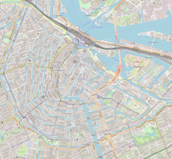
The Martelaarsgracht is an extension of the Nieuwezijds Voorburgwal and runs in a northeastern direction to the Prins Hendrikkade and the Stationsplein in front of Central Station. Hekelveld square separates the Martelaarsgracht from the Spuistraat. The Martelaarsgracht has been a short but wide and busy street since the canal was filled in 1884, and has been an electric tram route since 1906. The street has a central reservation with escape walls for the tram, but there is no longer a stop. There are, among other things, hotels, snack bars and internet cafés.

Origin of the name

The origin of the remarkable name is unknown. There are, however, different theories. The place could have been used as a gallows field, but there are no sources for that. According to the Amsterdam City Archives, there would once have been a house with a signboard depicting a martyr. In an old source there is a building "where the martyr hung". [1]

History

The Oude Haarlemmersluis with Martelaar Bridge at the Nieuwendijk; before the infill in 1884 Martelaarsgracht bij Nieuwendijk.jpg
The Oude Haarlemmersluis with Martelaar Bridge at the Nieuwendijk; before the infill in 1884

The first Haarlemmerpoort stood on the spot where Martelaarsgracht and Nieuwendijk now meet. Around 1400 the bank of the IJ must have been at the level of the current plot boundary between Martelaarsgracht 6 and 8. When part of the IJ north of the area was filled in at the beginning of the 15th century, the canal came to lie within the city walls. Afterwards the water from the Nieuwezijds Voorburgwal and that of the Nieuwezijds Achterburgwal flowed through the Martelaarsgracht via the Oude Haarlemmersluis to the IJ. Exactly how the urban expansion took place could be investigated locally when in 2003 a few derelict buildings were demolished for new construction in the northern corner. [2]

The Martelaarsbrug (bridge no. 29) ran over the Oude Haarlemmersluis, a lock that connected the two parts of the Nieuwendijk. The Spaarndammerbrug, a drawbridge, was at the Texelsche Kade (since 1879 Prins Hendrikkade). Both bridges disappeared when the canal was filled. The canal was filled in 1884, before Central Station was built, at the same time as the Nieuwezijds Voorburgwal.

In 1928 many buildings on the Martelaarsgracht acquired the status of a monument. This could not prevent some buildings being subject to speculation in the 1980s and 1990s and subsequently being squatted.

Buildings

Some of the buildings were built in the stately Style Louis XIV from the early 18th century. A number of buildings have been designated as Rijksmonument s (national monuments).

The imposing building of the Koninklijke Hollandsche Lloyd on the corner with the Prins Hendrikkade was built in 1917–21 against the advice of the then Welstand Commission. [3] The building on the opposite corner, with the advertising text "Kopje Koffie Karpershoek" on the cornice, dates from 1629. The café is said to be the oldest pub in Amsterdam. The Karpershoek started in 1606 as an inn on the IJ for the sailors of the Dutch East India Company (VOC). There is still silver sand on the floor of this brown café, as was used in the 17th century.

Other Martelaarsgrachts

The Martelaarsgracht in Assendorp, Zwolle was filled in in 1923. [4] Previously there was also a Martelaarsgracht in Bovenkerk near Amstelveen. [5]

There is also a Martelaarsgracht in the city of Hoorn. This runs from the Pakhuisbrug to the Achterstraat (originally to the Gouw). The northern quay was renamed Onder de Boompjes in the 19th century.

Notes

    1. Amsterdam.nl: Bekende en onbekende namen van bruggen, sluizen en tunnels binnen de Gemeente Amsterdam (2008)
    2. Amsterdam.nl: Martelaarsgracht, aanplemping in het IJ (15 september 2010)
    3. Amsterdamsebinnenstad.nl: De nieuwe Rijksmonumenten (Walther Schoonenberg, november 2000)
    4. Assendorpernieuws.nl: Beknopte geschiedenis van Assendorp (Dick Hogenkamp)
    5. Historischamstelveen.nl: Verdwenen topografische namen

    Sources

    Related Research Articles

    Rokin Canal in Amsterdam

    The Rokin is a canal and major street in the centre of Amsterdam. The street runs from Muntplein square to Dam square. The Rokin canal used to run from Muntplein square to Dam Square, but in 1936, the part between Spui square and Dam Square was filled in. Canal boats are now moored on the remaining part of the water, from the Amstel to Grimburgwal.

    Nieuwezijds Voorburgwal Street in Amsterdam

    The Nieuwezijds Voorburgwal is a street in the centre of Amsterdam. The street runs more or less north-south, and the Raadhuisstraat runs west.

    Walls of Amsterdam

    The walls of Amsterdam were built in the Middle Ages to protect the city against attack. The Medieval walls were replaced with a series of bastions in the 17th century. In the 19th century, the walls were torn down and replaced with the Defence Line of Amsterdam, a fortification line which encircled Amsterdam at a distance from the city.

    Scheepvaarthuis

    The Shipping House is a building on the western tip of the Waalseiland near Amsterdam harbour that is one of the top 100 Dutch heritage sites and generally regarded as the first true example of the Amsterdam School, a style characterised by "expressive dynamism, lavish ornamentation and colourful embellishments". It is situated on the Prins Hendrikkade and was erected on the spot where Cornelis Houtman's first trip to the East Indies had begun in 1595. The first part was built 1913 - 1916 ; the second part was built 1926 -1928. Originally, it was the headquarters of six leading Amsterdam shipping companies: the Netherlands Steamship Company (SMN), the Royal Packet Navigation Company (KPM), the Java-China-Japan Line (JCJL) and the Royal Dutch Steamboat Company (KNSM) with subsidiary New Rhine Navigation Company (NRM) and acquired in 1912 Royal West India Mail Service (KWIM).

    Nieuwendijk, Amsterdam Street in Amsterdam

    The Nieuwendijk is a major shopping street in central Amsterdam. There are some 200 shops along the street. The street, which dates to the early medieval history of Amsterdam, counts 98 buildings with rijksmonument status.

    Oudezijds Voorburgwal Canal in Amsterdam

    The Oudezijds Voorburgwal, often abbreviated to OZ Voorburgwal, is a street and canal in De Wallen in the center of Amsterdam. The OZ Voorburgwal runs from the Grimburgwal in the south to the Zeedijk in the north, where it changes into the Oudezijds Kolk, which drains into the IJ.

    Grimburgwal Canal in Amsterdam

    The Grimburgwal is a small canal and street in the center of Amsterdam.

    Oudezijds Achterburgwal Canal in Amsterdam

    The Oudezijds Achterburgwal, often abbreviated to OZ Achterburgwal, is a street and canal in De Wallen, the red light district in the center of Amsterdam.

    Oudezijds Kolk Canal in Amsterdam

    The Oudezijds Kolk is a short and narrow canal/lock in Amsterdam between the Oudezijds Voorburgwal and the Oosterdok.

    Nieuwe Vaart Canal in Amsterdam

    The Nieuwe Vaart or Nieuwevaart is a 17th-century canal in Amsterdam that runs from the center to Amsterdam-Oost.

    Kromme Waal Street in Amsterdam

    The Kromme Waal is a street in Amsterdam between the Prins Hendrikkade and the Oude Waal. From Kraansluis to Waalseilandbrug, the street forms the western quay of the Waalseilandsgracht, the old inner harbor of Amsterdam between the Montelbaanstoren and the IJ.

    Kromboomssloot Canal in Amsterdam

    The Kromboomssloot, or Krom Boomssloot, is a canal in the Lastage (Nieuwmarktbuurt) neighborhood in the center of Amsterdam. It provides a transverse navigation from the Rechtboomssloot and was previously called Dwarsboomssloot. As the names indicate, the Rechtboomssloot is completely straight, while there is a curve in the Kromboomssloot.

    Geldersekade Canal in Amsterdam

    The Geldersekade is a canal and a street in Amsterdam that connects the Nieuwmarkt with the Prins Hendrikkade. The Geldersekade is in the easternmost part of De Wallen, the red light district, and borders Chinatown.

    Oudeschans, Amsterdam Canal in Amsterdam

    The Oudeschans, or Oude Schans, originally the Nieuwe Gracht, is a wide canal in the eastern part of the inner city of Amsterdam.

    Waalseilandsgracht Canal in Amsterdam

    The Waalseilandsgracht,or Waalseilandgracht, is a short, wide canal in the east part of the inner city of Amsterdam.

    Schippersgracht Canal in Amsterdam

    The Schippersgracht is a canal and street in the Centrum district of Amsterdam that runs from the Rapenburgerplein to the Prins Hendrikkade.

    Nieuwezijds Achterburgwal Canal in Amsterdam

    The Nieuwezijds Achterburgwal is a former street and canal in Amsterdam, the Netherlands. From around 1380 to 1450 it was part of the town's defenses. The canal was filled in in 1866, and is now Spuistraat.

    Spuistraat Former canal, now street, in Amsterdam

    The Spuistraat in downtown Amsterdam connects the Hekelveld to the Spui. It runs roughly north to south, parallel to the Singel and the Nieuwezijds Voorburgwal. At the Royal Palace of Amsterdam, the Spuistraat crosses the Raadhuisstraat and Paleisstraat. Originally the Spuistraat was a canal, the Nieuwezijds Achterburgwal. The canal was filled in in 1867, and the street renamed then.

    Prins Hendrikkade Street in Amsterdam

    Prins Hendrikkade is a major street in the centre of Amsterdam. It passes Amsterdam Central Station, intersects the Damrak at the mouth of the Amstel river, and forms the southern end of the IJtunnel across the IJ bay. The street was named after Prince Henry of the Netherlands, youngest son of King William II, following Henry's death in 1879.