
U.S. Route 165 is a north–south United States highway spur of U.S. Highway 65. It currently runs for 412 miles (663 km) from U.S. Route 90 in Iowa, Louisiana north to U.S. Highway 70 in North Little Rock, Arkansas. The route passes through the states of Arkansas and Louisiana. It passes through the cities of Monroe and Alexandria in Louisiana. A segment of US 165 serves as a routing of the Great River Road within Arkansas.
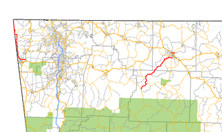
Highway 43 is a designation for three north–south state highways in Arkansas. One segment of 27.1 miles (43.6 km) runs from Highway 264 in Siloam Springs north into Delaware County, Oklahoma along Oklahoma State Highway 20 (SH-20) to terminate at Missouri Route 43 (Route 43) at the Missouri/Oklahoma/Arkansas tri-point near Southwest City, Missouri. A second segment of 20.0 miles (32.2 km) runs northeast from Highway 21 at Boxley to Highway 7 in Harrison. The third segment runs 1.8 miles (2.9 km) north in Harrison from US Route 65 (US 65) to Highway 7.
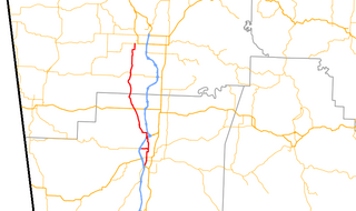
Highway 112 is a north–south state highway in Northwest Arkansas. The route of 25.84 miles (41.59 km) runs from Highway 16 Spur north through Fayetteville, across Interstate 49/US 62/US 71 (I-49/US 62/US 71) to Highway 12 in Bentonville.

State Road 2 is a former east–west state highway in the Arkansas Timberlands and Lower Arkansas Delta. The route was approximately 195 miles (314 km), and ran from US Route 67 (US 67) in Texarkana east to cross the Mississippi River near Lake Village, continuing as Mississippi Highway 10. On July 1, 1931, the route was entirely replaced by US Highway 82 (US 82) by the American Association of State Highway Officials (AASHTO). The route was maintained by the Arkansas Highway Department (AHD), now known as the Arkansas Department of Transportation (ArDOT).
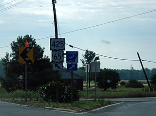
Highway 980 is a state highway designation for all state maintained airport roads in Arkansas.

Highway 8 is an east–west state highway in Lower Arkansas. The route of 229.83 miles (369.88 km) runs from Oklahoma State Highway 63 (SH-63) at the Oklahoma state line east across the state to US Route 65 (US 65) south of Eudora.

Arkansas Highway 133 is a designation for three state highways in South Arkansas. One route of 24.20 miles (38.95 km) runs from Louisiana Highway 142 north through Crossett to Highway 8 near Fountain Hill. A second segment runs from Highway 160 north to US Route 425 (US 425) at Lacey. A third segment begins in Rison at Highway 35 and runs north to Highway 54 south of Pine Bluff.

Highway 160 is a designation for four state highways in South Arkansas. The northernmost segment of 51.55 miles (82.96 km) runs from Farm to Market Road 249 at the Texas state line near Bloomburg, Texas east to Highway 19 at Macedonia. A second segment of 14.73 miles (23.71 km) runs east from Highway 57 east to Highway 7 Business in Smackover. In southern Calhoun County, Highway 160 begins at US Route 278 (US 278) and runs east to US 425 in Fountain Hill. A fourth segment begins at US 82 and runs 22.73 miles (36.58 km) east to US 65 at Chicot Junction.

Highway 45 is a designation for three state highways in northwest Arkansas. The southern segment of 26.97 miles (43.40 km) runs from Highway 96 north across US Route 71 (US 71) to Interstate 540/US 71 (I-540/US 71) in Fort Smith. Another segment of 10.64 miles (17.12 km) runs Highway 59 at Dutch Mills to US 62 in rural Washington County. A third route of 25.42 miles (40.91 km) runs from U.S. Route 71B (US 71B) in Fayetteville to Highway 12 near Clifty. These routes were formerly connected until a portion of approximately 50 miles (80 km) was redesignated Arkansas Highway 59 and many United States highways were rerouted through Fayetteville.
Route 84 is a state highway in the Missouri bootheel. The route starts at Arkansas Highway 90 over the St. Francis River on the Arkansas–Missouri state line. The road travels eastward to Kennett, where it becomes concurrent with U.S. Route 412. East of Kennett, the concurrent routes travel eastward on a divided highway to Hayti Heights, where the concurrency ends. Route 84 travels through Hayti Heights and Hayti, and it crosses Interstate 55 (I-55) and US 61. The route then travels southeastwards to Caruthersville, and bypasses the central area of the city. In the southern part of Caruthersville, Route 84 ends at an interchange with I-155 and US 412.
Eleven special routes of U.S. Route 62 currently exist. Six of them lie within the state of Arkansas. Four more existed in the past but have since been decommissioned.

Arkansas Highway 11 is a designation for three state highways in Arkansas. One segment of 36.23 miles (58.31 km) runs from US Route 63 (US 63) at Pansy to Huff Island Public Use Area near Grady. A second segment of 12.83 miles (20.65 km) begins just across the Arkansas River at the eastern terminus of Highway 88 at Reydell and runs north to US 65 west of De Witt. A third route of 37.53 miles (60.40 km) runs from Interstate 40 (I-40) and US 63 in Hazen north to Highway 367 in Searcy.
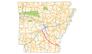
Arkansas Highway 35 is a northwest–southeast state highway in southeast Arkansas. The route runs 115.83 miles (186.41 km) from Dewey near the Mississippi River northwest to Arkansas Highway 5 in Benton.
Arkansas Highway 193 is a north–south state highway in northeast Arkansas. The route of 17.77 miles (28.60 km) runs from Highway 306 near Caldwell north across US Route 64 (US 64) through rural Cross County to Highway 42 near Hickory Ridge. The route has an officially designated exception of 0.49 miles (0.79 km) over Highway 284.

Arkansas Highway 134 is an east–west state highway in Miller County, Arkansas. The route of 20.27 miles (32.62 km) runs from US Route 71 (US 71) near Fouke to US 82 in Garland.
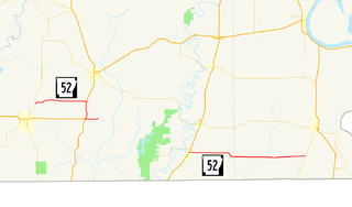
Highway 52 is a designation for three state highways in southeast Arkansas. One route of 7.49 miles (12.05 km) runs east from Highway 133 at North Crossett to US Route 82/US Route 425 (US 82/US 425) south of Hamburg. A second route of 1.83 miles (2.95 km) begins at US 82/US 425 south of the other junction and runs east to Ashley County Road 25/County Road 26 (CR 25/CR 26). A third route of 16.59 miles (26.70 km) runs from US 165 in Wilmot east to Highway 159 at Indian.

Arkansas Highway 19 is a designation for two state highway in South Arkansas. The first route of 18.05 miles (29.05 km) runs from Louisiana Highway 159 (LA 159) north to U.S. Route 79B (US 79B) in Magnolia. A second segment runs 24.73 miles (39.80 km) north from US Route 371/Arkansas Highway 24 (US 371/AR 24) across Interstate 30 (I-30) to Narrows Dam at Lake Greeson.

Highway 39 is a designation for two state highways in southeast Arkansas. The western segment of 9.98 miles (16.06 km) runs from US Route 49 (US 49) at Blackton to US 49/Highway 241. Another segment of 8.89 miles (14.31 km) runs north from Highway 1 and Highway 316 near Turner to US 49 in rural Phillips County.
Nine special routes of U.S. Route 82 currently exist. Four of them lie within the state of Arkansas, with four more in Texas, and one in Georgia. Six more existed in the past but have since been decommissioned.
Highway 144 is a designation for two state highways in Southeast Arkansas. One route of 7.82 miles (12.59 km) begins at Big Bayou Meto Use Area and runs east to US Highway 165 (US 165), Highway 1, and the Great River Road (GRR). A second route of 20.50 miles (32.99 km) begins at US 165 near Jerome and runs east through Lake Village to a levee near the Mississippi River. Both routes are maintained by the Arkansas Department of Transportation (ArDOT). While overlapping US 65/US 278 in Chicot County, the route is part of the Great River Road, a national scenic byway following the Mississippi River.


