Shives, Arkansas | |
|---|---|
 Shives  Shives | |
| Coordinates: 33°16′31″N91°10′15″W / 33.27528°N 91.17083°W | |
| Country | United States |
| State | Arkansas |
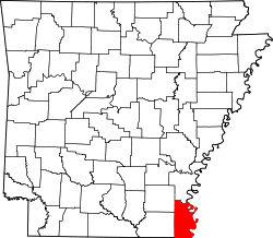
| County | Chicot |
| Elevation | 121 ft (37 m) |
| Time zone | UTC-6 (Central (CST)) |
| • Summer (DST) | UTC-5 (CDT) |
| GNIS feature ID | 58620 [1] |
Shives (also Shrives) is an unincorporated community in Chicot County, Arkansas, United States. [1]
Shives is located on the southeast shore of Lake Chicot, approximately 1 mi (1.6 km) west of the Mississippi River.
U.S. Route 278 passes through Shives, and Shives is the first settlement west of the Greenville Bridge.