Dermott, Arkansas | |
|---|---|
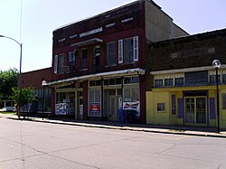 Downtown Dermott | |
 Location of Dermott in Chicot County, Arkansas. | |
| Coordinates: 33°31′38″N91°25′57″W / 33.52722°N 91.43250°W | |
| Country | United States |
| State | Arkansas |
| County | Chicot |
| Area | |
• Total | 3.49 sq mi (9.05 km2) |
| • Land | 3.42 sq mi (8.86 km2) |
| • Water | 0.073 sq mi (0.19 km2) |
| Elevation | 141 ft (43 m) |
| Population (2020) | |
• Total | 2,021 |
• Estimate (2024) | 2,453 |
| • Density | 590.7/sq mi (228.08/km2) |
| Time zone | UTC-6 (Central (CST)) |
| • Summer (DST) | UTC-5 (CDT) |
| ZIP code | 71638 |
| Area code | 870 |
| FIPS code | 05-18520 |
| GNIS feature ID | 2404221 [2] |
Dermott is a city in Chicot County, Arkansas, United States. The population was 2,021 at the 2020 census. [3] Dermott was incorporated in 1890.
Contents
- Geography
- Climate
- Demographics
- 2020 census
- 2010 census
- 2000 census
- Arts and culture
- Annual cultural events
- Education
- History
- Notable people
- References
- External links
Dermott was home to the Dermott Crawfish Festival.