Arkansas Highway 148

Last updated

Arkansas 148.svg

Highway 148
Arkansas 148.png
Route information
Maintained by ArDOT
Section 1
Length 4.61 mi [1] (7.42 km)
West endArkansas 151.svg AR 151 near Blytheville
East end Mississippi River levee near Blytheville
Section 2
Length 8.81 mi [1] (14.18 km)
West endArkansas 181.svg AR 181 near Dell
Major
junctions
I-55.svg I-55 in Burdette
East endUS 61 (AR).svg US 61 in Burdette
Section 3
Length 3.53 mi (5.68 km)
West endArkansas 135.svg AR 135 in Black Oak
East endArkansas 139.svg AR 139
Highway system
Arkansas 147.svg AR 147 AR 149 Arkansas 149.svg

Highway 148 (AR 148, Ark. 148, and Hwy. 148) is a designation for three east–west state highways in the Upper Arkansas Delta. One route of 4.61 miles (7.42 km) begins at Highway 239 and runs east to a Mississippi River levee. A second route of 8.81 miles (14.18 km) begins at Highway 181 and runs east to US Highway 61 (US 61) in Burdette. A third route of 3.53 miles (5.68 km) begins at Highway 135 in Black Oak and runs east to Highway 139. All routes are maintained by the Arkansas State Highway and Transportation Department (AHTD).

Arkansas Delta

The Arkansas Delta is one of the six natural regions of the state of Arkansas. Willard B. Gatewood Jr., author of The Arkansas Delta: Land of Paradox, says that rich cotton lands of the Arkansas Delta make that area "The Deepest of the Deep South."

Highway 239 is the name of two state highways in Mississippi County.

Mississippi River largest river system in North America

The Mississippi River is the largest river in the United States and chief river of the second-largest drainage system on the North American continent, second only to the Hudson Bay drainage system. Its source is Lake Itasca in northern Minnesota and it flows generally south for 2,320 miles (3,730 km) to the Mississippi River Delta in the Gulf of Mexico. With its many tributaries, the Mississippi's watershed drains all or parts of 32 U.S. states and two Canadian provinces between the Rocky and Appalachian mountains. The main stem is entirely within the United States; the total drainage basin is 1,151,000 sq mi (2,980,000 km2), of which only about one percent is in Canada. The Mississippi ranks as the fourth-longest and fifteenth-largest river by discharge in the world. The river either borders or passes through the states of Minnesota, Wisconsin, Iowa, Illinois, Missouri, Kentucky, Tennessee, Arkansas, Mississippi, and Louisiana.

Contents

Route description

Highway 239 to Mississippi River

AR 148 begins at the southern terminus of AR 239, heads east past the southern terminus of AR 151 and ends at a Mississippi River levee. [2] [3]

Arkansas Highway 151 highway in Arkansas

Arkansas Highway 151 is a designation for two north–south state highways in Mississippi County, Arkansas. An eastern route of 5.75 miles (9.25 km) runs from Highway 148 north to Highway 18. A second route of 6.65 miles (10.70 km) begins at Highway 18 in Blytheville and runs north to Missouri supplemental route TT (SSR-TT) at the Missouri state line. A third route was dedicated in May 2013 and begins at State Line Avenue in Texarkana and continues east to Interstate 49/U.S. Route 71.

Levee Ridge or wall to hold back water

A levee, dike, dyke, embankment, floodbank or stopbank is an elongated naturally occurring ridge or artificially constructed fill or wall, which regulates water levels. It is usually earthen and often parallel to the course of a river in its floodplain or along low-lying coastlines.

Highway 181 to Burdette

It begins heading east from an intersection with AR 181 through very rural farmlands until it enters Burdette town limits as it interchanges with I-55's Exit 57. After winding through some curves in downtown Burdette, it ends at an unsignalized intersection with US 61. [3]

Interstate 55 (I-55) is a north–south Interstate Highway that has a 72.22-mile (116.23 km) section in the U.S. state of Arkansas connecting sections in Tennessee and Missouri. The route enters Arkansas on the Memphis & Arkansas Bridge over the Mississippi River from Memphis. It travels northward through northeast Arkansas connecting the cities of West Memphis and Blytheville. I-55 continues into Missouri heading to St. Louis, Missouri. The highway overlaps Interstate 40 in West Memphis and has a junction with Interstate 555, a spur route to Jonesboro, in Turrell. For the majority of its routing through Arkansas, I-55 generally follows U.S. Route 61.

Black Oak to Highway 139

The highway begins at Highway 135 (Main St) in Black Oak south of downtown. Highway 148 runs due east as a section line road to Highway 139 in eastern Craighead County near the Mississippi County line. [4] [5]

Arkansas Highway 135 highway in Arkansas

Highway 135 is a north–south state highway in northeast Arkansas. The route of 69.67 miles (112.12 km) runs from US Route 63 (US 63) near Tyronza north through Paragould to US 62.

Black Oak, Arkansas Town in Arkansas, United States

Black Oak is a town in Craighead County, Arkansas, United States. The population was 262 at the 2010 census. It is included in the Jonesboro, Arkansas Metropolitan Statistical Area. Black Oak is the namesake of 1970s rock band Black Oak Arkansas and the setting of John Grisham's novel A Painted House.

In many jurisdictions in the US, roads were run along every section line, giving access to previously remote areas and serving in many instances as firebreaks. A road or arterial in which the centerline is laid out along a section line boundary is often referred to as a section line road or section line arterial. In Lubbock, Texas, Oklahoma City; Boise, Idaho; metropolitan areas of Arizona ; and much of the Las Vegas Valley, all major thoroughfares run along section lines, producing a readily identifiable grid.

Major junctions

CountyLocationmi [1] kmDestinationsNotes
Mississippi 0.000.00Arkansas 235.svg AR 235 north
3.525.66Arkansas 151.svg AR 151 north
4.617.42Mississippi River leveeEnd of state maintenance
Gap in route
0.000.00Arkansas 181.svg AR 181
Burdette 5.819.35I-55.svg I-55  Blytheville, Memphis Exit 57 (I-55)
8.8114.18US 61 (AR).svg US 61  Blytheville, Osceola
Craighead Black Oak 0.000.00Arkansas 135.svg AR 135
3.535.68Arkansas 139.svg AR 139
1.000 mi = 1.609 km; 1.000 km = 0.621 mi

See also

Related Research Articles

Arkansas Highway 139 highway in Arkansas

Highway 139 is a designation for two north–south state highways in the Upper Arkansas Delta. One route of 17.65 miles (28.40 km) begins at Highway 158 in Caraway and runs north to Missouri Supplemental Route F at the Missouri state line. A second route of 34.86 miles (56.10 km) runs from US Highway 412 (US 412) to Missouri Route 51 at the Missouri state line. Both routes are maintained by the Arkansas State Highway and Transportation Department (AHTD).

Arkansas Highway 90 highway in Arkansas

Arkansas Highway 90 is an east–west state highway in northeast Arkansas. The route of 81.93 miles (131.85 km) runs from Main Street in Ravenden to Route 84 at the Missouri state line. The route is an entirely undivided surface highway that passes through rich cotton country.

Arkansas Highway 24 highway in Arkansas

Arkansas Highway 24 is the designation of two separate state highways in southwest and south central Arkansas. The two sections were formerly connected, but a middle segment of 53 miles (85 km) between Lockesburg and Prescott was redesignated as U.S. Route 371 in 1994.

Arkansas Highway 131 highway in Arkansas

Highway 131 is a designation for five north–south state highways in northeast Arkansas. One route of 5.51 miles (8.87 km) runs from Highway 1 in Haynes east to Lee County Road 719. A second route of 9.57 miles (15.40 km) begins at US Route 79 (US 79) near Brickeys and runs south to the Mississippi River levee. A third route of 8.74 miles (14.07 km) forms a semicircle around Horseshoe Lake and Porter Lake, connecting to Highway 147 at both ends. A fourth route of 3.11 miles (5.01 km) begins at Highway 147 and runs through Edmondson. A fifth route begins at Interstate 55/US 61/US 64/US 79 in West Memphis and runs north to Martin Luther King Jr. Drive/Mound City Road in West Memphis. All routes are maintained by the Arkansas State Highway and Transportation Department (AHTD).

Highway 118 is a designation for two state highways in the Upper Arkansas Delta. One route of 41.43 miles (66.68 km) begins at US Highway 64 (US 64) and Highway 149 east to Mississippi County Road 495 near the Mississippi River levee. A second route of 4.29 miles (6.90 km) runs from US 70/US 79 in West Memphis to US 64 in Marion. Both routes are maintained by the Arkansas State Highway and Transportation Department (AHTD).

Arkansas Highway 230 highway in Arkansas

Highway 230 is a designation for four state highways in Arkansas. One route of 8.15 miles (13.12 km) begins at Highway 14/Highway 25 at Locust Grove and runs east to US Highway 167 (US 167) in Southside. A second route of 13.80 miles (22.21 km) begins at US 167 in Cave City and runs east to Highway 25 in Strawberry. A third route of 16.25 miles (26.15 km) begins at Highway 367 in Alicia and runs east to US 63 Business (US 63B) in Bono. A fourth route of 7.04 miles (11.33 km) begins at US 49B and runs east to Highway 135 at Dixie. All routes are maintained by the Arkansas State Highway and Transportation Department (AHTD).

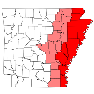
Arkansas Highway 119 is a series of state highways that run in eastern Arkansas.

Arkansas Highway 141 highway in Arkansas

Arkansas Highway 141 is a state highway of 61.1 miles (98.3 km) that runs in Craighead, Greene and Clay Counties.

Highway 349 is a designation for two state highways in Northeast Arkansas. One route of 4.45 miles (7.16 km) begins at Highway 226 and runs north to Highway 18/Highway 91. A second route of 2.44 miles (3.93 km) begins at Highway 230 and runs north to Highway 228. Both routes are maintained by the Arkansas Department of Transportation (ArDOT).

Highway 351 is a designation for two state highways in Northeast Arkansas. One route 0.92 miles (1.48 km) in Jonesboro begins at the Interstate 555/US Highway 63 (I-555/US 63) frontage road and runs north to Highway 18 as Industrial Drive. A second route of 13.87 miles (22.32 km) begins at Airport Road and runs north to Highway 358. Between Jonesboro and the northern terminus, the route is designated as part of the Crowley's Ridge Parkway, a National Scenic Byway, and two Civil War trails under the Arkansas Heritage Trails System. Both routes are maintained by the Arkansas State Highway and Transportation Department (AHTD).

Arkansas Highway 18 highway in Arkansas

Arkansas Highway 18 is a state highway of 93.43 miles (150.36 km) in Northeastern Arkansas.

Arkansas Highway 158 highway in Arkansas

Arkansas Highway 158 is a designation for two state highways in northeast Arkansas. The main segment of 44.24 miles (71.20 km) runs east from Highway 1 to US Route 61 (US 61) in Luxora. A short route of 0.33 miles (0.53 km) runs from U.S. Route 49 across railroad tracks in rural Craighead County.

Arkansas Highway 226 highway in Arkansas

Arkansas Highway 226 is a designation for two state highways in northeast Arkansas. The main segment of 25.28 miles (40.68 km) runs east from an intersection of U.S. Route 67/Arkansas Highway 367 to I-555/US 63/AR 18 in Jonesboro. A short route of 2.38 miles (3.83 km) runs in rural Jackson County west of Tuckerman.

Arkansas Highway 140 highway in Arkansas

Highway 140 is a designation for two east–west state highways in the Upper Arkansas Delta. One route of 32.70 miles (52.63 km) begins at US Highway 63 Business (US 63B)/Highway 14 in Marked Tree and runs east to US 61 in Osceola. A second segment of 1.93 miles (3.11 km) in east Osceola runs from US 61 to Pearl Street and Quinn Avenue. Both routes are maintained by the Arkansas State Highway and Transportation Department (AHTD).

Highway 198 is a designation for three state highways in the Upper Arkansas Delta. One route of 2.45 miles (3.94 km) in Trumann runs from Highway 69 east to Highway 463. A second route of 2.70 miles (4.35 km) connects Highway 140 and Highway 77. A third route of 3.38 miles (5.44 km) runs from US Highway 61 (US 61) near Grider east to the Sans Souci Landing on the Mississippi River. All routes are maintained by the Arkansas State Highway and Transportation Department (AHTD).

Arkansas Highway 29 highway in Arkansas

Arkansas Highway 29 is a state highway that extends 77.2 miles (124.2 km) in South Arkansas. It runs north from the Louisiana state line to its terminus at AR 301 in Antoine. It is intersected by many major thoroughfares including Interstate 30. Part of the highway is known as Bill Clinton Drive.

Three auxiliary routes of Arkansas Highway 18 exist in northeast Arkansas.

Arkansas Highway 224 is a designation for two east–west state highways in Jackson County, Arkansas. A northern route of 8.25 miles (13.28 km) runs east from Highway 367 to the city limits of Swifton. A second route of 8.26 miles (13.29 km) begins at US Route 67 (US 67) and runs to Highway 14 after serving as a frontage road of US 67.

References

  1. 1 2 3 System Information and Research Division (2014). "Arkansas Road Log Database" (MDB). Arkansas State Highway and Transportation Department. Retrieved March 27, 2016.
  2. State Highway Route and Section Map - Mississippi County, Arkansas (PDF) (Map). Arkansas State Highway and Transportation Department. Retrieved January 1, 2013.
  3. 1 2 Arkansas State Highway and Transportation Department. AHTD Mississippi County map Retrieved on August 28, 2009.
  4. Arkansas State Highway and Transportation Department. AHTD Craighead County map Retrieved on August 28, 2009.
  5. State Highway Route and Section Map - Craighead County, Arkansas (PDF) (Map). Arkansas State Highway and Transportation Department. November 27, 2012. Retrieved January 1, 2013.

Route map: Google

KML file (edithelp)
KML is from Wikidata

Commons-logo.svg Media related to Arkansas Highway 148 at Wikimedia Commons