Hollywood, sometimes informally called Tinseltown, is a neighborhood and district in the central region of Los Angeles County, California, within the city of Los Angeles. Its name has come to be a shorthand reference for the U.S. film industry and the people associated with it. Many notable film studios, such as Sony Pictures, Walt Disney Studios, Paramount Pictures, Warner Bros. and Universal Pictures, are located in or near Hollywood.

Northridge is a neighborhood in the San Fernando Valley region of the City of Los Angeles. The community is home to California State University, Northridge, and the Northridge Fashion Center.
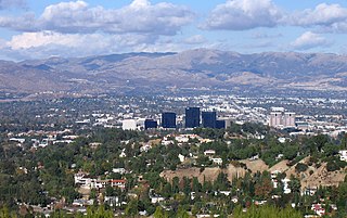
Woodland Hills is a neighborhood bordering the Santa Monica Mountains in the San Fernando Valley region of Los Angeles, California, United States.

San Pedro is a neighborhood located within the South Bay and Harbor region of the city of Los Angeles, California, United States. Formerly a separate city, it consolidated with Los Angeles in 1909. The Port of Los Angeles, a major international seaport, is partially located within San Pedro. The district has grown from being dominated by the fishing industry, to a working-class community within the city of Los Angeles, to an increasingly dense and diverse community.
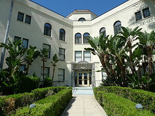
Eagle Rock is a neighborhood of Northeast Los Angeles, abutting the San Rafael Hills in Los Angeles County, California. The community is named after Eagle Rock, a large boulder whose shadow resembles an eagle. Eagle Rock was once part of the Rancho San Rafael under Spanish and Mexican governorship. In 1911, Eagle Rock was incorporated as a city, and in 1923 it was annexed by Los Angeles.

Lincoln Heights is one of the oldest neighborhoods in Los Angeles, California, United States. It was originally called "East Los Angeles" from 1873 to 1917. It is a densely populated, mostly Latino and Asian neighborhood that includes many historic landmarks and was known as "the Bedroom of the Pueblo".

Highland Park is a neighborhood in Los Angeles, California, located in the city's Northeast region. It was one of the first subdivisions of Los Angeles and is inhabited by a variety of ethnic and socioeconomic groups.

Granada Hills is a neighborhood in the San Fernando Valley region of Los Angeles. The community has a sports program and a range of city recreation centers. The neighborhood has fourteen public and ten private schools.

The Church of the Holy Rosary of the Blessed Virgin Mary was a Catholic parish church of the Archdiocese of New York located at 444 East 119th Street, in the East Harlem neighborhood of Manhattan in New York City.

Highland Avenue is a north–south road in Los Angeles. It is a major thoroughfare between Cahuenga Boulevard/U.S. Route 101 in Hollywood at the north and Wilshire Boulevard in Mid-Wilshire at the south, and a residential street from Wilshire Boulevard to Washington Boulevard in Mid-City.
Foothill Boulevard is a major road in the city and county of Los Angeles, as well as an arterial road in the city and county of San Bernardino, stretching well over 60 miles (97 km) in length, with some notable breaks along the route. Like its name implies, Foothill Boulevard runs across the foothills of the San Gabriel and San Bernardino Mountains.

East Memphis is a region of Memphis, Tennessee with several defined and informal subdivisions and neighborhoods such as Colonial Acres, White Station-Yates, Sherwood Forest, Normal Station, High Point Terrace, Belle Meade, Normandy Meadows, St. Nick, Pleasant Acres, Balmoral, and Ridgeway. The general boundaries are informal:

University City (UC) is a community in San Diego, California, located in the northwestern portion of the city next to the University of California, San Diego. The area was originally intended to serve as housing for the faculty of the university, hence the name.
The University District, often referred to as University or University Hills, is a foothill community and college town located approximately 5–8 miles north of downtown San Bernardino, California. The District is named after the California State University, San Bernardino. It is one of the most desirable neighborhoods in San Bernardino along with the Hospitality Lane District. As California State University, San Bernardino grew so did the region around it; it used to be nothing but mid-desert farmland, but has been developing quickly to become a neighborhood important to not only San Bernardino but also the entire region.
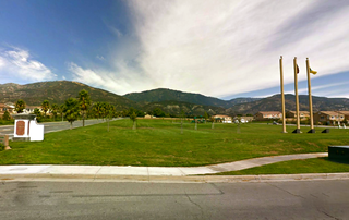
Verdemont, also known as Verdemont Heights, is a foothill and suburban neighborhood located in the northern portion of the city of San Bernardino, California. The neighborhood contains the Western Region Little League headquarters. Verdemont is one of the city's most desirable neighborhoods, holding the city's high income families, along with Arrowhead Springs, and the University District. Verdemont is home to most of the city's million dollar homes.
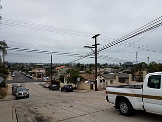
Shelltown is a neighborhood in San Diego, California, located within Southeast San Diego. It is bordered by National City to the south, Interstate 5 and Barrio Logan to the west, 43rd Avenue to the east, and Gamma Court and the neighborhood of Southcrest to the north. Prior to the 1980s the northern border of Shelltown was National Ave and many residents still consider that the northern border. Naval Base San Diego, an industrial park, and some commercial buildings are located just outside the western border of Shelltown along Main Street.
Beaumont Unified School District is located in central Riverside County, California. The district services the vast majority of Beaumont, California, as well as portions of Banning, and most of Calimesa and the census-designated place of Cherry Valley. It extends into San Bernardino County, where it includes a portion of Oak Glen CDP.
Holy Name of Jesus Parish is a Roman Catholic church in Redlands, California, United States, founded on July 1, 2006. It is part of the Diocese of San Bernardino. The Church is located on two sites, on the north side of town is the Columbia Street location formerly Saint Mary's Catholic Church. And the south side of Redlands, at the Olive Avenue location is the former Sacred Heart Catholic Church.


