Nedumangad is a city and a municipality in Thiruvananthapuram metropolitan area of Thiruvananthapuram district in the Indian state of Kerala, It's also the headquarters of Nedumangad (tehsil) and Nedumangad Revenue Division (RDO). It is a suburb of the extended metropolitan region of Thiruvananthapuram city. It is located around 18 km to the north-east of Thiruvananthapuram city on the Thiruvananthapuram — Shencottah. It is the second biggest commercial center in the district. It is a growing commercial, educational hub and important Government institutions situated in the Town. It is an important centre for the commercial trade in pepper and rubber. A wholesale market set up by the Department of Agriculture is also situated there.

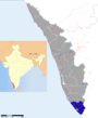
Padmanabhapuram is a town and a municipality near Thuckalay in Kanyakumari district in the Indian state of Tamil Nadu. As of 2011, the town had a population of 21,342.

Thiruvananthapuram District is the southernmost district of the coastal state of Kerala. The district was created 1957, with its headquarters in the city of Thiruvananthapuram (Trivandrum), which is also Kerala's capital.

Thiruvattar is a panchayat town in Kanniyakumari district in the Indian state of Tamil Nadu.

Tirunelveli district is a district of Tamil Nadu state in South India. It is the largest district in terms of area with Tirunelveli as its headquarters. Tirunelveli District was formed on 1 September 1790 by the British East India Company, and comprised the present Tirunelveli and Thoothukudi districts and parts of Virudhunagar and Ramanathapuram district. As of 2011, the district had a population of 3,077,233.

Karamana is a river flowing through the city of
Thiruvananthapuram in Kerala, India. The river starts near the southern tip of the Western Ghats at Agastyar Koodam. The river flows 66 km westward and merges with the Arabian Sea at Panathura near Kovalam. The river gets its name from Karamana, a suburb of Thiruvananthapuram city, Aryanad through which it flows.

Vithura is a small village situated 37 km from Thiruvananthapuram, capital of the Kerala state in India. Vithura is the crossroads to various tourist, cultural, and religious centres. Surrounded by the Western Ghats (Sahyadri), Vithura is a prime tourist spot. The Village is rich with scenic beauty and good climate. The campus for the Indian Institute of Science Education and Research, Thiruvananthapuram is being constructed here.

Agasthyarkoodam is a 1,868-metre (6,129 ft)-tall peak within Neyyar Wildlife Sanctuary, Kerala in the Western Ghats of South India. However, the peak lies in the border of Kerala and Tamil Nadu. This peak is a part of the Agasthyamala Biosphere Reserve which lies on the border between the Indian states of Kerala and Tamil Nadu. The perennial Thamirabarani River originates from the eastern side of the range and flows into the Tirunelveli district of Tamil Nadu.

Tourism in Thiruvananthapuram (Trivandrum) district in the Indian state of Kerala promotes the area's hill stations, back waters, beaches, lagoons, and wildlife sanctuaries. The area is a tourism destination and receives chartered flights for medical tourism, as there are more than hundred recognised Ayurveda centres in and around the city. This is primarily due to Ayurveda's popularity in foreign countries. Medical tourism is further promoted by modern medicine hospitals in the city. Recuperation facilities are available at five star beach resorts and hill stations nearby.

Kattakada is a small town in the eastern part of Thiruvananthapuram District, the capital city of the Indian state of Kerala.

Aruvikkara is a village in Thiruvananthapuram district in the state of Kerala, India. It is located on the banks of the Karamana River 15 km from Thiruvananthapuram, the capital of the state of Kerala in South India. The reservoir and garden makes it a tourist spot. It is famous for the ancient Bhagavathi temple dedicated to Durga, the divine embodiment of female power, which is built on a rock. The stream in front of the temple contains large fishes, which are fed by the devotees visiting the shrine. The headquarters of the Wellington Water Distribution project is located here. The small Aruvikkara Dam which provides water to the state capital Thiruvananthapuram is also located in Aruvikkara. K.S Shabarinath of INC is the sitting MLA of Aruvikkara constituency to the Kerala Legislative Assembly.

Peringammala is the first largest panchayat in Thiruvananthapuram district in the state of Kerala, India. There are two places named Peringammala, the other one is between balaramapuram and venganoor which is on the southern side of the Thiruvananthapuram district.There is two villages peringammala and thennoor. Beautiful tourist place in there including ponmudi, mankayam, brimore, etc. Festival palod mela also there.
Kallara is a village and a Grama Panchayat in Thiruvananthapuram district in the state of Kerala, India. It is located near Karette, a junction in the MC road.
Cheriya Konni is a small village in the suburb of Trivandrum district of Kerala, India, located 14 km from the Kerala Constituent assembly and 15 km from the Kerala Government Secretariat. The Karamana River flows through the village. Major Education Institutions:Govt LPS Mylom, G V Raja Sports school situated in Mylom,very near to Cheirya Konni. College of Architecture (CAT) situated very near to Cheriya konni.
Nedumangad Taluk is a Taluk (tehsil) in Thiruvananthapuram district in the Indian state of Kerala. It situated in the eastern part of the Thiruvananthapuram district. It comprises 28 villages and one municipality.
The Indian city of Thiruvananthapuram is located in Thiruvananthapuram district in the state of Kerala. The city is located at 8.5°N 76.9°E on the west coast, near the southern tip of mainland India. The city situated on the west coast of India, and is bounded by Arabian Sea to its west and the Western Ghats to its east. The city and the suburbs spans an area of 250 km2 (96.53 sq mi). The average elevation of the city is 16 ft above sea level. The highest point within the city limits is the observatory. Agastya Mala, which has an elevation of 1,868 metres (6,129 ft) is only about 60 km from the city. The Ponmudi hill station which has an elevation of 1,100 metres (3,609 ft) is also near the city.

Thirparappu(Thriparappu) is famous for its waterfalls and is located in Kanyakumari District of Tamil Nadu in the southern part of India. Thirparappu (Thriparappu) Falls is located 42 km (26 mi) from Nagercoil, 55 km (34 mi) from Thiruvananthapuram and a distance of 5 km (3.1 mi) from Kulasekaram. This famous falls is in the Kodayar. The Kodayar makes its descend at Thirparappu and the water fall at this place is about 13 km (8.1 mi) from Pechiparai dam.
Kudappanamoodu is a village in the south east of Thiruvananthapuram district in the state of Kerala in India. Kudappanamoodu is a village town with a population of 1789. An important ethnic group in the area is the Tamil Muslims. Kudappanamoodu is 41 km (25 mi) from the Agastiya mountain peak where Sage Agastiya, the founder of Ayurveda, is believed to have built his hermitage.
Kuttichal is a village in Thiruvananthapuram district in the state of Kerala, India. The Kuttichal panchayath has borders with Aryanad, Poovachal, Kallikkad, panchayaths and Thiruneveli District of Tamil Nadu India. Kuttichal is part of Kattakada Taluk, Vellanad block panchayath and Aruvikkara Legislative Assembly.
Meenankal is a village in Thiruvananthapuram district in the state of Kerala, India, and located around 5 kilometers away from the Peppara Wildlife Sanctuary. Meenankal has border with Uzhamalakkal, Vellanad, Anad, Kuttichal, Vithura, Tholickode panchayaths and Thiruneveli District of Tamil Nadu, India. It's located in the Nedumangad Taluk and Aruvikkara Legislative Assembly. It is situated around 35 km away from Thiruvananthapuram city.