
Mitchell County is a county located in the U.S. state of Kansas. Its county seat and largest city is Beloit. As of the 2020 census, the county population was 5,796. The county was named for William Mitchell.

Linn County is a county in the U.S. state of Kansas, located in along the eastern edge of Kansas, and is part of the Kansas City metropolitan area. Its county seat is Mound City, and its most populous city is Pleasanton. As of the 2020 census, the county population was 9,591. The county was named for Lewis Linn, a U.S. Senator from Missouri.

Cowley County is a county located in the U.S. state of Kansas. Its county seat is Winfield, and its most populous city is Arkansas City. As of the 2020 census, the county population was 34,549. The county was named after Matthew Cowley, first lieutenant in Company I, 9th Kansas Cavalry, who died during the American Civil War.
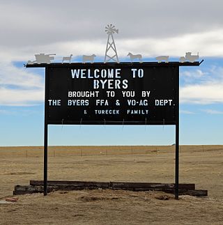
Byers is an unincorporated town, a post office, and a census-designated place (CDP) located in and governed by Arapahoe County, Colorado, United States. The CDP is a part of the Denver–Aurora–Lakewood, CO Metropolitan Statistical Area. The Byers post office has the ZIP Code 80103. At the United States Census 2020, the population of the Byers CDP was 1,322.

Leach is an unincorporated community and census-designated place (CDP) in southwestern Delaware County, Oklahoma, United States, along U.S. Route 412 and 412 Alternate. The population was 237 at the 2010 census.

Crosby is a census-designated place in Harris County, Texas, United States. The population was 3,417 at the 2020 census.

Spring is a census-designated place (CDP) within the extraterritorial jurisdiction of Houston in Harris County, Texas, United States, part of the Houston–The Woodlands–Sugar Land metropolitan area. The population was 62,559 at the 2020 census. While the name "Spring" is popularly applied to a large area of northern Harris County and a smaller area of southern Montgomery County, the original town of Spring, now known as Old Town Spring, is at the intersection of Spring-Cypress and Hardy roads and encompasses perhaps 1 square kilometer (0.39 sq mi).
Tecumseh is a census-designated place (CDP) in Shawnee County, Kansas, United States, and situated along the Kansas River. As of the 2020 census, the population was 696. The community and township are both named for the Shawnee chief.

Bendena is a census-designated place (CDP) in Doniphan County, Kansas, United States. As of the 2020 census, the population was 117. The community is part of the St. Joseph, MO–KS Metropolitan Statistical Area.

Dennis is a census-designated place (CDP) in Labette County, Kansas, United States. As of the 2020 census, the population was 152.

Detroit is a census-designated place (CDP) in Dickinson County, Kansas, United States. As of the 2020 census, the population was 102.

Peck is a census-designated place (CDP) in Sedgwick and Sumner counties in the U.S. state of Kansas. As of the 2020 census, the population areas was 162. It is located about 2 miles west of the Kansas Star Casino at Meridian Ave and 119th St S, next to the Union Pacific Railroad.

Williamstown is a census-designated place (CDP) in southeastern Jefferson County, Kansas, United States. As of the 2020 census, the population was 96. It is located south of the junction of US-24 and US-59 highways.

Beaver is a census-designated place (CDP) in Beaver Township, Barton County, Kansas, United States. As of the 2020 census, the population was 52. It is located northeast of Hoisington at the intersection of NE 190 Rd and NE 60 Ave.

Murdock is a census-designated place (CDP) in Kingman County, Kansas, United States. As of the 2020 census, the population was 37. It is 10 miles (16 km) east-southeast of Kingman.

Pierceville is a census-designated place (CDP) in Finney County, Kansas, United States. As of the 2020 census, the population was 98. It is located along U.S. Routes 50 and 400, 12 miles (19 km) southeast of Garden City.
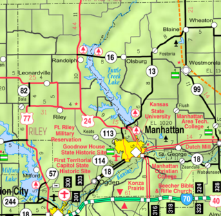
Bala is a census-designated place (CDP) in Bala Township, Riley County, Kansas, United States. As of the 2020 census, the population was 29.

Croweburg is a census-designated place (CDP) in Crawford County, Kansas, United States. As of the 2020 census, the population was 92.

Idana is a census-designated place (CDP) in Clay County, Kansas, United States. As of the 2020 census, the population was 54. It is located approximately 6.5 miles west of Clay Center, and 1.5 miles south of US Route 24 along 16th Rd.

Centropolis is a census-designated place (CDP) in Franklin County, Kansas, United States. As of the 2020 census, the population was 100. It is located about 11 miles northwest of Ottawa. In the 1850s, Centropolis had the distinction of briefly vying for territorial capital of Kansas.


