
Benton is a city in Butler County, Kansas, United States. As of the 2020 census, the population of the city was 943. It is located northeast of Wichita along K-254 highway.

Gridley is a city in Coffey County, Kansas, United States. As of the 2020 census, the population of the city was 313.

Jennings is a city in Decatur County, Kansas, United States. As of the 2020 census, the population of the city was 81.

Gove City, more commonly known as Gove, is a city in and the county seat of Gove County, Kansas, United States. As of the 2020 census, the population of the city was 80.
Grinnell is a city in Gove County, Kansas, United States. As of the 2020 census, the population of the city was 260.

Formoso is a city in Jewell County, Kansas, United States. As of the 2020 census, the population of the city was 94.

Haviland is a city in Kiowa County, Kansas, United States. As of the 2020 census, the population of the city was 678. It is located along Highway 54. It is home of Barclay College and known for meteorite finds connected to the Haviland Crater.

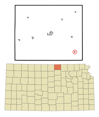
Barnard is a city in Lincoln County, Kansas, United States. As of the 2020 census, the population of the city was 64.

Meade is a city in and the county seat of Meade County, Kansas, United States. As of the 2020 census, the population of the city was 1,505.

Cawker City is a city in Mitchell County, Kansas, United States. As of the 2020 census, the population of the city was 457. The city is located along the north shore of Waconda Lake and Glen Elder State Park. It is one of several places claiming to be home of the largest ball of twine in the world.

Tipton is a city in Mitchell County, Kansas, United States. As of the 2020 census, the population of the city was 193.

Bazine is a city in Ness County, Kansas, United States. As of the 2020 census, the population of the city was 282.

Downs is a city in Osborne County, Kansas, United States. As of the 2020 census, the population of the city was 800.

Agra is a city in Phillips County, Kansas, United States. As of the 2020 census, the population of the city was 208.

Prairie View is a city in Phillips County, Kansas, United States. As of the 2020 census, the population of the city was 106.
Agenda is a city in Republic County, Kansas, United States. As of the 2020 census, the population of the city was 47.

Munden is a city in Republic County, Kansas, United States. As of the 2020 census, the population of the city was 96.

Maple Hill is a city in Wabaunsee County, Kansas, United States. As of the 2020 census, the population of the city was 631.

Haddam is a city in Washington County, Kansas, United States. It is named after Haddam, Connecticut. As of the 2020 census, the population of the city was 110.
Ionia is a census-designated place (CDP) in Ionia Township, Jewell County, Kansas, United States. As of the 2020 census, the population was 17.


