Related Research Articles

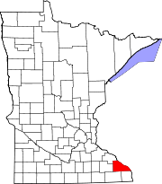
Winona County is a county in the U.S. state of Minnesota. As of the 2020 census, its population was 49,671. Its county seat is Winona.

Albee Township is a civil township of Saginaw County in the U.S. state of Michigan. As of the 2010 Census, the township population was 2,160. Albee Township was established in 1863.

Canton is a city in Fillmore County, Minnesota, United States. The population was 346 at the 2010 census.

Federal Dam is a city in Cass County, Minnesota, United States, near Leech Lake. The population was 110 at the 2010 census. It is part of the Brainerd Micropolitan Statistical Area.

Puposky is an unincorporated community in Durand Township, Beltrami County, Minnesota, United States. It lies at 47.68°N 94.91°W.

Peace Valley is a small unincorporated community in eastern Howell County, Missouri, United States. It is located approximately two miles east of Route 17 on Route W.
Beulah is an unincorporated community in northern Texas county and southern Phelps County, Missouri, United States. It is located at the edge of the Mark Twain National Forest, approximately nine miles north of Licking in adjacent Texas County. The community is on both sides of Missouri Route K, three miles west of U.S. Route 63.
Flat is an unincorporated community in southern Phelps County, Missouri, United States. It is located approximately sixteen miles southwest of Rolla. The community is at the intersection of Missouri routes M and T. Edgar Springs lies about four miles to the southeast at the intersection of route M and U.S. Route 63. The headwaters of Mill Creek are just to the east of the community. The village lies within the boundaries of the Mark Twain National Forest.

Dugdale is an unincorporated community in Polk County, Minnesota, United States. Dugdale is located at 47°42′06″N96°15′59″W.

Bruce was the name of a town in Martin Township, Rock County, in the U.S. state of Minnesota. The townsite is now abandoned, and no trace remains.
Clayton was the name of a town in section 4 of Seely Township, Faribault County, Minnesota, United States.
Enterprise is an abandoned townsite in section 36 of Utica Township, in Winona County, Minnesota, United States.

Giard is an unincorporated community in Clayton County, Iowa, United States. Its elevation is 1,122 feet (342 m), and it is located at 43°0′20″N91°17′21″W. A post office was established in the community on September 28, 1854; after being disestablished, it was restored on August 7, 1914, and operated until January 15, 1925, except for a short hiatus at the end of 1918.
The Badger Lakes are a pair of lakes in Murray County, in the U.S. state of Minnesota.
Topelius is a ghost town in Otter Tail County, in the U.S. state of Minnesota.
Ashton is an unincorporated community in Clark County, in the U.S. state of Missouri.
Anutt is an unincorporated community in western Dent County, in the U.S. state of Missouri.
Cull is an unincorporated community in eastern Howell County, in the U.S. state of Missouri. The community is located on a county road south of U.S. Route 160 and is approximately nine miles east of West Plains, near the eastern border of the county. The community of Rover in Oregon County lies about two miles to the east.
Lanes Prairie is an unincorporated community in eastern Maries County, in the U.S. state of Missouri.
Pinckney is an unincorporated community in Warren County, in the U.S. state of Missouri.
References
- ↑ Upham, Warren (2001). Minnesota Place Names, A Geographical Encyclopedia, 3rd Edition. Saint Paul, Minnesota: Minnesota Historical Society. p. 632. ISBN 0-87351-396-7.
- ↑ U.S. Geological Survey Geographic Names Information System: Ashton Post Office (historical), Minnesota
- ↑ "Ahston, Minnesota". Ghosttowns.com. Retrieved 2012-12-23.
Coordinates: 43°55′N91°30′W / 43.917°N 91.500°W
