Lewiston | |
---|---|
Coordinates: 43°58′57″N91°52′20″W / 43.98250°N 91.87222°W | |
Country | United States |
State | Minnesota |
County | Winona |
Government | |
• Type | Mayor - Council |
• Mayor | Beth Carlson |
Area | |
• Total | 1.26 sq mi (3.28 km2) |
• Land | 1.26 sq mi (3.28 km2) |
• Water | 0.00 sq mi (0.00 km2) |
Elevation | 1,214 ft (370 m) |
Population (2020) | |
• Total | 1,533 |
• Density | 1,211.86/sq mi (467.72/km2) |
Time zone | UTC-6 (Central (CST)) |
• Summer (DST) | UTC-5 (CDT) |
ZIP code | 55952 |
Area code | 507 |
FIPS code | 27-36800 [3] |
GNIS feature ID | 2395692 [2] |
Website | City of Lewiston |
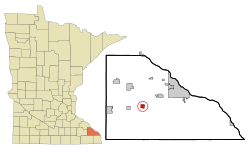
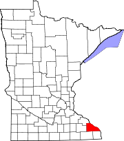
Lewiston is a city in Winona County, Minnesota, United States. The population was 1,620 at the 2010 census. [4]
A post office called Lewiston has been in operation since 1872. [5] The city was named for Jonathan Smith Lewis, a pioneer settler. [6] Lewiston was incorporated in 1873. [7] Lewiston - the first stop on the Winona-Rochester stagecoach line - was an important source of support for those travelers. [8]
According to the United States Census Bureau, the city has a total area of 1.15 square miles (2.98 km2), all land. [9]
Census | Pop. | Note | %± |
---|---|---|---|
1880 | 241 | — | |
1890 | 324 | 34.4% | |
1900 | 371 | 14.5% | |
1910 | 473 | 27.5% | |
1920 | 758 | 60.3% | |
1930 | 656 | −13.5% | |
1940 | 761 | 16.0% | |
1950 | 786 | 3.3% | |
1960 | 890 | 13.2% | |
1970 | 1,000 | 12.4% | |
1980 | 1,226 | 22.6% | |
1990 | 1,298 | 5.9% | |
2000 | 1,484 | 14.3% | |
2010 | 1,620 | 9.2% | |
2020 | 1,533 | −5.4% | |
U.S. Decennial Census [10] |
As of the census [11] of 2010, there were 1,622 people, 600 households, and 428 families living in the city. The population density was 1,408.7 inhabitants per square mile (543.9/km2). There were 634 housing units at an average density of 551.3 per square mile (212.9/km2). The racial makeup of the city was 97.0% White, 1.2% African American, 0.1% Native American, 0.7% Asian, 0.4% from other races, and 0.6% from two or more races. Hispanic or Latino of any race were 1.3% of the population.
There were 600 households, of which 38.5% had children under the age of 18 living with them, 59.0% were married couples living together, 8.3% had a female householder with no husband present, 4.0% had a male householder with no wife present, and 28.7% were non-families. 25.0% of all households were made up of individuals, and 11% had someone living alone who was 65 years of age or older. The average household size was 2.62 and the average family size was 3.15.
The median age in the city was 36.2 years. 29.9% of residents were under the age of 18; 5.8% were between the ages of 18 and 24; 26.7% were from 25 to 44; 24.5% were from 45 to 64; and 13.2% were 65 years of age or older. The gender makeup of the city was 50.9% male and 49.1% female.
As of the census [3] of 2000, there were 1,484 people, 538 households, and 392 families living in the city. The population density was 1,355.9 inhabitants per square mile (523.5/km2). There were 563 housing units at an average density of 514.4 per square mile (198.6/km2). The racial makeup of the city was 98.72% White, 0.61% African American, 0.34% Native American, 0.07% Asian, 0.07% from other races, and 0.20% from two or more races. Hispanic or Latino of any race were 0.88% of the population.
There were 538 households, out of which 40.3% had children under the age of 18 living with them, 60.6% were married couples living together, 7.8% had a female householder with no husband present, and 27.1% were non-families. 24.2% of all households were made up of individuals, and 12.6% had someone living alone who was 65 years of age or older. The average household size was 2.67 and the average family size was 3.19.
In the city, the population was spread out, with 29.7% under the age of 18, 8.0% from 18 to 24, 29.0% from 25 to 44, 18.5% from 45 to 64, and 14.9% who were 65 years of age or older. The median age was 35 years. For every 100 females, there were 96.6 males. For every 100 females age 18 and over, there were 94.2 males.
The median income for a household in the city was $43,220, and the median income for a family was $48,631. Males had a median income of $32,037 versus $22,083 for females. The per capita income for the city was $17,666. About 4.7% of families and 5.7% of the population were below the poverty line, including 7.0% of those under age 18 and 7.5% of those age 65 or over.
St. John's Lutheran Church is a member of the Wisconsin Evangelical Lutheran Synod (WELS) in Lewiston. [12]
Immanuel Lutheran Church is a member of the Lutheran Church Missouri Synod (LCMS) in Lewiston. [13]
Lewiston-Altura public school is mainly located in Lewiston.
St. John's Lutheran School is a preschool and K-8 school operated by the Wisconsin Evangelical Lutheran Synod (WELS) in Lewiston. [14]
Immanuel Lutheran School (Silo) is a K-8 school operated by the Lutheran Church Missouri Synod (LCMS) in Lewiston. [15]
Odessa Township is a township in Big Stone County, Minnesota, United States. The population was 147 as of the 2000 census. Odessa Township was named after Odesa, Ukraine.
Clara City is a city in Chippewa County, Minnesota, United States. The population was 1,360 at the 2010 census.
Cannon Falls is a city in Goodhue County, Minnesota, United States. The population was 4,083 at the 2010 census. Located along U.S. Route 52, southeast of the Twin Cities, Cannon Falls is the home of Pachyderm Studio, where many famous musicians have recorded, including Nirvana, which recorded its 1993 album In Utero there.
Zumbrota is a city in Goodhue County, Minnesota, United States, along the North Fork of the Zumbro River. The population was 3,252 at the 2010 census. It promotes itself as "the only Zumbrota in the world."
Wendell is a city in Grant County, Minnesota, United States. The population was 167 at the 2010 census.
Grand Rapids is a city in Itasca County, Minnesota, United States, and it is the county seat. The population was 11,126 at the 2020 census. The city is named for the 3.5-mile (5.6 km) long rapids in the Mississippi River which was the uppermost limit of practical steamboat travel during the late 19th century. Today the rapids are hidden below the dam of UPM Paper Company.
Avoca is a city in Murray County, Minnesota, United States. The population was 111 at the 2020 census.
Fulda is a city in Murray County, Minnesota, United States. The population was 1,318 at the 2010 census.
North Saint Paul is a city in Ramsey County, Minnesota, United States, located east-northeast of the city of Saint Paul. The population was 12,364 at the 2020 census.
Arlington is a city in Sibley County, Minnesota, United States. The population was 2,233 at the 2010 census.
Dakota is a city in Winona County, Minnesota, United States. The population was 295 at the 2020 census.
Minnesota City is a city in Winona County, Minnesota, United States. The population was 202 at the 2020 census.
Rollingstone is a city in Winona County, Minnesota, United States. The population was 678 at the 2020 census.
Stockton is a city in Winona County, Minnesota, United States. The population was 809 at the 2020 census.
Porter is a city in Yellow Medicine and Lincoln counties, Minnesota, United States. The population was 183 at the 2010 census.
Frohna is a city in Perry County, Missouri, United States. The population was 245 at the 2020 census.
Laurel is a city in Cedar County, Nebraska located at the merger of Highway 20 and Highway 15 in the northeast corner of the state. Laurel sits roughly 40 miles east of Norfolk, Nebraska, west of Sioux City, Iowa, and south of Yankton, South Dakota. Wayne State College in Wayne, Nebraska is 15 miles south of Laurel. Its population was 975 at the 2020 census.
St. Charles is a city in Winona County, Minnesota, United States. The population was 3,990 at the 2020 census, up from 3,735 in 2010. It promotes itself as the gateway to Whitewater State Park, which is located 7 miles (11 km) north of the city on Minnesota State Highway 74.
North Fond du Lac is a village in Fond du Lac County, Wisconsin, United States. The population was 5,378 at the 2020 census. Despite the name, North Fond du Lac is actually located northwest of Fond du Lac, as Lake Winnebago is directly north of Fond du Lac.
Fox Lake is a city in Dodge County, Wisconsin, United States. The population was 1,519 at the 2010 census. The city is located within the Town of Fox Lake.