Saratoga, Minnesota

Last updated
Saratoga, Minnesota
Unincorporated community
USA Minnesota location map.svg
Red pog.svg
Saratoga, Minnesota
Location of the community of Saratoga
within Saratoga Township, Winona County
Usa edcp location map.svg
Red pog.svg
Saratoga, Minnesota
Saratoga, Minnesota (the US)
Coordinates: 43°53′31″N92°04′12″W / 43.89194°N 92.07000°W / 43.89194; -92.07000 Coordinates: 43°53′31″N92°04′12″W / 43.89194°N 92.07000°W / 43.89194; -92.07000
Country United States
State Minnesota
County Winona County
Township Saratoga Township
Elevation 1,073 ft (327 m)
Time zone Central (CST) (UTC-6)
  Summer (DST) CDT (UTC-5)
ZIP code 55972
Area code(s) 507
GNIS feature ID 651213 [1]

Saratoga is an unincorporated community in Saratoga Township, Winona County, Minnesota, United States.

Unincorporated area Region of land not governed by own local government

In law, an unincorporated area is a region of land that is not governed by a local municipal corporation; similarly an unincorporated community is a settlement that is not governed by its own local municipal corporation, but rather is administered as part of larger administrative divisions, such as a township, parish, borough, county, city, canton, state, province or country. Occasionally, municipalities dissolve or disincorporate, which may happen if they become fiscally insolvent, and services become the responsibility of a higher administration. Widespread unincorporated communities and areas are a distinguishing feature of the United States and Canada. In most other countries of the world, there are either no unincorporated areas at all, or these are very rare; typically remote, outlying, sparsely populated or uninhabited areas.

Saratoga Township, Winona County, Minnesota Township in Minnesota, United States

Saratoga Township is a township in Winona County, Minnesota, United States. The population was 618 at the 2010 census.

Winona County, Minnesota county in Minnesota, United States

Winona County is a county in the U.S. state of Minnesota. As of the 2010 census, the population was 51,461. Its county seat is Winona.

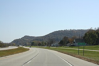
The community is located south of St. Charles; near the junction of State Highway 74 (MN 74) and Winona County Road 10.

Minnesota State Highway 74 (MN 74) is a highway in southeast Minnesota, which runs from its intersection with U.S. Highway 52 and State Highway 30 in Chatfield and continues north to its northern terminus at its intersection with U.S. Highway 61 at Weaver along the Mississippi River. It is 35 miles (56 km) in length. It is the only remaining road in the state highway system which is still partially unpaved.

Nearby places include St. Charles, Troy, Clyde, Dover, and Chatfield. Trout Run Creek flows through the community.

St. Charles, Minnesota City in Minnesota, United States

St. Charles is a city in Winona County, Minnesota, United States. The population was 3,735 at the 2010 census. It promotes itself as the gateway to Whitewater State Park, which is located 7 miles (11 km) north of the city on Minnesota State Highway 74.

Troy, Minnesota Unincorporated community in Minnesota, United States

Troy is an unincorporated community in Saratoga Township, Winona County, Minnesota, United States.

Clyde, Minnesota Unincorporated community in Minnesota, United States

Clyde is an unincorporated community in Saratoga Township, Winona County, Minnesota, United States.

Related Research Articles

Winona, Minnesota City in Minnesota, United States

Winona is a city in and the county seat of Winona County, in the state of Minnesota. Located in picturesque bluff country on the Mississippi River, its most noticeable physical landmark is Sugar Loaf. The city is named after legendary figure Winona, said to have been the first-born daughter of Chief Wapasha (Wabasha) III. The population was 27,592 at the 2010 census.

Homer, Minnesota Census-designated place and Unincorporated community in Minnesota, United States

Homer is an unincorporated community and census-designated place (CDP) in Homer Township, Winona County, Minnesota, United States, on the south bank of the Mississippi River. As of the 2010 census, its population was 181.

National Register of Historic Places listings in Winona County, Minnesota Wikimedia list article

This is a list of the National Register of Historic Places listings in Winona County, Minnesota. It is intended to be a complete list of the properties and districts on the National Register of Historic Places in Winona County, Minnesota, United States. The locations of National Register properties and districts for which the latitude and longitude coordinates are included below, may be seen in an online map.

Beaver, Minnesota Unincorporated community in Minnesota, United States

Beaver is an unincorporated community in Whitewater Township, Winona County, Minnesota, United States, located near the junction of State Highway 74 and Winona County Road 30. Nearby places include Altura, Elba, Plainview, St. Charles, Weaver, and Whitewater State Park. The Whitewater River and Beaver Creek both flow through the area.

Nodine, Minnesota Unincorporated community in Minnesota, United States

Nodine is an unincorporated community in New Hartford Township, Winona County, Minnesota, United States.

Ridgeway, Minnesota Unincorporated community in Minnesota, United States

Ridgeway is an unincorporated community in Pleasant Hill Township, Winona County, Minnesota, United States.

Fremont, Minnesota Unincorporated community in Minnesota, United States

Fremont is an unincorporated community in Fremont Township, Winona County, Minnesota, United States.

Witoka, Minnesota Unincorporated community in Minnesota, United States

Witoka is an unincorporated community in Winona County, Minnesota, United States.

Donehower, Minnesota Unincorporated community in Minnesota, United States

Donehower is an unincorporated community in Richmond Township, Winona County, Minnesota, United States.

Centerville, Winona County, Minnesota Unincorporated community in Minnesota, United States

Centerville is an unincorporated community in Wilson Township, Winona County, Minnesota, United States.

Dresbach, Minnesota Unincorporated community in Minnesota, United States

Dresbach is an unincorporated community in Dresbach Township, Winona County, Minnesota, United States.

Lamoille, Minnesota Unincorporated community in Minnesota, United States

Lamoille is an unincorporated community in Richmond Township, Winona County, Minnesota, United States. Big Trout Creek and the Mississippi River meet at Lamoille.

1908 United States presidential election in Minnesota

The 1908 United States presidential election in Minnesota took place on November 3, 1908, in Minnesota as part of the 1908 United States presidential election.

References