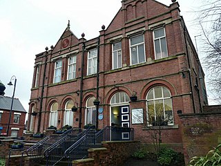
Tameside is a metropolitan borough of Greater Manchester, England, named after the River Tame, which flows through it, and includes the towns of Ashton-under-Lyne, Audenshaw, Denton, Droylsden, Dukinfield, Hyde, Mossley and Stalybridge. Tameside is bordered by the metropolitan boroughs of Stockport to the south, Oldham to the north and northeast, Manchester to the west, and to the east by the Borough of High Peak in Derbyshire. As of 2021, the population of Tameside was 231,199, making it the 8th-most populous borough of Greater Manchester by population.

Stalybridge is a town in Tameside, Greater Manchester, England, with a population of 23,731 at the 2011 Census.

Denton is a town in Tameside, Greater Manchester, England, five miles (8 km) east of Manchester city centre. Historically part of Lancashire, it had a population of 36,591 at the 2011 Census.

Ashton-under-Lyne is a market town in Tameside, Greater Manchester, England. The population was 48,604 at the 2021 census. Historically in Lancashire, it is on the north bank of the River Tame, in the foothills of the Pennines, 6 miles (9.7 km) east of Manchester.

Dukinfield is a town in Tameside, Greater Manchester, England, on the south bank of the River Tame opposite Ashton-under-Lyne, 6.3 miles (10.1 km) east of Manchester. At the 2011 Census, it had a population of 19,306.

Hyde is a town in Tameside, Greater Manchester, England, which had a population of 35,890 in 2021.

Audenshaw is a town in Tameside, Greater Manchester, England, 4.9 miles (7.9 km) east of Manchester. Historically part of Lancashire, in 2011 it had a population of 11,419.

Mossley (/ˈmɒzli/) is a town and civil parish in Tameside, Greater Manchester, England. It is located in the upper Tame Valley and the foothills of the Pennines, 3 miles (4.8 km) south-east of Oldham and 8.9 miles (14.3 km) east of Manchester.

Droylsden is a town in Tameside, Greater Manchester, England, 4.1 miles (6.6 km) east of Manchester city centre and 2.2 miles (3.5 km) west of Ashton-under-Lyne, with a population at the 2011 Census of 22,689.

Ashton upon Mersey is an area of the Metropolitan Borough of Trafford, Greater Manchester, England, with a population of 9,693 at the 2011 census. It lies on the south bank of the River Mersey, 5 miles (8.0 km) south of Manchester city centre.

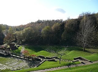
Park Bridge is an area of Ashton-under-Lyne, in the Metropolitan Borough of Tameside, in Greater Manchester, England. It is situated in the Medlock Valley, by Ashton-under-Lyne's border with Oldham. Park Bridge anciently lay within medieval manor of Ashton, however there is no record of Park Bridge until the 17th century. The name is probably a reference to the medieval Lyme Park, in the north west of the manor of Ashton. For nearly two hundred years from the 18th to the 20th centuries it was the site of the Park Bridge Ironworks.

Nico Ditch is a six-mile (9.7 km) long linear earthwork between Ashton-under-Lyne and Stretford in Greater Manchester, England. It was dug as a defensive fortification, or possibly a boundary marker, between the 5th and 11th century.

Hartshead Pike is a hill in Tameside in Greater Manchester, England, and its name is associated with the monument on its summit. It overlooks Ashton-under-Lyne, Mossley, Saddleworth, Lees and Oldham. On a clear day you can get views of Manchester, Cheshire and Snowdonia in Wales. Hartshead Pike Tower has been a Grade II listed building since 1967.

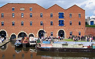
Dukinfield Junction is the name of the canal junction where the Peak Forest Canal, the Ashton Canal and the Huddersfield Narrow Canal meet near Ashton-under-Lyne, Greater Manchester, England. The area has been designated by Tameside Metropolitan Borough Council as a conservation area.

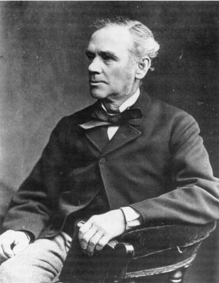
Hugh Mason was an English mill owner, social reformer and Liberal politician. He was born in Stalybridge and brought up in Stalybridge and Ashton-under-Lyne until he entered the family cotton business in 1838 after a seven-year period working in a bank. Having originally opposed trade unions, Mason became a paternalistic mill owner, creating a colony for his workers with associated facilities and ensuring that they experienced good conditions. During the Lancashire Cotton Famine of the 1860s he refused to cut workers' wages although it was common practice.
Ryecroft is an area of Ashton-under-Lyne, a town in Greater Manchester, England. It occupies a western area of Ashton.
Ashton Ladysmith Cricket Club are an open age English cricket team, based in the town of Ashton-under-Lyne in Tameside, Greater Manchester. The club plays its home games at the Ladysmith Sports Centre on Rose Hill Road, and competes in the North Manchester Cricket League. The club was formerly known as Ashton St. James Cricket Club and played their games on St Albans Avenue in Ashton-under-Lyne.

Ladysmith Barracks was a British military installation on Mossley Road, Ashton-under-Lyne, Greater Manchester.

Tameside General Hospital is an acute general hospital in Ashton-under-Lyne, England, managed by Tameside and Glossop Integrated Care NHS Foundation Trust. It serves the surrounding area of Tameside in Greater Manchester, and the town of Glossop in Derbyshire. Employing just under 2,500 staff, the hospital provides Accident and Emergency services, and full consultant-led obstetric and paediatric hospital services for women, children and babies.


