
The River Lugg rises near Llangynllo, Powys. It flows through the border town of Presteigne, Wales then through Herefordshire, England, to the south of Leominster where it meets a tributary, the River Arrow. Its confluence with the River Wye is at Mordiford, 9 miles (14 km) downstream of Hereford and 45 miles (72 km) from its source.

Moreton on Lugg is a village in Herefordshire, England, between Hereford, 4.25 miles (6.84 km) to the south, and Leominster, to the north.

Little Hereford is a small village and civil parish in Herefordshire, England. The civil parish includes the hamlet of Middleton. The population of the civil parish at the 2011 census was 394.

Lugwardine is a village and civil parish in Herefordshire, England, to the east of Hereford. It lies on the north-east bank of the River Lugg, which gives the village its name. The population of the civil parish taken at the 2011 Census was 1,721.
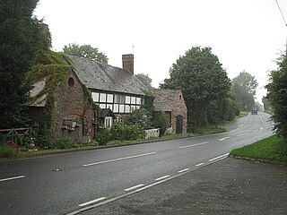
The village of Kinsham lies in the wooded hills of Herefordshire, England in the Marches near to the border with Wales and near the town of Presteigne. Surrounding villages include Stapleton and Lingen. Kinsham lies on the River Lugg. The 2001 census records that 71 people lived in the parish of Kinsham, of whom 32 were male and 39 female.
Dilwyn is a village in Herefordshire, England located about 18 km (11 mi) from the city of Hereford and 9 km (6 mi) from its nearest town, Leominster. It is situated on the northern edge of a broad valley that stretches from the River Wye through to Leominster. Running through the valley, south of the village, is the Stretford Brook whilst to the north are the rivers Arrow and Lugg.

The Herefordshire Trail is a long distance footpath in Herefordshire, England.
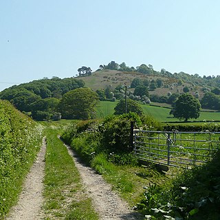
Croft Ambrey is a Iron Age hill fort in Herefordshire, England.
Titley is a village and civil parish in Herefordshire, England. It lies on the B4355 between Kington and Presteigne.

Richard's Castle is a village, castle and two civil parishes on the border of the counties of Herefordshire and Shropshire in England. The Herefordshire section of the parish had a population of 250 at the 2011 Census. The Shropshire section of the parish had a population of 424 at the 2011 Census.
Ashton is a village in the Eye, Moreton and Ashton civil parish of Herefordshire, England, and is 3 miles (5 km) north from Leominster, 15 miles (24 km) north from the city and county town of Hereford, and in the catchment area of the River Lugg. The village is on the A49 road; to the north is Brimfield. Bordering the village to the south-west is Berrington Hall.
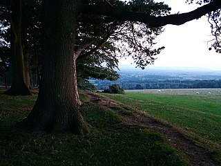
Bircher Common is an area of lowland heath in the civil parish of Croft and Yarpole in Herefordshire, England, and 6 miles (10 km) north from Leominster. The common, owned by the National Trust, is adjacent at the west to Croft Castle, a further National Trust Property. Croft Ambrey, an Iron Age hill fort, is to the north-west within the border of the neighbouring parish of Aymestrey.
Yatton is a hamlet in the civil parish of Aymestrey in north-western Herefordshire, England. In 1870–72 the township had a population of 214.

Humber is a hamlet and civil parish in the county of Herefordshire, England, and is 10 miles (16 km) north from the city and county town of Hereford. The closest large town is Leominster 3 miles (5 km) to the north-west.
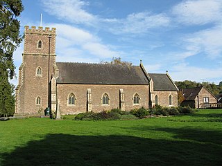
Ford and Stoke Prior is a civil parish in the county of Herefordshire, England, and is 10 miles (16 km) north from the city and county town of Hereford. The closest large town is the market town of Leominster, adjacent at the north-west. The parish includes the hamlet of Ford, the village of Stoke Prior, and the medieval parish churches of St Luke and St John of Jerusalem. At the west of the parish is the site of a Romano-British settlement.
Newton is a linear settlement hamlet and civil parish in the county of Herefordshire, England, and is 10 miles (16 km) north from the city and county town of Hereford. The closest large town is the market town of Leominster, 3 miles (5 km) to the north. A Cadbury's confectionery factory is within the parish.

Eye, Moreton and Ashton is a civil parish in the county of Herefordshire, England. The parish is 15 miles (24 km) north from the city and county town of Hereford. The closest large town is the market town of Leominster, 3 miles (5 km) to the south. Within the parish is the National Trust property of Berrington Hall.

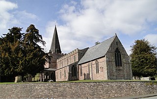
King's Pyon is a village and civil parish in the county of Herefordshire, England, and is approximately 8 miles (13 km) north-west from the city and county town of Hereford. The closest large town is the market town of Leominster, 6 miles (10 km) to the north-west. The parish includes the Grade I listed church of St Mary the Virgin.

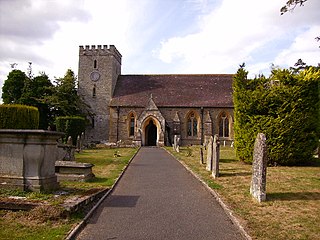
Pudleston, is a small village and civil parish, in the county of Herefordshire, England, and is 13 miles (20 km) north from the city and county town of Hereford. The closest large town is Leominster 4 miles (6 km) to the west. At Pudleston is the c.1200 Church of St Peter, and the 1846 Tudor-Gothic Pudleston Court.


