
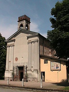
Bonemerse is a comune (municipality) in the Province of Cremona in the Italian region Lombardy, located about 80 kilometres (50 mi) southeast of Milan and about 4 kilometres (2 mi) southeast of Cremona.

Capergnanica is a comune (municipality) in the Province of Cremona in the Italian region Lombardy, located about 45 kilometres (28 mi) southeast of Milan, about 45 kilometres (28 mi) south of Bergamo and about 40 kilometres (25 mi) northwest of Cremona.
Casalbuttano ed Uniti is a comune (municipality) in the Province of Cremona in the Italian region Lombardy, located about 70 kilometres (43 mi) southeast of Milan and about 14 kilometres (9 mi) northwest of Cremona.

Casaletto Vaprio is a comune (municipality) in the Province of Cremona in the Italian region Lombardy, located about 35 kilometres (22 mi) east of Milan and about 45 kilometres (28 mi) northwest of Cremona.
Cicognolo is a comune (municipality) in the Province of Cremona in the Italian region Lombardy, located about 90 kilometres (56 mi) southeast of Milan and about 14 kilometres (9 mi) northeast of Cremona. As of 31 December 2012, it had a population of 961 and an area of 7.0 square kilometres (2.7 sq mi).

Genivolta is a comune (municipality) in the Province of Cremona in the Italian region Lombardy, located about 60 kilometres (37 mi) east of Milan and about 25 kilometres (16 mi) northwest of Cremona.
Gerre de' Caprioli is a comune (municipality) in the Province of Cremona in the Italian region Lombardy, located about 80 kilometres (50 mi) southeast of Milan and about 6 kilometres (4 mi) south of Cremona.
Madignano is a comune (municipality) in the Province of Cremona in the Italian region Lombardy, located about 45 kilometres (28 mi) southeast of Milan and about 35 kilometres (22 mi) northwest of Cremona. As of 31 December 2006, it had a population of 2,977 and an area of 10.8 square kilometres (4.2 sq mi).
Malagnino is a comune (municipality) in the Province of Cremona in the Italian region Lombardy, located about 80 kilometres (50 mi) southeast of Milan and about 7 kilometres (4 mi) east of Cremona.

Olmeneta is a comune (municipality) in the Province of Cremona in the Italian region Lombardy, located about 70 kilometres (43 mi) southeast of Milan and about 11 kilometres (7 mi) north of Cremona.
Pescarolo ed Uniti is a comune (municipality) in the Province of Cremona in the Italian region Lombardy, located about 90 kilometres (56 mi) southeast of Milan and about 14 kilometres (9 mi) northeast of Cremona. As of 31 December 2004, it had a population of 1,520 and an area of 16.6 square kilometres (6.4 sq mi).
Pianengo is a comune (municipality) in the Province of Cremona in the Italian region Lombardy, located about 40 kilometres (25 mi) east of Milan and about 40 kilometres (25 mi) northwest of Cremona. As of 31 December 2004, it had a population of 2,474 and an area of 5.9 square kilometres (2.3 sq mi).
Sesto ed Uniti is a comune (municipality) in the Province of Cremona in the Italian region Lombardy, located about 70 kilometres (43 mi) southeast of Milan and about 11 kilometres (7 mi) northwest of Cremona.

Soresina is a comune (municipality) in the Province of Cremona in the Italian region Lombardy, located about 60 kilometres (37 mi) southeast of Milan and about 25 kilometres (16 mi) northwest of Cremona.
Spinadesco is a comune (municipality) in the Province of Cremona in the Italian region Lombardy, located about 70 kilometres (43 mi) southeast of Milan and about 8 kilometres (5 mi) west of Cremona.
Stagno Lombardo is a comune (municipality) in the Province of Cremona in the Italian region Lombardy, located about 80 kilometres (50 mi) southeast of Milan and about 8 kilometres (5 mi) southeast of Cremona.
Tornata is a comune (municipality) in the Province of Cremona in the Italian region Lombardy, located about 110 kilometres (68 mi) southeast of Milan and about 30 kilometres (19 mi) east of Cremona. As of 31 December 2004, it had a population of 522 and an area of 10.3 square kilometres (4.0 sq mi).
Vailate is a comune (municipality) in the Province of Cremona in the Italian region Lombardy, located about 35 kilometres (22 mi) east of Milan and about 50 kilometres (31 mi) northwest of Cremona. As of 31 December 2004, it had a population of 4,299 and an area of 9.8 square kilometres (3.8 sq mi).


