Cella Dati

Last updated
Cella Dati
Comune
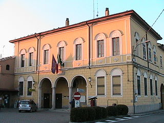
Comune di Cella Dati
Santa Maria Assunta (Cella Dati).jpg
Italy provincial location map 2015.svg
Red pog.svg
Cella Dati
Location of Cella Dati in Italy
Coordinates: 45°6′N10°13′E / 45.100°N 10.217°E / 45.100; 10.217 Coordinates: 45°6′N10°13′E / 45.100°N 10.217°E / 45.100; 10.217
Country Italy
Region Lombardy
Province Cremona (CR)
Government
  Mayor Giuseppe Rivaroli
Area
  Total 19.1 km2 (7.4 sq mi)
Elevation 34 m (112 ft)
Population (30 June 2017) [1]
  Total 506
  Density 26/km2 (69/sq mi)
Demonym(s) Cellesi
Time zone CET (UTC+1)
  Summer (DST) CEST (UTC+2)
Postal code26040
Dialing code 0372
Website Official website

Cella Dati (Cremunés: Céla) is a comune (municipality) in the Province of Cremona in the Italian region Lombardy, located about 90 kilometres (56 mi) southeast of Milan and about 15 kilometres (9 mi) east of Cremona.

<i>Comune</i> third-level administrative divisions of the Italian Republic

The comune is a basic administrative division in Italy, roughly equivalent to a township or municipality.

Province of Cremona Province of Italy

The Province of Cremona is a province in the Lombardy region of Italy. Its capital city is Cremona.

Italy republic in Southern Europe

Italy, officially the Italian Republic, is a country in Southern and Western Europe. Located in the middle of the Mediterranean Sea, Italy shares open land borders with France, Switzerland, Austria, Slovenia and the enclaved microstates San Marino and Vatican City. Italy covers an area of 301,340 km2 (116,350 sq mi) and has a largely temperate seasonal and Mediterranean climate. With around 61 million inhabitants, it is the fourth-most populous EU member state and the most populous country in Southern Europe.

Cella Dati borders the following municipalities: Cingia de' Botti, Derovere, Motta Baluffi, Pieve San Giacomo, San Daniele Po, Sospiro.

Cingia de Botti Comune in Lombardy, Italy

Cingia de' Botti is a comune (municipality) in the Province of Cremona in the Italian region Lombardy, located about 100 kilometres (62 mi) southeast of Milan and about 20 kilometres (12 mi) southeast of Cremona.

Derovere Comune in Lombardy, Italy

Derovere is a comune (municipality) in the Province of Cremona in the Italian region Lombardy, located about 90 kilometres (56 mi) southeast of Milan and about 15 kilometres (9 mi) east of Cremona.

Motta Baluffi Comune in Lombardy, Italy

Motta Baluffi is a comune (municipality) in the Province of Cremona in the Italian region Lombardy, located about 100 kilometres (62 mi) southeast of Milan and about 20 kilometres (12 mi) southeast of Cremona.

Related Research Articles

Ca dAndrea Comune in Lombardy, Italy

Ca' d'Andrea is a comune (municipality) in the Province of Cremona in the Italian region Lombardy, located about 90 kilometres (56 mi) southeast of Milan and about 20 kilometres (12 mi) east of Cremona.

Cappella Cantone Comune in Lombardy, Italy

Cappella Cantone is a comune (municipality) in the Province of Cremona in the Italian region of Lombardy, located about 60 kilometres (37 mi) southeast of Milan and about 20 kilometres (12 mi) northwest of Cremona.

Casteldidone Comune in Lombardy, Italy

Casteldidone is a comune (municipality) in the Province of Cremona in the Italian region Lombardy, located about 110 kilometres (68 mi) southeast of Milan and about 30 kilometres (19 mi) east of Cremona.

Castelvisconti Comune in Lombardy, Italy

Castelvisconti is a comune (municipality) in the Province of Cremona in the Italian region Lombardy, located about 60 kilometres (37 mi) southeast of Milan and about 20 kilometres (12 mi) northwest of Cremona.

Formigara Comune in Lombardy, Italy

Formigara is a comune (municipality) in the Province of Cremona in the Italian region Lombardy, located about 50 kilometres (31 mi) southeast of Milan and about 25 kilometres (16 mi) northwest of Cremona.

Martignana di Po Comune in Lombardy, Italy

Martignana di Po is a comune (municipality) in the Province of Cremona in the Italian region Lombardy, located about 110 kilometres (68 mi) southeast of Milan and about 30 kilometres (19 mi) southeast of Cremona.

Ostiano Comune in Lombardy, Italy

Ostiano is a comune (municipality) in the Province of Cremona in the Italian region Lombardy, located about 90 kilometres (56 mi) southeast of Milan and about 20 kilometres (12 mi) northeast of Cremona. As of 31 December 2004, it had a population of 3,054 and an area of 19.4 square kilometres (7.5 sq mi).

Persico Dosimo Comune in Lombardy, Italy

Persico Dosimo is a comune (municipality) in the Province of Cremona in the Italian region Lombardy, located about 80 kilometres (50 mi) southeast of Milan and about 8 kilometres (5 mi) northeast of Cremona.

Pieve dOlmi Comune in Lombardy, Italy

Pieve d'Olmi is a comune (municipality) in the Province of Cremona in the Italian region Lombardy, located about 90 kilometres (56 mi) southeast of Milan and about 9 kilometres (6 mi) southeast of Cremona.

Pieve San Giacomo Comune in Lombardy, Italy

Pieve San Giacomo is a comune (municipality) in the Province of Cremona in the Italian region Lombardy, located about 90 kilometres (56 mi) southeast of Milan and about 12 kilometres (7.5 mi) east of Cremona.

San Bassano Comune in Lombardy, Italy

San Bassano is a comune (municipality) in the Province of Cremona in the Italian region Lombardy, located about 60 kilometres (37 mi) southeast of Milan and about 20 kilometres (12 mi) northwest of Cremona.

San Daniele Po Comune in Lombardy, Italy

San Daniele Po is a comune in the Province of Cremona in the Italian region Lombardy, located about 90 kilometres (56 mi) southeast of Milan and about 14 kilometres (9 mi) southeast of Cremona.

San Giovanni in Croce Comune in Lombardy, Italy

San Giovanni in Croce is a comune (municipality) in the Province of Cremona in the Italian region Lombardy, located about 100 kilometres (62 mi) southeast of Milan and about 25 kilometres (16 mi) east of Cremona.

Solarolo Rainerio Comune in Lombardy, Italy

Solarolo Rainerio is a comune (municipality) in the Province of Cremona in the Italian region Lombardy, located about 100 kilometres (62 mi) southeast of Milan and about 25 kilometres (16 mi) east of Cremona. As of 31 December 2004, it had a population of 1,016 and an area of 11.4 square kilometres (4.4 sq mi).

Sospiro Comune in Lombardy, Italy

Sospiro is a comune (municipality) in the Province of Cremona in the Italian region Lombardy, located about 90 kilometres (56 mi) southeast of Milan and about 10 kilometres (6 mi) southeast of Cremona.

Vescovato, Lombardy Comune in Lombardy, Italy

Vescovato is a comune (municipality) in the Province of Cremona in the Italian region Lombardy, located about 90 kilometres (56 mi) southeast of Milan and about 11 kilometres (7 mi) northeast of Cremona.

Voltido Comune in Lombardy, Italy

Voltido is a comune (municipality) in the Province of Cremona in the Italian region Lombardy, located about 90 kilometres (56 mi) southeast of Milan and about 20 kilometres (12 mi) east of Cremona.

References

  1. All demographics and other statistics: Italian statistical institute Istat.