Olmeneta

Last updated
Olmeneta
Ulmenéeda  (Lombard)
Comune
Comune di Olmeneta
Olmeneta San Giovanni Battista 20100725.jpg
Italy provincial location map 2015.svg
Red pog.svg
Olmeneta
Location of Olmeneta in Italy
Coordinates: 45°14′N10°1′E / 45.233°N 10.017°E / 45.233; 10.017 Coordinates: 45°14′N10°1′E / 45.233°N 10.017°E / 45.233; 10.017
Country Italy
Region Lombardy
Province Cremona (CR)
Government
  Mayor Renzo Felisari
Area
  Total 9.2 km2 (3.6 sq mi)
Elevation 55 m (180 ft)
Population (28 February 2017) [1]
  Total 947
  Density 100/km2 (270/sq mi)
Time zone CET (UTC+1)
  Summer (DST) CEST (UTC+2)
Postal code26010
Dialing code 0372

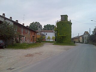
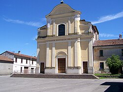
Olmeneta (Cremunés: Ulmenéeda) is a comune (municipality) in the Province of Cremona in the Italian region Lombardy, located about 70 kilometres (43 mi) southeast of Milan and about 11 kilometres (7 mi) north of Cremona.

<i>Comune</i> third-level administrative divisions of the Italian Republic

The comune is a basic administrative division in Italy, roughly equivalent to a township or municipality.

Province of Cremona Province of Italy

The Province of Cremona is a province in the Lombardy region of Italy. Its capital city is Cremona.

Italy republic in Southern Europe

Italy, officially the Italian Republic, is a European country consisting of a peninsula delimited by the Italian Alps and sorrounded by several islands. Located in the middle of the Mediterranean sea and traversed along its lenght by the Apennines, Italy has a largely temperate seasonal climate. The country covers an area of 301,340 km2 (116,350 sq mi) and shares open land borders with France, Slovenia, Austria, Switzerland and the enclaved microstates of Vatican City and San Marino. Italy has a territorial exclave in Switzerland (Campione) and a maritime exclave in the Tunisian sea (Lampedusa). With around 60 million inhabitants, Italy is the fourth-most populous member state of the European Union.

Olmeneta borders the following municipalities: Casalbuttano ed Uniti, Castelverde, Corte de' Cortesi con Cignone, Pozzaglio ed Uniti, Robecco d'Oglio.

Casalbuttano ed Uniti Comune in Lombardy, Italy

Casalbuttano ed Uniti is a comune (municipality) in the Province of Cremona in the Italian region Lombardy, located about 70 kilometres (43 mi) southeast of Milan and about 14 kilometres (9 mi) northwest of Cremona.

Castelverde Comune in Lombardy, Italy

Castelverde is a comune (municipality) in the Province of Cremona in the Italian region Lombardy, located about 70 kilometres (43 mi) southeast of Milan and about 8 kilometres (5 mi) northwest of Cremona.

Corte de Cortesi con Cignone Comune in Lombardy, Italy

Corte de' Cortesi con Cignone is a comune in the province of Cremona, in Lombardy, northern Italy.

Transportation

Olmeneta has a railway station which is a junction of the lines Brescia–Cremona and Treviglio–Cremona.

Brescia–Cremona railway railway line in Italy

Brescia–Cremona railway is a railway line in Lombardy, Italy.

Treviglio–Cremona railway railway line in Italy

The Treviglio–Cremona railway is a railway line in Lombardy, Italy.

Related Research Articles

Acquanegra Cremonese Comune in Lombardy, Italy

Acquanegra Cremonese is a comune (municipality) in the Province of Cremona in the Italian region Lombardy, located about 70 kilometres (43 mi) southeast of Milan and about 12 kilometres (7 mi) northwest of Cremona.

Annicco Comune in Lombardy, Italy

Annicco is a comune (municipality) in the Province of Cremona in the Italian region Lombardy, located about 60 kilometres (37 mi) southeast of Milan and about 20 kilometres (12 mi) northwest of Cremona.

Bordolano Comune in Lombardy, Italy

Bordolano is a comune (municipality) in the Province of Cremona in the Italian region Lombardy, located about 70 kilometres (43 mi) southeast of Milan and about 15 kilometres (9 mi) north of Cremona.

Cappella Cantone Comune in Lombardy, Italy

Cappella Cantone is a comune (municipality) in the Province of Cremona in the Italian region of Lombardy, located about 60 kilometres (37 mi) southeast of Milan and about 20 kilometres (12 mi) northwest of Cremona.

Cappella de Picenardi Comune in Lombardy, Italy

Cappella de' Picenardi is a comune (municipality) in the Province of Cremona in the Italian region Lombardy, located about 90 kilometres (56 mi) southeast of Milan and about 15 kilometres (9 mi) east of Cremona.

Casalmorano Comune in Lombardy, Italy

Casalmorano is a comune (municipality) in the Province of Cremona in the Italian region Lombardy, located about 60 kilometres (37 mi) southeast of Milan and about 20 kilometres (12 mi) northwest of Cremona.

Casteldidone Comune in Lombardy, Italy

Casteldidone is a comune (municipality) in the Province of Cremona in the Italian region Lombardy, located about 110 kilometres (68 mi) southeast of Milan and about 30 kilometres (19 mi) east of Cremona.

Cicognolo Comune in Lombardy, Italy

Cicognolo is a comune (municipality) in the Province of Cremona in the Italian region Lombardy, located about 90 kilometres (56 mi) southeast of Milan and about 14 kilometres (9 mi) northeast of Cremona. As of 31 December 2012, it had a population of 961 and an area of 7.0 square kilometres (2.7 sq mi).

Crotta dAdda Comune in Lombardy, Italy

Crotta d'Adda is a comune (municipality) in the Province of Cremona in the Italian region Lombardy, located about 60 kilometres (37 mi) southeast of Milan and about 15 kilometres (9.3 mi) west of Cremona.

Gabbioneta-Binanuova Comune in Lombardy, Italy

Gabbioneta-Binanuova is a comune (municipality) in the Province of Cremona in the Italian region Lombardy, located about 90 kilometres (56 mi) southeast of Milan and about 15 kilometres (9 mi) northeast of Cremona.

Grumello Cremonese ed Uniti Comune in Lombardy, Italy

Grumello Cremonese ed Uniti is a comune (municipality) in the Province of Cremona in the Italian region Lombardy, located about 60 kilometres (37 mi) southeast of Milan and about 15 kilometres (9.3 mi) northwest of Cremona. Grumello Cremonese ed Uniti borders the following municipalities: Acquanegra Cremonese, Annicco, Cappella Cantone, Crotta d'Adda, Pizzighettone, Sesto ed Uniti.

Persico Dosimo Comune in Lombardy, Italy

Persico Dosimo is a comune (municipality) in the Province of Cremona in the Italian region Lombardy, located about 80 kilometres (50 mi) southeast of Milan and about 8 kilometres (5 mi) northeast of Cremona.

Pescarolo ed Uniti Comune in Lombardy, Italy

Pescarolo ed Uniti is a comune (municipality) in the Province of Cremona in the Italian region Lombardy, located about 90 kilometres (56 mi) southeast of Milan and about 14 kilometres (9 mi) northeast of Cremona. As of 31 December 2004, it had a population of 1,520 and an area of 16.6 square kilometres (6.4 sq mi).

Pozzaglio ed Uniti Comune in Lombardy, Italy

Pozzaglio ed Uniti is a comune (municipality) in the Province of Cremona in the Italian region Lombardy, located about 80 kilometres (50 mi) southeast of Milan and about 8 kilometres (5 mi) north of Cremona.

Rivarolo del Re ed Uniti Comune in Lombardy, Italy

Rivarolo del Re ed Uniti is a comune (municipality) in the Province of Cremona in the Italian region Lombardy, located about 110 kilometres (68 mi) southeast of Milan and about 35 kilometres (22 mi) southeast of Cremona.

Sesto ed Uniti Comune in Lombardy, Italy

Sesto ed Uniti is a comune (municipality) in the Province of Cremona in the Italian region Lombardy, located about 70 kilometres (43 mi) southeast of Milan and about 11 kilometres (7 mi) northwest of Cremona.

Spinadesco Comune in Lombardy, Italy

Spinadesco is a comune (municipality) in the Province of Cremona in the Italian region Lombardy, located about 70 kilometres (43 mi) southeast of Milan and about 8 kilometres (5 mi) west of Cremona.

Vescovato, Lombardy Comune in Lombardy, Italy

Vescovato is a comune (municipality) in the Province of Cremona in the Italian region Lombardy, located about 90 kilometres (56 mi) southeast of Milan and about 11 kilometres (7 mi) northeast of Cremona.

References

  1. All demographics and other statistics: Italian statistical institute Istat.