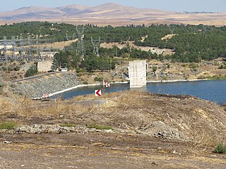
Cip Dam is a dam in Turkey. The development was backed by the Turkish State Hydraulic Works.
Çaltıkoru Dam is a dam in Izmir Province, Turkey, built between 1996 and 2002. The development was backed by the Turkish State Hydraulic Works.
Çamköy Dam is a dam in Turkey. The development was backed by the Turkish State Hydraulic Works.
Çatören Dam is a dam in Turkey. The development was backed by the Turkish State Hydraulic Works.
Çavdarhisar Dam is a dam in Kütahya Province, Turkey, built between 1985 and 1990. The development was backed by the Turkish State Hydraulic Works.
Çaygören Dam is a dam in Turkey. The development was backed by the Turkish State Hydraulic Works.
Çoğun Dam is a dam in Turkey. The development was backed by the Turkish State Hydraulic Works.
Darıdere Dam is a dam in Turkey. The development was backed by the Turkish State Hydraulic Works.
Demirköprü Dam is an embankment dam on the Gediz River in Manisa Province, Turkey. Constructed between 1954 and 1960, the development was backed by the Turkish State Hydraulic Works. The dams supports a 69 MW power station and provides water for the irrigation of 99,220 hectares.
Enne Dam is a dam in Kütahya Province, Turkey, built between 1969 and 1972. The development was backed by the Turkish State Hydraulic Works.
Erzincan Dam is an embankment dam on Cardakli Creek in Erzincan, Turkey. The development was backed by the Turkish State Hydraulic Works.
Gayt Dam is a dam in the eastern part of Turkey. The dam spans the Gayt River, a right-bank tributary of the Eastern Euphrates. The development was backed by the Turkish State Hydraulic Works.
Gazibey Dam is a dam in Turkey. The development was backed by the Turkish State Hydraulic Works.
Gelingüllü Dam is a dam in Turkey. The development was backed by the Turkish State Hydraulic Works.

Gönen Dam is a dam in Turkey. The development was backed by the Turkish State Hydraulic Works.
Hacıhıdır Dam is a dam in Turkey. The development was backed by the Turkish State Hydraulic Works.
Havran Dam is a dam in the agricultural province of Balıkesir, Turkey. The development was backed by the Turkish State Hydraulic Works. A large cave located in the dam reservoir was home to 15–20,000 bats, making it the second largest such colony in the country. Because these creatures are important to the local agriculture, the pumping operation for the dam was delayed until April, 2008 when the bats ended their hibernation.

Hirfanlı Dam is a dam in Turkey. The development was backed by the Turkish State Hydraulic Works. It was built by Wimpey Construction and was completed in 1959.
İkizcetepeler Dam is a dam in Turkey. The development was backed by the Turkish State Hydraulic Works.
İmranlı Dam is a dam in Turkey on the Kızılırmak. The development was backed by the Turkish State Hydraulic Works.


