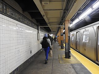
The J Nassau Street Local and Z Nassau Street Express are two rapid transit services in the B Division of the New York City Subway. Their route emblems, or "bullets", are colored brown since they use the BMT Nassau Street Line in Lower Manhattan.

Glendale is a neighborhood in the west-central portion of the New York City borough of Queens. It is bounded by Forest Hills to the east, Ridgewood to the west, Woodhaven to the south, and Middle Village to the north.
The Myrtle Avenue Line, also called the Myrtle Avenue Elevated, is a fully elevated line of the New York City Subway as part of the BMT division. The line is the last surviving remnant of one of the original Brooklyn elevated railroads. The remnant line operates as a spur branch from the Jamaica Line to Bushwick, Ridgewood, and Middle Village, terminating at its original eastern terminal across the street from Lutheran Cemetery. Until 1969, the line continued west into Downtown Brooklyn and, until 1944, over the Brooklyn Bridge to the Park Row Terminal in Manhattan.

Ridgewood is a neighborhood in the New York City borough of Queens. It borders the Queens neighborhoods of Maspeth to the north, Middle Village to the east, and Glendale to the southeast, as well as the Brooklyn neighborhoods of Bushwick to the southwest and East Williamsburg to the west. Historically, the neighborhood straddled the Queens-Brooklyn boundary.

Myrtle Avenue is a 8.1-mile-long (13.0 km) street that runs from Duffield Street in Downtown Brooklyn to Jamaica Avenue in Richmond Hill, Queens, in New York City, United States. Myrtle is a main thoroughfare through the neighborhoods of Fort Greene, Clinton Hill, Bedford-Stuyvesant, Bushwick, Ridgewood, and Glendale.

The Halsey Street station is a station on the BMT Canarsie Line of the New York City Subway. Located on the border of Ridgewood, Queens, and Bushwick, Brooklyn, at the intersection of Halsey Street and Wyckoff Avenue, it is served by the L train at all times.

The Myrtle–Wyckoff Avenues station is a New York City Subway station complex formed by the intersecting stations of the BMT Canarsie Line and the BMT Myrtle Avenue Line, served by the L and M trains at all times. It is located at Myrtle Avenue and Wyckoff Avenue in the Bushwick neighborhood of Brooklyn and the Ridgewood neighborhood of Queens. The complex is connected by a set of stairs and several elevators and escalators between the elevated and underground levels. The station was renovated completely from 2004 to 2008.

The Jefferson Street station is a station on the BMT Canarsie Line of the New York City Subway. Located in Bushwick, Brooklyn at the intersection of Jefferson Street and Wyckoff Avenue, it is served by the L train at all times.

The B54 is a bus route on Myrtle Avenue in Brooklyn, New York City. The line travels between Downtown Brooklyn in the west and Myrtle–Wyckoff Avenues station in the east. The B54 operates from MTA New York City Bus's Fresh Pond Depot in Ridgewood, Queens. The route serves only the section of Myrtle Avenue within Brooklyn; the section within Queens is served by the Q55 bus.

The Putnam Avenue Line is a public transit line in Brooklyn, New York City, running mostly along Fulton Street, Putnam Avenue, and Halsey Street between downtown Brooklyn and Ridgewood, Queens. Originally a streetcar line, it is now the B26 Halsey/Fulton Streets bus route, operated by the New York City Transit Authority.

The B52 is a bus route that constitutes a public transit line operating in Brooklyn, New York City, running mostly along Fulton Street, Greene Avenue, and Gates Avenue between Downtown Brooklyn and Ridgewood, Queens. The B52 is operated by the MTA New York City Transit Authority. Its precursor was a streetcar line that began operation by 1874, and was known as the Greene and Gates Avenues Line. The route became a bus line in 1941.

The Grand Street Line is a public transit line in Brooklyn and Queens, New York City, running mostly along the continuous Grand Street and Grand Avenue between Williamsburg, Brooklyn and Maspeth, Queens. It then continues down Queens Boulevard to the 63rd Drive–Rego Park station. Originally a streetcar line, it is now the Q59 bus route, operated by the New York City Transit Authority between Williamsburg and Rego Park, Queens.

The Wilson Avenue Line is a public transit line in Brooklyn, New York City, running along Wilson Avenue and Rockaway Avenue between Williamsburg and Canarsie. Originally a streetcar line, it is now the B60 bus route, operated by MTA New York City Bus.

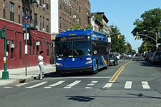
The Sumner Avenue Line and New Lots Avenue Line were two streetcar lines in Brooklyn, New York City, running mainly along Marcus Garvey Boulevard, East 98th Street, and New Lots Avenue between northern Bedford–Stuyvesant and New Lots. Originally streetcar lines, the two lines were combined as a bus route in 1947. That bus route became the present B15 Marcus Garvey Boulevard / New Lots Avenue service, operated by MTA New York City Bus' East New York Depot in East New York. The B15 continues east from New Lots to John F. Kennedy International Airport in Queens.

The Crosstown Line is a public transit line in Brooklyn, New York City, running along Van Brunt Street and Manhattan Avenue between Red Hook and Long Island City, Queens. Originally a streetcar line, it is now the B61 and the B62 bus routes. The northern section, the B62, is operated by MTA New York City Bus' Grand Avenue Depot in Maspeth, Queens, and the southern section is the B61, operated by MTA New York City Bus' Jackie Gleason Depot in Sunset Park. The entire route was a single line, the B61, until January 3, 2010; the B62 was previously a separate, parallel route between Downtown Brooklyn and Greenpoint, now part of the B43 route. The streetcar line, B61 and the original B62 previously operated from the now-closed Crosstown Depot in Greenpoint.

The B48 bus route constitutes a public transit line in Brooklyn, New York City, running along Lorimer Street, Franklin Avenue, and Classon Avenue between Flatbush and Greenpoint. Originally the Lorimer Street streetcar line, it is now a bus route operated by MTA New York City Bus.

The B67 and B69 bus routes comprise a public transit line in Brooklyn, New York City. Both bus routes originated as streetcar lines: The B67 originated as the Seventh Avenue Line, while the B69 originated as the Vanderbilt Avenue Line. The current bus routes are operated by MTA Regional Bus Operations. The B67 runs primarily along Seventh Avenue, Flatbush Avenue, and Atlantic Avenue, while the B69 runs along Seventh Avenue and Vanderbilt Avenue. Although both routes' southern termini are in Kensington, Brooklyn, the northern terminus of the B67 is in Williamsburg while the northern terminus of the B69 is in Dumbo.

Jamaica Avenue is a major avenue in the New York City boroughs of Brooklyn and Queens, New York, in the United States. Jamaica Avenue's western end is at Fulton Street and Broadway, as a continuation of East New York Avenue, in Brooklyn's East New York neighborhood. Physically, East New York Avenue connects westbound to New York Avenue, where East New York Avenue changes names another time to Lincoln Road; Lincoln Road continues to Ocean Avenue in the west, where it ends. Its eastern end is at the city line in Bellerose, Queens, where it merges into NY 25 to serve the rest of Long Island.

The Q58 and Q58 Limited are bus routes that constitute a public transit line operating primarily in Queens, New York City, with its southern terminal on the border with Brooklyn. The Q58 is operated by the MTA New York City Transit Authority. Its precursor was a streetcar line that began operation in November 1899. and was known variously as the Flushing–Ridgewood Line, the Corona Avenue Line, and the Fresh Pond Road Line. The route became a bus line in 1949.

The B20 and B83 constitute bus routes between Broadway Junction and East New York, running primarily on Pennsylvania Avenue in Brooklyn, New York City. They are operated by the New York City Transit Authority, with the B20 being based out of the Fresh Pond Depot and the B83 being based out of the East New York Depot.


