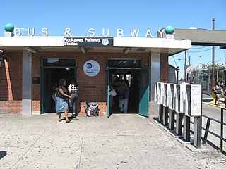
The Canarsie–Rockaway Parkway station is the southern terminal station of the BMT Canarsie Line of the New York City Subway, and is one of the few grade-level stations in the system. Located at the intersection of Rockaway Parkway and Glenwood Road in the Canarsie neighborhood of Brooklyn, it is served by the L train at all times.

The DeKalb Avenue Line is a public transit line in Brooklyn and Queens, New York City, running mostly along DeKalb Avenue, as well as eastbound on Lafayette Avenue, between Downtown Brooklyn and Ridgewood, Queens. Originally a streetcar line, it is now the B38 DeKalb/Lafayette Avenues bus route, operated by the New York City Transit Authority.

The Grand Street Line is a public transit line in Brooklyn and Queens, New York City, running mostly along the continuous Grand Street and Grand Avenue between Williamsburg, Brooklyn and Maspeth, Queens. It then continues down Queens Boulevard to the 63rd Drive–Rego Park station. Originally a streetcar line, it is now the Q59 bus route, operated by the New York City Transit Authority between Williamsburg and Rego Park, Queens.

The Church Avenue Line is a public transit line in Brooklyn, New York City, running mainly along 39th Street and Church Avenue between Sunset Park and Brownsville. Originally a streetcar line, it is now the B35 bus route, operated by MTA New York City Bus' Jackie Gleason Depot in Sunset Park.

The Wilson Avenue Line is a public transit line in Brooklyn, New York City, running along Wilson Avenue and Rockaway Avenue between Williamsburg and Canarsie. Originally a streetcar line, it is now the B60 bus route, operated by MTA New York City Bus.

The Eighth and Ninth Streets Crosstown is a public transit line in Manhattan, New York City, running mostly along Eighth Street, Ninth Street, Tenth Street, and Christopher Street through the West Village, Greenwich Village, and East Village. Originally a streetcar line, it is now the M8 bus route, operated by the Manhattan and Bronx Surface Transit Operating Authority.
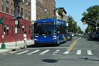
The Sumner Avenue Line and New Lots Avenue Line were two streetcar lines in Brooklyn, New York City, running mainly along Marcus Garvey Boulevard, East 98th Street, and New Lots Avenue between northern Bedford–Stuyvesant and New Lots. Originally streetcar lines, the two lines were combined as a bus route in 1947. That bus route became the present B15 Marcus Garvey Boulevard / New Lots Avenue service, operated by MTA New York City Bus' East New York Depot in East New York. The B15 continues east from New Lots to John F. Kennedy International Airport in Queens.
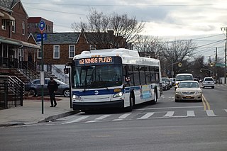
The B2 is a bus route in the New York City borough of Brooklyn. Originally operated by the Brooklyn-Manhattan Transit Corporation, it is now operated by MTA Regional Bus Operations under the New York City Transit brand.

The B4 is a bus route in the New York City borough of Brooklyn, which serves the corridor of Bay Ridge Parkway as well as the majority of Neptune Avenue. Originally operated by the Brooklyn-Manhattan Transit Corporation, it is now operated by MTA Regional Bus Operations under the New York City Transit brand.

The B6 constitutes a bus route between Bath Beach and East New York in Brooklyn, New York City. Originally operated by Brooklyn-Manhattan Transit, the route is operated by the MTA Regional Bus Operations under the New York City Transit Authority brand.

The B7 is a bus route in the New York City borough of Brooklyn, which serves the corridor of Saratoga Avenue as well as the majority of Kings Highway. Originally operated by the Brooklyn-Manhattan Transit Corporation, it is now operated by MTA Regional Bus Operations under the New York City Transit brand.

The B9 is a bus route in the New York City borough of Brooklyn, which serves the corridor of 60th Street, plus some of Avenue M and Avenue L. Originally operated by the Brooklyn-Manhattan Transit Corporation, it is now operated by MTA Regional Bus Operations under the New York City Transit brand.

The B11 is a bus route in the New York City borough of Brooklyn, which serves the corridors of 49th Street and 50th Street. Originally operated by the Brooklyn-Manhattan Transit Corporation, it is now operated by MTA Regional Bus Operations under the New York City Transit brand.

The B12 is a bus route in the New York City borough of Brooklyn, which serves the corridors of Clarkson and East New York Avenues. Originally operated by the Brooklyn–Manhattan Transit Corporation, it is now operated by MTA Regional Bus Operations under the New York City Transit brand.
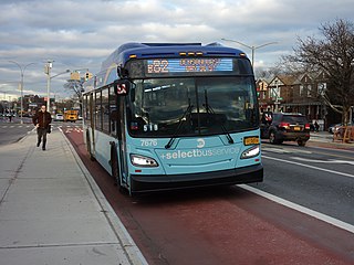
The B82 bus route constitutes a public transit line in central Brooklyn, New York City. It connects Starrett City in southeast Brooklyn with Coney Island on Brooklyn's southwestern coast. The B82 operates primarily via Kings Highway and Flatlands Avenue in southern Brooklyn. The route is operated by MTA Regional Bus Operations, under the New York City Bus and Select Bus Service brands.
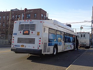
The B70 bus route is a public transit line in Brooklyn in New York City, running mostly on 8th Avenue and 39th Street between Sunset Park and Fort Hamilton. The route was originally a streetcar line known as the Eighth Avenue Line, and is currently operated by MTA New York City Bus.

The B47 is a surface transit line on Ralph Avenue in Brooklyn, New York City. Once a streetcar line, it is now part of the B47 bus route, operated by the New York City Transit Authority, Prior to 1995, it was the B78 route; the northern part of the route from St. Johns Place to Woodhull Hospital was part of the B40 line. The B47 was created as a result of a merger of the B40 and B78 on September 8, 2002.

Fourth Avenue is a major thoroughfare in the New York City borough of Brooklyn. It stretches for 6 miles (9.7 km) south from Times Plaza, which is the triangle intersection created by Atlantic and Flatbush Avenues in Downtown Brooklyn, to Shore Road and the Belt Parkway in Bay Ridge.

The M79 Select Bus Service, formerly the 79th Street Crosstown Line, is a bus line in Manhattan, New York City, running mostly along 79th Street on the Upper West and Upper East Sides of Manhattan. The route was previously owned by the private Green Bus Lines, and is now part of MTA Regional Bus Operations, operated by the Manhattan and Bronx Surface Transit Operating Authority under the New York City Transit brand.
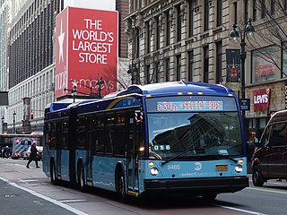
The 34th Street Crosstown Line is a surface transit line on 34th Street in Manhattan, New York City, United States. It currently hosts the M34/M34A SBS routes of MTA's Regional Bus Operations. The M34 runs from 12th Avenue to FDR Drive via 34th Street, while the M34A runs from Port Authority Bus Terminal to Waterside Plaza.


