The BMT Brighton Line, also known as the Brighton Beach Line, is a rapid transit line in the B Division of the New York City Subway in Brooklyn, New York. Local service is provided at all times by the Q train, but is joined by the B express train on weekdays. The Q train runs the length of the entire line from Coney Island–Stillwell Avenue to the Manhattan Bridge south tracks. The B begins at Brighton Beach and runs via the bridge's north tracks.

Atlantic Avenue is a major thoroughfare in the New York City boroughs of Brooklyn and Queens. It stretches from the Brooklyn waterfront on the East River all the way to Jamaica, Queens. Atlantic Avenue runs parallel to Fulton Street for much of its course through Brooklyn, where it serves as a border between the neighborhoods of Prospect Heights and Fort Greene and between Bedford-Stuyvesant and Crown Heights, and between Brooklyn Heights and Cobble Hill. This stretch of avenue is known for having a high rate of pedestrian fatalities and has been described as "the killing fields of the city."

South Brooklyn is a historic term for a section of the former City of Brooklyn – now the New York City borough of Brooklyn – encompassing what are now the Boerum Hill, Carroll Gardens, Cobble Hill, Gowanus, Park Slope, Windsor Terrace, Sunset Park and Red Hook neighborhoods. It was named for its location along the waterfront that was the southern border of the original Village of Brooklyn, and has remained widely used as a colloquialism despite it no longer being the southernmost point of the borough. It should not be confused with the geographic southern region of the modern borough of Brooklyn, which includes the neighborhoods of Gravesend, Seagate, Coney Island, Brighton Beach, Manhattan Beach, Sheepshead Bay, Gerritsen Beach, Marine Park, Mill Basin, and Bergen Beach.

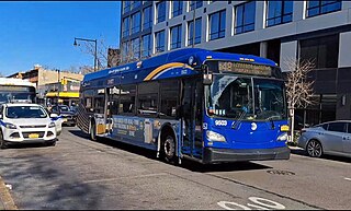
The B68 is a bus route that constitutes a public transit line operating in Brooklyn, New York City. The B68 is operated by the MTA New York City Transit Authority. Its precursor was a streetcar line that began operation in June 1862, and was known as the Coney Island Avenue Line. The route became a bus line in 1955.

Culver Depot, also called Culver Terminal or Culver Plaza, was a railroad and streetcar terminal in Coney Island, Brooklyn, New York City, United States, located on the northern side of Surf Avenue near West 5th Street. It was just north of the boardwalk, near the former Luna Park amusement complex, and across from the current New York Aquarium. Originally built by the Prospect Park and Coney Island Railroad for the Culver surface line, it later became a major terminal for the Brooklyn Rapid Transit Company (BRT).
The Culver Line, Gravesend Avenue Line, or McDonald Avenue Line was a surface public transit line in Brooklyn, New York City, United States, running along McDonald Avenue and built by the Prospect Park and Coney Island Railroad. Most of its main line has been essentially replaced by the IND Culver Line of the New York City Subway.

The B54 is a bus route on Myrtle Avenue in Brooklyn, New York City. The line travels between Downtown Brooklyn in the west and Myrtle–Wyckoff Avenues station in the east. The B54 operates from MTA New York City Bus's Fresh Pond Depot in Ridgewood, Queens. The route serves only the section of Myrtle Avenue within Brooklyn; the section within Queens is served by the Q55 bus.

The B41 is a bus route that constitutes a public transit line operating in Brooklyn, New York City, running along Flatbush Avenue between Downtown Brooklyn and Marine Park. The B41 is operated by the MTA New York City Transit Authority. Its precursor was a streetcar line that began operation in 1860, and was known as the Flatbush Avenue Line. The route became a bus line in 1951. Limited-stop service began along the route in 1992.

The DeKalb Avenue Line is a public transit line in Brooklyn and Queens, New York City, running mostly along DeKalb Avenue, as well as eastbound on Lafayette Avenue, between Downtown Brooklyn and Ridgewood, Queens. Originally a streetcar line, it is now the B38 DeKalb/Lafayette Avenues bus route, operated by the New York City Transit Authority.

The Bergen Street Line is a public transit line in Brooklyn, New York City, running westbound mostly along Bergen Street, as well as eastbound on Dean Street, between Downtown Brooklyn and Ocean Hill. Originally a streetcar line, it is now the B65 bus route, operated by the New York City Transit Authority. The B65 is based out of the East New York Depot in East New York, Brooklyn.

The Church Avenue Line is a public transit line in Brooklyn, New York City, running mainly along 39th Street and Church Avenue between Sunset Park and Brownsville. Originally a streetcar line, it is now the B35 bus route, operated by MTA New York City Bus' Jackie Gleason Depot in Sunset Park.

The B63 is a bus route in Brooklyn, New York City, running mainly along Fifth Avenue and Atlantic Avenue between Fort Hamilton and Cobble Hill. Originally a streetcar line called the Fifth Avenue Line, it is now operated by the New York City Transit Authority as the Fifth/Atlantic Avenues bus.

The Crosstown Line is a public transit line in Brooklyn, New York City, running along Van Brunt Street and Manhattan Avenue between Red Hook and Long Island City, Queens. Originally a streetcar line, it is now the B61 and the B62 bus routes. The northern section, the B62, is operated by MTA New York City Bus' Grand Avenue Depot in Maspeth, Queens, and the southern section is the B61, operated by MTA New York City Bus' Jackie Gleason Depot in Sunset Park. The entire route was a single line, the B61, until January 3, 2010; the B62 was previously a separate, parallel route between Downtown Brooklyn and Greenpoint, now part of the B43 route. The streetcar line, B61 and the original B62 previously operated from the now-closed Crosstown Depot in Greenpoint.

The Graham Avenue Line and Tompkins Avenue Line were two public transit lines in Brooklyn, New York City with the Graham Avenue Line running mainly along Graham Avenue and Manhattan Avenue and the Tompkins Avenue Line running mainly along Tompkins Avenue. The Graham Avenue line ran between Downtown Brooklyn and Greenpoint and the Tompkins Avenue Line ran between Prospect Lefferts Gardens and Williamsburg. Originally streetcar lines, they were replaced by the B47 and B62 bus routes which were then combined to form the B43 route which currently operates between Prospect Lefferts Gardens and Greenpoint. The line is dispatched from Jackie Gleason Depot in Sunset Park, Brooklyn.
The B48 bus route constitutes a public transit line in Brooklyn, New York City, running along Lorimer Street, Franklin Avenue, and Classon Avenue between Flatbush and Greenpoint. Originally the Lorimer Street streetcar line, it is now a bus route operated by MTA New York City Bus.

The B67 and B69 bus routes comprise a public transit line in Brooklyn, New York City. Both bus routes originated as streetcar lines: The B67 originated as the Seventh Avenue Line, while the B69 originated as the Vanderbilt Avenue Line. The current bus routes are operated by MTA Regional Bus Operations. The B67 runs primarily along Seventh Avenue, Flatbush Avenue, and Atlantic Avenue, while the B69 runs along Seventh Avenue and Vanderbilt Avenue. Although both routes' southern termini are in Kensington, Brooklyn, the northern terminus of the B67 is in Williamsburg while the northern terminus of the B69 is in Dumbo.

The West End Line or New Utrecht Avenue Line was a surface transit line in Brooklyn, New York City, United States, running along New Utrecht Avenue and other streets between Coney Island and Sunset Park. Built by the Brooklyn, Bath and Coney Island Railroad as a steam line, it became a trolley line, along which elevated trains ran until the new elevated BMT West End Line opened. This route is no longer part of any bus line; its southern part was part of a bus route. In 2013, the B64 route to Coney Island was restored.
MTA Regional Bus Operations operates local and express buses serving New York City in the United States out of 29 bus depots. These depots are located in all five boroughs of the city, plus one located in nearby Yonkers in Westchester County. 21 of these depots serve MTA New York City Transit (NYCT)'s bus operations, while the remaining eight serve the MTA Bus Company These facilities perform regular maintenance, cleaning, and painting of buses, as well as collection of revenue from bus fareboxes. Several of these depots were once car barns for streetcars, while others were built much later and have only served buses.

The Brooklyn–Queens Connector, abbreviated the BQX, was a proposed streetcar line in New York City. It is planned to operate on a north–south corridor along the East River between the boroughs of Queens and Brooklyn. A previous plan bearing similarities to the BQX was initially proposed in 1989 as part of a Brooklyn waterfront streetcar line connecting Red Hook with Downtown Brooklyn. A study by the city, published in 2011, found the proposal to be infeasible. A later proposal by the nonprofit Friends of the Brooklyn Queens Connector, made public in January 2016, found backing from Mayor Bill de Blasio. A director for Friends of the Brooklyn Queens Connector was appointed in May 2016, and a list of possible routings was released in November 2016.

