B6 (New York City bus)

Last updated

b6
b6
Bay Parkway Line
Glenwood Road/Cozine Avenue
4887 B6.jpg
A 2011 XD40 (4887) on the B6 local short-turning at the Rockaway Parkway subway station in Canarsie.
Overview
System MTA Regional Bus Operations
Operator New York City Transit Authority
Garage Ulmer Park Depot
Vehicle New Flyer Xcelsior XD40
Began serviceAugust 24, 1931
September 11, 2000 (B6 Limited)
Route
Locale Brooklyn, New York, U.S.
Communities served Bath Beach, Bensonhurst, Mapleton, Midwood, Flatbush, Flatlands, Canarsie, East New York
Start Bath Beach - Cropsey Avenue and Bay 37th Street (full route)
Midwood - Avenue J and Coney Island Avenue (select weekday local trips)
Via Bay Parkway, Avenue J, Avenue H, Flatlands Avenue, Cozine Avenue
End East New York - New Lots Avenue station (full route)
Canarsie - Canarsie–Rockaway Parkway station (daytime local terminus)
Length10.5 miles (16.9 km)
Other routes B82 Bay Parkway/Kings Highway/Flatlands Avenue
Service
OperatesAll times
Annual patronage6,049,383 (2023) [1]
TransfersYes
Timetable B6
  B4  {{{system_nav}}}  B7  

The B6 constitutes a bus route between Bath Beach and East New York in Brooklyn, New York City. Originally operated by Brooklyn-Manhattan Transit, the route is operated by the MTA Regional Bus Operations under the New York City Transit Authority brand.

Contents

The B6 has consistently ranked as one of the busiest bus routes in the city, being the busiest bus route in Brooklyn, and ranked third overall citywide, with over 6 million people riding the route in 2023.

Route description

A 2010 XDE40 (#0058) used as a demo bus on the B6 Limited to Bensonhurst. This bus is now privately operated by New York University as #2192. New Flyer Xcelsior demo bus (MTA test).jpg
A 2010 XDE40 (#0058) used as a demo bus on the B6 Limited to Bensonhurst. This bus is now privately operated by New York University as #2192.

The eastbound B6 starts at Cropsey Avenue and Bay 37th Street. It continues north to Bay Parkway and runs north on Bay Parkway until Avenue J, continuing on it until turning north on Bedford Avenue, passing through Brooklyn College. After turning east onto Glenwood Road, it runs past Flatbush Junction before dogleg turning onto Avenue H via Albany Avenue, it runs onto Avenue H before once again dogleg turning onto Flatlands Avenue via Ralph Avenue, later running on Flatlands Avenue before transitioning back to Glenwood Road, running on East 96th Street eastbound and passing through Canarsie-Rockaway Parkway. It continues east on Glenwood Road, which becomes Cozine Avenue until running north on Ashford Street. Northbound buses dogleg turn onto Cleveland Street via Hegeman Avenue before shifting on Livonia Avenue and terminating at Ashford Street, by the New Lots Avenue station. [2]

The westbound B6 starts at New Lots Avenue, turning onto Warwick Street and dogleg turning onto Ashford Street via New Lots Avenue. It continues south and shares routing with the eastbound routing until Canarsie-Rockaway Parkway, where it stops inside of the station's bus loop. It then runs south on Rockaway Parkway before turning west onto Flatlands Avenue, continuing and sharing routing with the eastbound routing once again, until Cropsey Avenue, where it continues south before turning west on Shore Parkway to serve Caesar's Bay Shopping Center and later running north on 26th Avenue. It later turns west on Cropsey Avenue until terminating at Bay 37th Street. [2]

A 2011 Nova Bus LFS (8034) on the Bensonhurst-bound B6 Limited at Flatlands Avenue/East 82nd Street in Canarsie. MTA New York City Bus Nova LFS Rigid (2011).jpg
A 2011 Nova Bus LFS (8034) on the Bensonhurst-bound B6 Limited at Flatlands Avenue/East 82nd Street in Canarsie.

On weekdays and Saturdays, the B6 employs limited-stop service, making limited stops between Rockaway Parkway and Coney Island Avenue and local stops elsewhere. When the B6 Limited is operating, local service is provided west of Rockaway Parkway, with some weekday B6 local trips short turning at Coney Island Avenue. On Sundays, B6 trips alternate between Rockaway Parkway and New Lots Avenue. [3]

History

A 2011 Nova Bus LFS (8053) on the Rockaway Parkway-bound B6 local just leaving the Bensonhurst terminal NYMTA Nova Bus LFS Low Floor 8053.jpg
A 2011 Nova Bus LFS (8053) on the Rockaway Parkway-bound B6 local just leaving the Bensonhurst terminal

The B6 began as the Bay Parkway bus, initiated by Brooklyn-Manhattan Transit, or the BMT, on August 24, 1931.[ citation needed ] In 1968, service on Cozine Avenue was supplemented by the new B84 bus (different from the current B84), [4] which was later merged into the B6.[ citation needed ]

On November 7, 1982, the routes of the B6 and B50 in Canarsie and Spring Creek were swapped between Rockaway Parkway and Pennsylvania Avenue. The B6, which had previously run along Flatlands Avenue along this whole segment would run along Flatlands Avenue, East 103rd Street, and Glenwood Road, while the B50, which had run along Glenwood Road, would run along Flatlands Avenue. [5]

On May 10, 1987, as a part of a series of changes to B6 and B11 bus service, with the shortening of the B11 to Brooklyn College, a third-leg transfer would be introduced between the B6 and B11 to ensure that riders would not have to pay a second fare. In addition, B6 service was rerouted to Glenwood Road from Flatlands Avenue between East 103rd Street and Rockaway Parkway, and eastbound service was rerouted to stay on Avenue H and Ralph Avenue instead of East 56th Street and Farragut Road. Weekday and Saturday service operating only between Cozine Avenue and Ashford Street and Rockaway Parkway station was increased. [6]

In 1989, the B6 was extended from Ashford Street and Cozine Avenue to New Lots Avenue station. In May 2000, the MTA announced a plan to implement limited-stop service on weekdays between 6 a.m. and 8 p.m., with local trips only running on the limited-stop section between Rockaway Parkway station and Coney Island Avenue. [7] This was implemented on September 11, 2000 [8] and limited-stop service was later expanded to run on Saturdays alongside the expansion of local trips to/from Bath Beach.

On December 1, 2022, the MTA released a draft redesign of the Brooklyn bus network. [9] [10] As part of the redesign, service would be rerouted onto Avenue H between Flatbush Avenue and Albany Avenue, along with service being streamlined onto Glenwood Road between Ralph Avenue and East 80th Street to remove a difficult turn at Ralph Avenue/Flatlands Avenue. All B6 local buses would run/to from Bath Beach/Gravesend, alongside a new B5 Limited bus, which would run alongside the B6 Limited, but run to Gateway Center instead of New Lots Avenue. B6 Limited (and by extension, B5 Limited) service would be expanded to run on Sundays as well. [11] [12] [13]

An RTS bus on the New Lots Avenue-bound B6 Limited, across from a B6 Bensonhurst/B82 Coney Island bus stop, viewed from Bay Parkway/85th Street. BaypkwyBhurst.jpg
An RTS bus on the New Lots Avenue-bound B6 Limited, across from a B6 Bensonhurst/B82 Coney Island bus stop, viewed from Bay Parkway/85th Street.

Related Research Articles

<span class="mw-page-title-main">Flatbush Avenue</span> Avenue in Brooklyn, New York

Flatbush Avenue is a major avenue in the New York City Borough of Brooklyn. It runs from the Manhattan Bridge south-southeastward to Jamaica Bay, where it joins the Marine Parkway–Gil Hodges Memorial Bridge, which connects Brooklyn to the Rockaway Peninsula in Queens. The north end was extended from Fulton Street to the Manhattan Bridge as "Flatbush Avenue Extension".
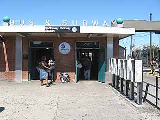
The BMT Canarsie Line is a rapid transit line of the B Division of the New York City Subway system, named after its terminus in the Canarsie neighborhood of Brooklyn. It is served by the L train at all times, which is shown in medium gray on the New York City Subway map and on station signs.

<span class="mw-page-title-main">Canarsie–Rockaway Parkway station</span> New York City Subway station in Brooklyn

The Canarsie–Rockaway Parkway station is the southern terminal station of the BMT Canarsie Line of the New York City Subway, and is one of the few grade-level stations in the system. Located at the intersection of Rockaway Parkway and Glenwood Road in the Canarsie neighborhood of Brooklyn, it is served by the L train at all times.

<span class="mw-page-title-main">B41 (New York City bus)</span> Bus route in Brooklyn, New York

The B41 is a bus route that constitutes a public transit line operating in Brooklyn, New York City, running along Flatbush Avenue between Downtown Brooklyn and Marine Park. The B41 is operated by the MTA New York City Transit Authority. Its precursor was a streetcar line that began operation in 1860, and was known as the Flatbush Avenue Line. The route became a bus line in 1951. Limited-stop service began along the route in 1992.

<span class="mw-page-title-main">B42 (New York City bus)</span> Bus route in Brooklyn, New York

The Rockaway Parkway Line is a public transit line in Brooklyn, New York City, running mostly along Rockaway Parkway between Canarsie Pier and the Canarsie–Rockaway Parkway terminal of the BMT Canarsie Line of the New York City Subway. Originally a streetcar line, it is now the B42 bus route, operated by the New York City Transit Authority.

<span class="mw-page-title-main">B60 (New York City bus)</span> Bus route in Brooklyn, New York

The Wilson Avenue Line is a public transit line in Brooklyn, New York City, running along Wilson Avenue and Rockaway Avenue between Williamsburg and Canarsie. Originally a streetcar line, it is now the B60 bus route, operated by MTA New York City Bus.

<span class="mw-page-title-main">Rockaway Parkway</span> Avenue in Brooklyn, New York

Rockaway Parkway is a major commercial street in the Canarsie and Brownsville neighborhoods of Brooklyn, New York. It occupies the position of East 97th Street in the Brooklyn street grid. Contrary to its name, Rockaway Parkway does not enter the Rockaways in Queens.

<span class="mw-page-title-main">B82 (New York City bus)</span> Bus route in Brooklyn, New York

The B82 bus route constitutes a public transit line in central Brooklyn, New York City. It connects Starrett City in southeast Brooklyn with Coney Island on Brooklyn's southwestern coast. The B82 operates primarily via Kings Highway and Flatlands Avenue in southern Brooklyn. The route is operated by MTA Regional Bus Operations, under the New York City Bus and Select Bus Service brands.

<span class="mw-page-title-main">B103 (New York City bus)</span> Bus route in Brooklyn, New York

The B103 constitutes a bus route in the New York City borough of Brooklyn. Originally operated by Command Bus Company, the bus route is now operated by MTA Bus Company, running between Downtown Brooklyn and Canarsie.

<span class="mw-page-title-main">Q10 (New York City bus)</span> Bus route in Queens, New York

The Q10 bus route constitutes a public transit line in Queens, New York City, running primarily along Lefferts Boulevard between a transfer with the New York City Subway in Kew Gardens to the AirTrain JFK's Lefferts Boulevard station at John F. Kennedy International Airport. Formerly privately operated by Green Bus Lines, the route is currently city-operated under the MTA Bus Company brand of MTA Regional Bus Operations.

<span class="mw-page-title-main">Q35 (New York City bus)</span> Bus route in New York City

The Q35 bus route constitutes a public transit line in southeast Brooklyn as well as the Rockaway Peninsula of southern Queens in New York City. The Q35 is operated by MTA Regional Bus Operations under the MTA Bus Company brand, but was formerly privately operated by Green Bus Lines. The bus provides service between Midwood in central Brooklyn to Rockaway Park on the Rockaway Peninsula, running mainly along Flatbush Avenue in Brooklyn and Newport Avenue on the Rockaway Peninsula. The route utilizes the Marine Parkway–Gil Hodges Memorial Bridge to cross between Brooklyn and Queens.
<span class="mw-page-title-main">Q37 (New York City bus)</span> Bus route in Queens, New York

The Q37 bus route constitutes a public transit line in Queens, New York City, running primarily along 111th Street between Kew Gardens and South Ozone Park. The Q37 was formerly privately operated by Green Bus Lines, under a subsidized franchise with the New York City Department of Transportation (NYCDOT). The route is now operated by MTA Regional Bus Operations under the MTA Bus Company brand.

<span class="mw-page-title-main">B84 (New York City bus)</span> Bus route in Brooklyn, New York

The Flatlands Avenue Line, consisting of the B84, is a public transit line in Brooklyn in New York City, running mostly on Flatlands Avenue right between East New York and Spring Creek. The route began operating in 2013, replicating the B83 route in East New York through Jerome Street and Berriman Street.

<span class="mw-page-title-main">B47 (New York City bus)</span> Bus route in Brooklyn, New York

The B47 is a surface transit line on Ralph Avenue in Brooklyn, New York City. Once a streetcar line, it is now part of the B47 bus route, operated by the New York City Transit Authority, Prior to 1995, it was the B78 route; the northern part of the route from St. Johns Place to Woodhull Hospital was part of the B40 line. The B47 was created as a result of a merger of the B40 and B78 on September 8, 2002.

<span class="mw-page-title-main">Bx1 and Bx2 buses</span> Bus routes in the Bronx, New York

The Bx1 and Bx2 are two bus routes that run on the Grand Concourse in the Bronx, New York City. The routes, which are operated by the Manhattan and Bronx Surface Transit Operating Authority, also follow Sedgwick Avenue and Mosholu Parkway for a short distance at their northern end. As the numbers suggest, these were the first two bus routes in the Bronx.

Flatlands Avenue is a major street in the New York City borough of Brooklyn. It runs approximately 5 miles (8.0 km) east-west, from Avenue N and East 35th Street in Flatlands in the west to Forbell Street, east of Fountain Avenue in East New York, near the Brooklyn-Queens border. The right-of-way continues in Lindenwood and Howard Beach, Queens as 156th Avenue, separated by the remnants of Spring Creek. The portion of Flatlands Avenue east of Louisiana Avenue in East New York was previously mapped as Fairfield Avenue.

The Q11, Q21, Q52, and Q53 bus routes constitute a public transit corridor running along Woodhaven and Cross Bay Boulevards in Queens, New York City. The corridor extends primarily along the length of the two boulevards through "mainland" Queens, a distance of 6 miles (9.7 km) between Elmhurst and the Jamaica Bay shore in Howard Beach. The Q52 and Q53 buses, which provide Select Bus Service along the corridor, continue south across Jamaica Bay to the Rockaway peninsula, one of the few public transit options between the peninsula and the rest of the city.

<span class="mw-page-title-main">Union Turnpike express buses</span> Express bus routes in Queens and Manhattan, New York

The QM1, QM5, QM6, QM7, QM8, QM31, QM35, and QM36 bus routes constitute a public transit line in New York City, operating express between Northeast Queens and Midtown or Downtown Manhattan. The routes operate primarily on Union Turnpike in Queens, and travel non-stop via Queens Boulevard, the Long Island Expressway, and the Midtown Tunnel or Queensboro Bridge between Queens and Manhattan.

<span class="mw-page-title-main">B20 and B83 buses</span> Bus routes in Brooklyn, New York

The B20 and B83 constitute bus routes between Broadway Junction and East New York, running primarily on Pennsylvania Avenue in Brooklyn, New York City. They are operated by the New York City Transit Authority, with the B20 being based out of the Fresh Pond Depot and the B83 being based out of the East New York Depot.

<span class="mw-page-title-main">S53 and S93 buses</span> Bus routes in Brooklyn and Staten Island, New York

The S53 and S93 constitute a public transit line in New York City, running primarily on Clove Road and utilizing the Verrazano-Narrows Bridge to travel between Brooklyn and Staten Island. They are operated by the MTA Regional Bus Operations under the New York City Transit Authority brand.

References

  1. "Subway and bus ridership for 2023". mta.info. April 29, 2024. Retrieved May 2, 2024.
  2. 1 2 "Brooklyn Bus Map" (PDF). Metropolitan Transportation Authority. October 2020. Retrieved December 1, 2020.
  3. MTA Regional Bus Operations. "B6 bus schedule".
  4. "1960s bus timetables". Flickr. New York City Transit Authority. 1966. Archived from the original on April 7, 2023. Retrieved June 24, 2019.
  5. Harney, James (November 9, 1982). "B-6 & B-50 buses travel new routes". New York Daily News. Retrieved February 19, 2024.
  6. "Attention B6 & B11 Bus Riders". Flickr.com. New York City Transit Authority. 1987. Retrieved February 18, 2024.
  7. May 2000 NYC Transit Committee Agenda. New York City Transit. May 16, 2000. pp.  106, 107, 108-109, 110, 111, 112, 113.
  8. "B6 Introducing Limited-Stop service on weekdays". New York Daily News. September 8, 2000. p. 160. Archived from the original on February 4, 2019. Retrieved February 3, 2019.
  9. Brachfeld, Ben (December 1, 2022). "Draft plan for new Brooklyn bus network aims to finally end decades of slow, unreliable service". amNewYork. Retrieved December 2, 2022.
  10. "Brooklyn bus riders could finally get faster service under MTA redesign". Crain's New York Business. December 1, 2022. Retrieved December 2, 2022.
  11. "Draft Plan: B5 Limited". MTA. Retrieved July 26, 2023.
  12. "Draft Plan: B6 Local". MTA. Retrieved July 26, 2023.
  13. "Draft Plan: B6 Limited". MTA. Retrieved July 26, 2023.