B7 (New York City bus)

Last updated

b7
Saratoga Avenue Line
Kings Highway Line
Kings Hwy Nostrand Av td (2018-10-04) 06.jpg
A 2018 XD40 (7513) on the Bed-Stuy bound B7 at Kings Highway/Nostrand Avenue in October 2018
Overview
System MTA Regional Bus Operations
Operator New York City Transit Authority
Garage Fresh Pond Depot
Vehicle New Flyer Xcelsior XD40
Orion VII NG HEV
Began serviceJune 29, 1930
Route
Locale Brooklyn, New York, U.S.
Communities served Bushwick [1] , Bedford-Stuyvesant, Brownsville, East Flatbush, Flatlands, Marine Park [2] , Midwood, Sheepshead Bay [3] , Madison [4] , Homecrest [5] , Gravesend
Start Bedford-Stuyvesant – Saratoga Avenue and Halsey Street at Halsey Street ( NYCS-bull-trans-J-Std.svg train)
ViaSaratoga Avenue, Pitkin Avenue [6] /Thomas S. Boyland Street/Broadway (northbound only), Riverdale Avenue, East 98th Street, Lenox Road, Kings Highway, Quentin Road (full route, southbound only), Coney Island Avenue (full route, northbound only)
End Flatlands [7] /Marine Park [8] - Kings Highway and Flatbush Avenue (early morning/late evening terminus)
Gravesend [9] [10] - Quentin Road and Coney Island Avenue (daytime terminus)
Length6.8 miles (10.9 km)
Service
Operates4:30 AM - 1:32 AM
Annual patronage899,165 (2023) [11]
TransfersYes
Timetable B7
  B6  {{{system_nav}}}  B8  

The B7 is a bus route in the New York City borough of Brooklyn, which serves the corridor of Saratoga Avenue as well as the majority of Kings Highway. Originally operated by the Brooklyn-Manhattan Transit Corporation, it is now operated by MTA Regional Bus Operations under the New York City Transit brand.

Contents

Route description

A 2015 XD40 (7300) on the Midwood-bound B7 at Kings Highway/Nostrand Avenue in August 2018 Kings Hwy Nostrand Av td (2018-08-12) 37a.jpg
A 2015 XD40 (7300) on the Midwood-bound B7 at Kings Highway/Nostrand Avenue in August 2018

The B7 bus route begins at Saratoga Avenue/Halsey Street near the station on the J/Z lines. It continues on Saratoga until turning right on Riverdale Avenue, and heads to Kings Highway via East 98th Street and Lenox Road. It then continues on Kings Highway until Quentin Road, where it turns right and terminates at Coney Island Avenue. Northbound buses head back onto Kings Highway straight from Coney Island Avenue. Due to Saratoga Avenue being a one-way south street north of East New York Avenue, which is one-way west there, [12] it turns right onto Pitkin Avenue [13] and left onto Thomas S. Boyland Street. It then heads back to Saratoga and Halsey via Broadway. [14] [15] After 8 p.m. weekdays and Saturdays and 9:15 p.m. Sundays, all B7 buses terminate at Flatbush Avenue while on Kings Highway. Service to Halsey Street from Coney Island Avenue begins after 6 a.m. on weekdays and 7 a.m. on weekends. [16]

History

Two Orion VII HEVs: a 2005 OG (6515) and a 2009 NG (3967) on the Midwood-bound B7 at Kings Highway/Nostrand Avenue MTA Kings Hwy Nostrand 02.jpg
Two Orion VII HEVs: a 2005 OG (6515) and a 2009 NG (3967) on the Midwood-bound B7 at Kings Highway/Nostrand Avenue

The B7 began on June 29, 1930 under the operation of Brooklyn-Manhattan Transit, which was sold to the City on June 1, 1940. It initially ran 24/7 between the Halsey Street station at Broadway and the Kings Highway station on the B/Q lines, which was the weekday extension from Flatbush Avenue during the daytime.

On September 13, 1999, service was extended along Kings Highway from the B/Q station to Coney Island Avenue. [17] Partially as a result of the extension, ridership increased by 15.4 percent between September 1999 and May 2000 over the previous year, compared to 4.5 percent for buses in Brooklyn overall. [18] In February 2001, the MTA announced a plan to extend weekend service between 8 a.m. to 8 p.m. from Ryder Street to Coney Island, citing lack of transfers to the B44 , B49 and B68 bus routes and the Kings Highway station, which was served by just the D train at the time, as well as access to the Kings Highway shopping district. The extension would cost about $120,000, and was set to be implemented in June 2001. [18] On November 10, 2005, to improve traffic flow on Kings Highway, bus stops at Linden Boulevard and Remsen Avenue were moved to the service road from the main road. [19] On June 27, 2010, overnight service was discontinued due to a budget crisis.

On December 1, 2022, the MTA released a draft redesign of the Brooklyn bus network. As part of the redesign, the B7 would be extended to the Forest Avenue station, replacing the B13 on 61st/62nd Streets and the B20 north of Broadway Junction but using Cooper Street/Avenue instead of Decatur/Summerfield/Schaefer Streets. Closely spaced stops would be eliminated. [20]

Related Research Articles

<span class="mw-page-title-main">Q (New York City Subway service)</span> Rapid transit service

The Q Second Avenue/Broadway Express/Brighton Local is a rapid transit service in the B Division of the New York City Subway. Its route emblem, or "bullet", is colored yellow since it is a part of the BMT Broadway Line in Manhattan.

The BMT Brighton Line, also known as the Brighton Beach Line, is a rapid transit line in the B Division of the New York City Subway in Brooklyn, New York. Local service is provided at all times by the Q train, but is joined by the B express train on weekdays. The Q train runs the length of the entire line from Coney Island–Stillwell Avenue to the Manhattan Bridge south tracks. The B begins at Brighton Beach and runs via the bridge's north tracks.

<span class="mw-page-title-main">Brighton Beach station (BMT Brighton Line)</span> New York City Subway station in Brooklyn

The Brighton Beach station is an elevated express and terminal station on the BMT Brighton Line of the New York City Subway. It is located over Brighton Beach Avenue between Brighton 5th Street and Brighton 7th Street in Brighton Beach, Brooklyn. The station is served by the Q train at all times and is the southern terminal for the B train on weekdays only.
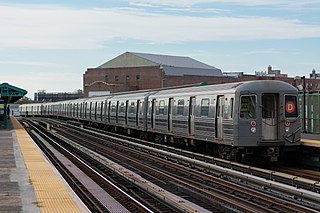
<span class="mw-page-title-main">D (New York City Subway service)</span> Rapid transit service

The D Sixth Avenue Express is a rapid transit service in the B Division of the New York City Subway. Its route emblem, or "bullet", is colored orange, since it uses the IND Sixth Avenue Line in Manhattan.

<span class="mw-page-title-main">N (New York City Subway service)</span> Rapid transit service

The N Broadway Express is a rapid transit service in the B Division of the New York City Subway. Its route emblem, or "bullet," is colored yellow, since it uses the BMT Broadway Line in Manhattan.

<span class="mw-page-title-main">Avenue H station</span> New York City Subway station in Brooklyn

The Avenue H station is a local station on the BMT Brighton Line of the New York City Subway. It is located at Avenue H between East 15th and East 16th Streets near the border of Midwood and Flatbush, Brooklyn. The station is served by the Q train at all times. It is also served by the B train on weekdays until early 2025.

<span class="mw-page-title-main">Newkirk Plaza station</span> New York City Subway station in Brooklyn

The Newkirk Plaza station is an express station on the BMT Brighton Line of the New York City Subway in Flatbush, Brooklyn. It is located on an open-cut at the center of the pedestrian-only Newkirk Plaza shopping mall, which is bounded by Newkirk Avenue on the north, Foster Avenue on the south, Marlborough Road to the west, and East 16th Street to the east. The station is served by the Q train at all times and by the B train on weekdays only.

<span class="mw-page-title-main">Sheepshead Bay station</span> New York City Subway station in Brooklyn

The Sheepshead Bay station is an express station on the BMT Brighton Line of the New York City Subway. It is located in the Sheepshead Bay neighborhood of Brooklyn. It is served by the Q train at all times and by the B train on weekdays.

<span class="mw-page-title-main">B68 (New York City bus)</span> Bus route in Brooklyn, New York

The B68 is a bus route that constitutes a public transit line operating in Brooklyn, New York City. The B68 is operated by the MTA New York City Transit Authority. Its precursor was a streetcar line that began operation in June 1862, and was known as the Coney Island Avenue Line. The route became a bus line in 1955.

<span class="mw-page-title-main">Avenue M station</span> New York City Subway station in Brooklyn

The Avenue M station, is a local station on the BMT Brighton Line of the New York City Subway. It is located in Midwood, Brooklyn, at Avenue M between East 15th and East 16th Streets. The station is served by the Q train at all times. It is also served by the B train on weekdays until early 2025.

<span class="mw-page-title-main">Kings Highway station (BMT Brighton Line)</span> New York City Subway station in Brooklyn

The Kings Highway station is an express station on the BMT Brighton Line of the New York City Subway. It is located at Kings Highway between East 15th and East 16th Streets on the border of Midwood and Homecrest neighborhoods of Brooklyn. The station is served by the Q train at all times and by the B train on weekdays only.

<span class="mw-page-title-main">Church Avenue station (BMT Brighton Line)</span> New York City Subway station in Brooklyn

The Church Avenue station is an express station on the BMT Brighton Line of the New York City Subway, located at Church Avenue near East 18th Street in the Flatbush neighborhood of Brooklyn. The station is served by the Q train at all times and by the B train on weekdays only.

<span class="mw-page-title-main">Avenue X station</span> New York City Subway station in Brooklyn

The Avenue X station is a local station in the Gravesend neighborhood of Brooklyn on the IND Culver Line of the New York City Subway. It is served by the F train at all times and the <F> train during rush hours in the peak direction.

<span class="mw-page-title-main">B41 (New York City bus)</span> Bus route in Brooklyn, New York

The B41 is a bus route that constitutes a public transit line operating in Brooklyn, New York City, running along Flatbush Avenue between Downtown Brooklyn and the Marine Park/Mill Basin border. The B41 is operated by the MTA New York City Transit Authority. Its precursor was a streetcar line that began operation in 1860, and was known as the Flatbush Avenue Line. The route became a bus line in 1951. Limited-stop service began along the route in 1992.
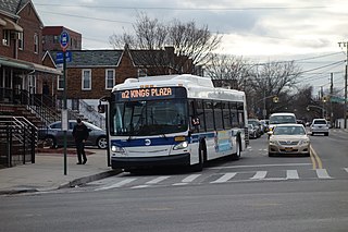
<span class="mw-page-title-main">B2 (New York City bus)</span> Bus route in Brooklyn, New York

The B2 is a bus route in the New York City borough of Brooklyn. Originally operated by the Brooklyn-Manhattan Transit Corporation, it is now operated by MTA Regional Bus Operations under the New York City Transit brand.

<span class="mw-page-title-main">B8 (New York City bus)</span> Bus route in Brooklyn, New York

The B8 is a bus route in the New York City borough of Brooklyn, which serves the corridors of 18th Avenue and Avenue D. Originally operated by Queens Bus Lines, it is now operated by MTA Regional Bus Operations under the New York City Transit brand.

<span class="mw-page-title-main">B11 (New York City bus)</span> Bus route in Brooklyn, New York

The B11 is a bus route in the New York City borough of Brooklyn, which serves the corridors of 49th Street and 50th Street. Originally operated by the Brooklyn-Manhattan Transit Corporation, it is now operated by MTA Regional Bus Operations under the New York City Transit brand.
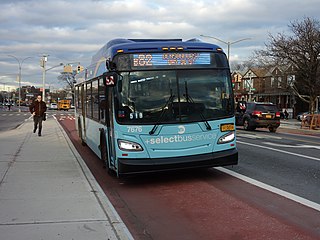
<span class="mw-page-title-main">B82 (New York City bus)</span> Bus route in Brooklyn, New York

The B82 bus route constitutes a public transit line in central Brooklyn, New York City. It connects Starrett City in southeast Brooklyn with Coney Island on Brooklyn's southwestern coast. The B82 operates primarily via Kings Highway and Flatlands Avenue in southern Brooklyn. The route is operated by MTA Regional Bus Operations, under the New York City Bus and Select Bus Service brands.

<span class="mw-page-title-main">B67 and B69 buses</span> Bus routes in Brooklyn, New York

The B67 and B69 bus routes comprise a public transit line in Brooklyn, New York City. Both bus routes originated as streetcar lines: The B67 originated as the Seventh Avenue Line, while the B69 originated as the Vanderbilt Avenue Line. The current bus routes are operated by MTA Regional Bus Operations. The B67 runs primarily along Seventh Avenue, Flatbush Avenue, and Atlantic Avenue, while the B69 runs along Seventh Avenue and Vanderbilt Avenue. Although both routes' southern termini are in Kensington, Brooklyn, the northern terminus of the B67 is in Williamsburg while the northern terminus of the B69 is in Dumbo.

<span class="mw-page-title-main">B47 (New York City bus)</span> Bus route in Brooklyn, New York

The B47 is a surface transit line on Ralph Avenue in Brooklyn, New York City. Once a streetcar line, it is now part of the B47 bus route, operated by the New York City Transit Authority, Prior to 1995, it was the B78 route; the northern part of the route from St. Johns Place to Woodhull Hospital was part of the B40 line. The B47 was created as a result of a merger of the B40 and B78 on September 8, 2002.

References

  1. "Bushwick, Brooklyn" (Map). Google Maps . Retrieved December 24, 2024.
  2. "Marine Park, Brooklyn" (Map). Google Maps . Retrieved December 24, 2024.
  3. "Sheepshead Bay, Brooklyn" (Map). Google Maps . Retrieved December 24, 2024.
  4. "Madison, Brooklyn" (Map). Google Maps . Retrieved December 24, 2024.
  5. "Homecrest, Brooklyn" (Map). Google Maps . Retrieved December 24, 2024.
  6. "Saratoga/Pitkin Avenues" (Map). Google Maps . Retrieved December 23, 2024.
  7. "Flatlands, Brooklyn" (Map). Google Maps . Retrieved December 23, 2024.
  8. "Marine Park, Brooklyn" (Map). Google Maps . Retrieved December 23, 2024.
  9. "Gravesend, Brooklyn" (Map). Google Maps . Retrieved December 23, 2024.
  10. "Midwood, Brooklyn" (Map). Google Maps . Retrieved December 23, 2024.
  11. "Subway and bus ridership for 2023". mta.info. April 29, 2024. Retrieved December 23, 2024.
  12. "Saratoga/East New York Avenues" (Map). Google Maps . Retrieved December 23, 2024.
  13. "Saratoga/Pitkin Avenues" (Map). Google Maps . Retrieved December 23, 2024.
  14. MTA Regional Bus Operations. "B7 bus schedule".
  15. "Brooklyn Bus Map" (PDF). Metropolitan Transportation Authority. October 2020. Retrieved December 1, 2020.
  16. "Brooklyn Bus Service: November 2019" . Retrieved December 23, 2024.
  17. "Bus Service Notices". October 28, 1999. Archived from the original on November 5, 1999. Retrieved February 3, 2019.
  18. 1 2 February 2001 NYC Transit Committee Agenda. New York City Transit. February 15, 2001. pp.  86, 87, 88-89, 90, 91, 92, 93, 94.
  19. "Bus Service Notices Brooklyn". mta.nyc.ny.us. Metropolitan Transportation Authority. 2006. Archived from the original on January 29, 2006. Retrieved June 28, 2019.
  20. "Draft Plan: B7 Local" . Retrieved December 23, 2024.