Bagasara taluka

Last updated

Bagasara taluka
Bagasara taluka
Interactive Map Outlining Bagasara taluka
Coordinates: 21°29′00″N70°57′00″E / 21.483333°N 70.95°E / 21.483333; 70.95
CountryFlag of India.svg  India
State Gujarat
District Amreli
Headquarters Bagasara
Population
 (2011) [1]
  Total83,054
   Sex ratio
956 /
  Literacy
70.6%
Languages
  Official Gujarati, Hindi
Time zone UTC+5:30 (IST)
Telephone code+91-079
Vehicle registration GJ
Website amrelidp.gujarat.gov.in/en/taluka/Bagasara/home OOjs UI icon edit-ltr-progressive.svg

Bagasara Taluka is a geographical subdivision located in the Amreli district of the state of Gujarat, India. It is situated in the western part of the country and falls within the Saurashtra region. Bagasara is the headquartes of the taluka. [2] [3]

Contents

History

During the medieval period, Bagasara Taluka became a part of the larger socio-political landscape of Gujarat Sultanate. The strategic location of the region facilitated trade routes connecting the western coast to the hinterlands. The rise of various local rulers and dynasties further shaped the history of the taluka, leaving behind architectural remnants and cultural influences that are still palpable.Bagasara was conquered in about 1525 by Vala Mancha Bhaiya of Devgam Devli. Vala Mancha was succeeded by his son Bhaiya, from whom the Bagasara Kathis are called Bhaiyani. There are many dawoodi bohras in the city. During British period, the town belonged to the Vala Kathis and is the seat of Kathiawar Agency thana. [4]

Geography

Bagasara Taluka is a geographical subdivision located in the Amreli district of the Indian state of Gujarat. Situated within the western reaches of India, Bagasara Taluka is characterized by its diverse landscape, encompassing various natural features and landforms. Its geographical coordinates range approximately from 21.9706° N latitude to 71.7543° E longitude. [5]

The taluka is characterized by its undulating terrain, which ranges from plains to low hills. The region's elevation varies, providing a picturesque panorama of valleys and plateaus interspersed with gentle slopes. This diverse topography plays a pivotal role in shaping the local climatic patterns and agricultural practices. [6]

Climate

Climate data for Amreli (1981–2010, extremes 1973–2012)
MonthJanFebMarAprMayJunJulAugSepOctNovDecYear
Record high °C (°F)36.6
(97.9)
39.0
(102.2)
43.6
(110.5)
45.6
(114.1)
46.2
(115.2)
45.6
(114.1)
39.1
(102.4)
38.6
(101.5)
40.1
(104.2)
42.1
(107.8)
38.2
(100.8)
36.6
(97.9)
46.2
(115.2)
Average high °C (°F)29.6
(85.3)
32.1
(89.8)
36.5
(97.7)
40.1
(104.2)
40.6
(105.1)
37.2
(99.0)
32.6
(90.7)
31.1
(88.0)
33.0
(91.4)
35.2
(95.4)
33.1
(91.6)
30.7
(87.3)
34.3
(93.7)
Average low °C (°F)11.5
(52.7)
14.0
(57.2)
18.7
(65.7)
22.6
(72.7)
25.2
(77.4)
26.3
(79.3)
25.1
(77.2)
24.2
(75.6)
23.2
(73.8)
21.0
(69.8)
16.5
(61.7)
12.7
(54.9)
20.1
(68.2)
Record low °C (°F)1.6
(34.9)
3.5
(38.3)
9.1
(48.4)
14.1
(57.4)
18.0
(64.4)
20.6
(69.1)
21.4
(70.5)
21.1
(70.0)
18.1
(64.6)
14.4
(57.9)
9.1
(48.4)
4.1
(39.4)
1.6
(34.9)
Average rainfall mm (inches)0.0
(0.0)
0.0
(0.0)
0.0
(0.0)
1.5
(0.06)
7.2
(0.28)
98.0
(3.86)
205.3
(8.08)
128.5
(5.06)
97.4
(3.83)
17.5
(0.69)
6.2
(0.24)
0.0
(0.0)
561.8
(22.12)
Average rainy days0.00.00.00.10.74.28.97.04.31.00.40.026.6
Average relative humidity (%) (at 17:30 IST)27212019275268726239322939
Source: India Meteorological Department [7] [8]

Economy

Agriculture forms the major part of the economy in Bagasara Taluka. [9] [10] The fertile soil and adequate water resources foster the cultivation of a variety of crops, including groundnuts, cotton, millets, and pulses. [9] The taluka is well known in gold plating. [11]

Administrative divisions

Bagsara taluka in Amreli district Amreli Gujarat map.svg
Bagsara taluka in Amreli district

There are 34 villages in this taluka and 34 gram panchayats are included. [12] [13] [14] [15]

Related Research Articles

<span class="mw-page-title-main">Amreli district</span> District of Gujarat in India

Amreli district is one of the 33 administrative districts of the state of Gujarat in western India. The district headquarters are located at Amreli. The district occupies an area of 6,760 km2 and has a population of 1,514,190 of which 22.45% were urban. Amreli is the land of Yogiji Maharaj(Dhari), Danbapu, Sage Muldas, Sage Bhojalrambapa, Sage Muktanand Swami, Magician K.Lal, Zaverchand Megahani's place (Bagasara), Dr. Jivaraj Mehata etc. Amreli covers Dhari Gir National forest sanctuary area. Now it is developing as a Hub of Education.

<span class="mw-page-title-main">Amreli</span> City in Gujarat, India

Amreli is a city and a municipality in Amreli district in Indian state of Gujarat.

Bagasara is a municipality in Bagasara Taluka of Amreli district, Gujarat, India. The town is situated on the northern bank of the Satalli river. nearest airport div airport.

<span class="mw-page-title-main">Dhari, Gujarat</span> Village/Town in Gujarat, India

Dhari is a town in Amreli District in Indian state of Gujarat, India. It is an administrative headquarter of the Dhari tehsil(almost 87 villages and ness).Dhari is the most populous town in Amreli District as per census 2011 with 30352 population. Dhari is located on the bank of Shetrunji River, 42 km(26.2 mi) from district headquarter Amreli & 318 km(199.8 mi) from state capital Gandhinagar. Dhari is famous for kesar mango and Asiatic lion. Dhari is capital of East Gir Forest.

Morbi is one of the 182 Legislative Assembly constituencies of Gujarat state in India. It is part of Morbi district. It is numbered as 65-Morbi.

Visavadar is one of the 182 Legislative Assembly constituencies of Gujarat state in India. It is part of Junagadh district and a segment of Junagadh Lok Sabha constituency.

Dhari is one of the 182 Legislative Assembly constituencies of Gujarat state in India. It is part of Amreli district, and is a segment of Amreli Lok Sabha constituency.

Rajula is one of the 182 Legislative Assembly constituencies of Gujarat state in India. It is part of Amreli district.

Bhavnagar Rural is one of the 182 Legislative Assembly constituencies of Gujarat state in India. It is part of Bhavnagar district.

Barvala Baval is a small village in Kunkavav Taluka of Amreli district of the Saurashtra region in the Indian state of Gujarat.

Babra is a town and the taluka headquarter in the Amreli district, Gujarat, India. It is situated to the north of Amreli. The main road linking Rajkot and Bhavnagar and Amreli passes through Babra.

Amrutvel is a village in Savarkundla Taluka of Amreli district, Gujarat, India. It is about six miles north-east of Savarkundla.

Juna Vaghanya or Vaghaniya Juna is a town in Bagasara Taluka of Amreli district, Gujarat, India. The town is situated on the northern bank of the Satladi river.

Dahida is a village in Dhari Taluka of Amreli district, Gujarat, India. It is a former non-salute princely state.

Charkha is one of 11 villages in Dhari Taluka and one of 616 in the Amreli district of the Saurashtra peninsula in the Indian state of Gujarat.[1]

Chobari is a village in Chotila Taluka of Surendranagar district, Gujarat, India. It is a former princely state.

Thordi is a village / panchayat located in the Gir Gadhada Taluka of Gir Somnath district in Gujarat State, India. Earlier, until August 2013, Thordi was part of Una Taluka and Junagadh district. The latitude 20.973820 and longitude 70.833509 are the geo-coordinate of the Village Thordi. Gandhinagar is the state capital of Thordi village which is located around 400 kilometres away from Thordi.

Nava Ugla, also known as Ugla, is a village / panchayat located in the Gir Gadhada Taluka of Gir Somnath district in Gujarat, India. Earlier, until August 2013, Nava Ugla was part of Una Taluka and Junagadh district. The latitude 20.940104 and longitude 71.036577 are the geo-coordinate of the Village Nava Ugla. Gandhinagar is the state capital of Nava Ugla village which is located around 350 kilometres away from Nava Ugla.

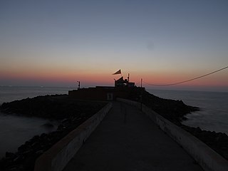
Jafrabad Taluka is a geographical subdivision located in the Amreli district of the state of Gujarat, India. It is situated in the western part of the country and falls within the Saurashtra region. Jafrabad is the headquarters of the taluka.

References

  1. "District wise Statistics | NITI Aayog, (National Institution for Transforming India), Government of India". 164.100.94.191. Retrieved 5 January 2023.
  2. "Taluka | District Amreli, Government of Gujarat | India" . Retrieved 29 August 2023.
  3. https://amrelidp.gujarat.gov.in/gu/taluka/Bagasara/History
  4. Gazetteer of the Bombay Presidency: Kathiawar (Public Domain text). Vol. VIII. Printed at the Government Central Press, Bombay. 1884. p. 373.
  5. Gujarat, India Director of Census Operations (1972). District Census Handbook: Amreli (3 pt.).
  6. Encyclopaedia of Cities and Towns in India: Gujarat. Gyan Publishing House. 2008. ISBN   978-81-212-0981-6.
  7. "Station: Amreli Climatological Table 1981–2010" (PDF). Climatological Normals 1981–2010. India Meteorological Department. January 2015. pp. 43–44. Archived from the original (PDF) on 5 February 2020. Retrieved 28 September 2020.
  8. "Extremes of Temperature & Rainfall for Indian Stations (Up to 2012)" (PDF). India Meteorological Department. December 2016. p. M48. Archived from the original (PDF) on 5 February 2020. Retrieved 28 September 2020.
  9. 1 2 Gohil, P. J.; Savaliya, S. G.; Bharadiya, A. M. (25 November 2022). "Farmer First Programme: An Effective Extension Approach for Dissemination of Sustainable Cotton Production Technologies". Gujarat Journal of Extension Education. 2022 (1): 15–18. doi:10.56572/gjoee.2022.si.0004. ISSN   2322-0678. S2CID   254339108.
  10. Mathukia, R. K.; Savalia, S. G.; Chovatia, P. K. (25 November 2022). "Crop Diversification and Intensification Approach Under Farmer First Programme". Gujarat Journal of Extension Education. 2022 (1): 88–90. doi:10.56572/gjoee.2022.si.0017. ISSN   2322-0678. S2CID   254350821.
  11. "Handicraft | District Amreli, Government of Gujarat | India" . Retrieved 29 August 2023.
  12. "Bagasara Taluka Population Amreli, Gujarat, List of Villages & Towns in Bagasara Taluka". Censusindia2011.com. Retrieved 29 August 2023.
  13. "Village & Panchayats | District Amreli, Government of Gujarat | India" . Retrieved 29 August 2023.
  14. "Villages in Bagasara Taluka". amrelidp.gujarat.gov.in.
  15. https://amrelidp.gujarat.gov.in/gu/taluka/Bagasara/Taluka-General-Outline