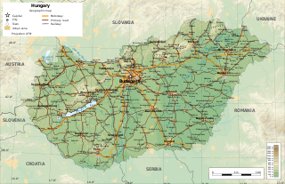
Hungary is a landlocked country in the southern region of East-Central Europe. It has a land area of 93,030 square km and measures about 250 km from north to south and 524 km from east to west. It has 2,106 km of boundaries, shared with Slovakia to the north, Ukraine to the northeast, Romania to the east and southeast, Serbia to the south, Croatia to the southwest, Slovenia to the west and southwest, and Austria to the west.
Lake Balaton is a lake in Hungary, the largest lake in Central Europe.

Abov is historically the Slovak name of an Abaúj County in the Kingdom of Hungary. Today, it is an informal designation of the part of that county situated in Slovakia, as well as the official name of one of Slovakia's tourist regions. The southern half of the former county is part of modern Hungary.
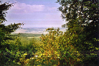
Bélapátfalva is a town in Heves County, in Hungary, located north of the city of Eger. The town is located inside the Eger river valley at an altitude of 311 meters above sea level. Facing the town is the Bél-kő mountain which rises 811 meters and is one of the highest peaks of the Bükk mountains. Because of the picturesque landscape and notable attraction the village is on the path of the National Blue Trail.

Lake Tisza, also known as Kisköre Reservoir, is the largest artificial lake in Hungary. It is located at the southeastern edge of Heves county, next to counties Borsod-Abaúj-Zemplén, Hajdú-Bihar and Jász-Nagykun-Szolnok.

Northern Hungary is a region in Hungary. As a statistical region it includes the counties Borsod-Abaúj-Zemplén, Heves and Nógrád, but in colloquial speech it usually also refers to Szabolcs-Szatmár-Bereg county. The region is in the north-eastern part of the country. The region's centre and largest city is Miskolc.
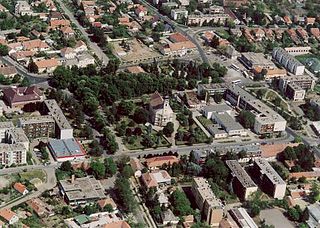
Heves is a small town in eastern Hungary. About 100 km east of Budapest, Heves lies at the northern extreme of the Great Hungarian Plain, just south of the Mátra and Bükk hills and west of the Tisza River. Heves gave its name to the Heves County, however it is not its seat and it is the fourth largest town in the county. The closest major city is Eger, which lies 40 km to the north. Heves is a significant transportation hub for the towns and agricultural areas of southern Heves County.

Upper Hungary is the usual English translation of Felvidék, the Hungarian term for the area that was historically the northern part of the Kingdom of Hungary, now mostly present-day Slovakia. The region has also been called Felső-Magyarország.

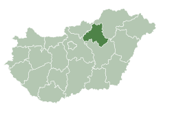
Heves county lies in northern Hungary, between the right bank of the river Tisza and the Mátra and Bükk mountains. It shares borders with the Hungarian counties Pest, Nógrád, Borsod-Abaúj-Zemplén and Jász-Nagykun-Szolnok. Eger is the county seat.

Veszprém was an administrative county (comitatus) of the Kingdom of Hungary. Its territory, which was smaller than that of present Veszprém county, in western Hungary. The capital of the county was Veszprém.
Zabar is a village in Nógrád county, Hungary.
Szolnok County was a county in the Kingdom of Hungary between the 11th century and 1426. It was made up of two disconnected parts, one in what later became Transylvania and the Partium, the other around the Tisza centred on the settlement of Szolnok. The county was eventually split and became:

Heves is a district in south-eastern part of Heves County. Heves is also the name of the town where the district seat is found. The district is located in the Northern Hungary Statistical Region.

Bélapátfalva is a district in north-eastern part of Heves County. Bélapátfalva is also the name of the town where the district seat is found. The district is located in the Northern Hungary Statistical Region. This district is a part of Bükk Mountains geographical region.
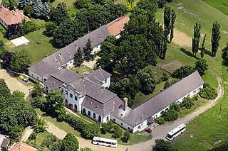
Boconád is a village in Heves County, Northern Hungary Region, Hungary.
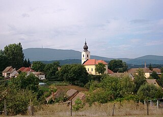
Mátraderecske is a village in Heves County, Northern Hungary Region, Hungary.

Erk is a village in Heves County, Northern Hungary Region, Hungary.

The 2nd constituency of Heves County is one of the single member constituencies of the National Assembly, the national legislature of Hungary. The constituency standard abbreviation: Heves 02. OEVK.
