Demographic features of the population of Hungary include population density, ethnicity, education level, health of the populace, economic status, religious affiliations and other aspects.

Békéscsaba is a city with county rights in southeast Hungary, the capital of Békés County.

Balatonlelle is a resort town located in Hungary on the southern shore of Lake Balaton, about 35 km west of Siófok.
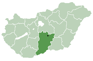
Borota is a village and municipality in Bács-Kiskun county, located in the Southern Great Plain region of Hungary.

Nyárlőrinc is a village in Bács-Kiskun county, in the Southern Great Plain region of southern Hungary.

Csengersima is a village in Szabolcs-Szatmár-Bereg county, in the Northern Great Plain region of eastern Hungary.
Nyírvasvári is a village in Szabolcs-Szatmár-Bereg county, in the Northern Great Plain region of eastern Hungary.

Kozármisleny is a town in Baranya County, southern Hungary. It is south-east of the city of Pécs.

Tóalmás is a village in Pest county, Hungary.

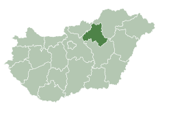
Abasár is a village in Heves County, Hungary, under the Sár mountain, in the Mátra mountain ranges. As of 2022 census, it has a population of 2501. The village located 7.4 km from Vámosgyörk–Gyöngyös railway line, 4.3 km from the main road 3 and 11.7 km from the M3 motorway. The closest train station with public transport in Gyöngyös.

Gyöngyösoroszi is a village in Heves County, Hungary, beside of the Toka creek, under the Mátra mountain ranges. As of 2022 census, it has a population of 1464. The village located 6.7 km from Vámosgyörk–Gyöngyös railway line, 7.2 km from the main road 3 and 14.6 km from the M3 motorway. The closest train station with public transport in Gyöngyös.
Szentlászló is a village in Baranya county, Hungary.

Markaz is a village in Heves County, Hungary, under the Markaz Lake in the Mátra mountain ranges. As of 2022 census, it has a population of 1698. The village located 13.8 km from Vámosgyörk–Gyöngyös railway line, 10.3 km from the main road 3 and 18.1 km from the M3 motorway. The closest train station with public transport in Gyöngyös.

Nyírmihálydi is a village in Szabolcs-Szatmár-Bereg County, Hungary. As of the 2011 Hungarian census the village had a population of 1,995, an increase of 155 from 2001.

Mátramindszent is a village in Nógrád County, Hungary, in the Mátra mountain range, the bottom of the north side of the Galya-tető peak, the Mindszenti creek flows through the settlement. As of 2022 census, it has a population of 707. The village is located 2.0 km from Kisterenye–Kál-Kápolna railway line, 11.7 km from the main road 21 and 52.1 km from the M25 expressway. Although the settlement has its own railway station, but public transport on the railway line ceased on 3 March 2007. The closest train station with public transport in Bátonyterenye 11.7 km far.
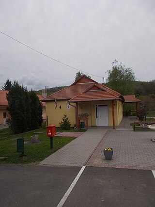
Mátraszele is a village in Nógrád County, Hungary, the Zagyva river flows through the settlement. As of 2022 census, it has a population of 904. The village located 8.5 km from Hatvan–Fiľakovo railway line, 12.0 km far from Salgótarján, 10.4 km from the main road 21 and 52.8 km from the M3 motorway. The closest train station with public transport in Bátonyterenye 10.4 km far.

Mátraterenye is a village in Nógrád County, Hungary, the Zagyva river flows through the settlement. As of 2022 census, it has a population of 1661. The village located 7.1 km from Kisterenye–Kál-Kápolna railway line, 14.8 km from the main road 21 and 47.1 km from the M25 expressway. Although the Nemti railway stop is the closest, but public transport on the railway line ceased on 3 March 2007. The closest train station with public transport in Bátonyterenye 13.7 km far.

Verpelét is a town in Heves County, Hungary, under the Mátra mountain range, beside of the Tarna River. As of 2022 census, it has a population of 3738. The town located 17.3 km from Eger, the capital of the county and beside of the Kisterenye–Kál-Kápolna railway line, 10.7 km from the main road 3 and 16.4 km from the M3 motorway. Although the settlement has its own railway station, public transport on the railway line ceased on 3 March 2007. The closest train station with public transport is in Kál 14.0 km away.
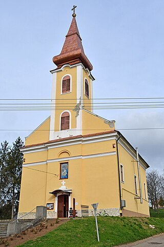
Rózsaszentmárton is a village in Heves County, Hungary, beside of the Ágó creek, under the Mátra mountain ranges. As of 2022 census, it has a population of 1854. The village located 6.5 km from Hatvan–Fiľakovo railway line, 7.0 km from the main road 21 and 18.0 km from the M3 motorway. The closest train station with public transport in Zagyvaszántó.

Egercsehi is a village in Heves County, Hungary. As of 2015, it has a population of 1,320, and 1,281 as of the 2021 estimate.

