
Ghana is a West African country in Africa, along the Gulf of Guinea.

Togo is a small Sub-Saharan state, comprising a long strip of land in West Africa. Togo's geographic coordinates are a latitude of 8° north and a longitude of 1°10′ east. It is bordered by three countries: Benin to the east, with 644 km (400 mi) of border; Burkina Faso to the north, with 126 km (78 mi) of border; and Ghana, with 877 km (545 mi) of border. To the south Togo has 56 km (35 mi) of coastline along the Bight of Benin of the Gulf of Guinea in the North Atlantic Ocean. Togo stretches 579 km (360 mi) north from the Gulf and is only 160 km (99 mi) wide at the broadest point. In total, Togo has an area of 56,785 km2 (21,925 sq mi), of which 54,385 km2 (20,998 sq mi) is land and 2,400 km2 (927 sq mi) is water.

The Volta River is the main river system in the West African country of Ghana. It flows south into Ghana from the Bobo-Dioulasso highlands of Burkina Faso. The main parts of the river are the Black Volta, the White Volta, and the Red Volta. In the northwest, the Black Volta forms the international borders between the Ivory Coast, Ghana, and Burkina Faso. The Volta flows southward along the Akwapim-Togoland highlands, and it empties into the Atlantic Ocean at the Gulf of Guinea at Ada Foah. It has a smaller tributary river, the Oti, which enters Ghana from Togo in the east. The Volta River has been dammed at Akosombo for the purpose of generating hydroelectricity. The reservoir named Lake Volta stretches from Akosombo Dam in the south to the northern part of the country, and is the largest man-made reservoir by area in the world.

Volta Region is one of Ghana's sixteen administrative regions, with Ho designated as its capital. It is located west of Republic of Togo and to the east of Lake Volta. Divided into 25 administrative districts, the region is multi-ethnic and multilingual, including groups such as the Ewe, the Guan, and the Akan peoples. The Guan peoples include the Lolobi, Likpe, Akpafu, Buem, and Nkonya people. This region was carved out of the Volta Region in December 2018 by the New Patriotic Party. The people of the Volta Region are popularly known as Ewes. The people of the Volta Region are popular known for their rich cultural display and music some of which include Agbadza, Borborbor and Zigi.

Kpando Municipal District is one of the eighteen districts in Volta Region, Ghana. Originally created as an ordinary district assembly on 10 March 1989 when it was known as Kpando District, until the southern part of the district was split off by a decree of president John Agyekum Kufuor on 19 August 2004 to create South Dayi District; thus the remaining part has been retained as Kpando District. However on 28 June 2012, the southern part of the district was later split off to create North Dayi District on 28 June 2012; while the remaining part was elevated to municipal district assembly status on the same year to become Kpando Municipal District. The municipality is located in the western part of Volta Region and has Kpando as its capital town.
South Dayi District is one of the eighteen districts in Volta Region, Ghana. Originally it was formerly part of the then-larger Kpando District on 10 March 1989, until the southern part of the district was split off by a decree of president John Agyekum Kufuor on 19 August 2004 to create South Dayi District; thus the remaining part has been retained as Kpando District. The district assembly is located in the western part of Volta Region and has Kpeve as its capital town.
Kpeve is a small town located in the Volta Region of Ghana and divided into Kpeve Old Town, which is part of the Afadjato South District and Kpeve New Town which is part of the South Dayi District, the administrative district capital of South Dayi district.
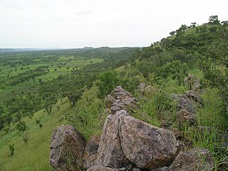
The Togo Mountains is a mountain range which stretches across the central region of the West African country of Togo and across the eastern and western borders of that country into Ghana and Benin. In Ghana, the range is also known as the Akwapim Hills, and in Benin it is also known as the Atakora Mountains. Part of the range is associated with the country of Niger, where the W National Park is found. The African wild dog, Lycaon pictus, was historically found in this region but may now be extirpated from this locale.

Ho West is one of the constituencies represented in the Parliament of Ghana. It elects one Member of Parliament (MP) by the first past the post system of election. Ho West is located is in the Ho West District of the Volta Region of Ghana. Its capital is Dzolokpuita.
Klefe is a small town in the Ho Municipal District of the Volta Region of Ghana. It is in the southern part of the Volta Region. The town is set on a hill and there are trails for hiking.
Wegbe Kpalime is a village located in the South Dayi District of the Volta Region of Ghana.

Peki is a town in the South Dayi District in the Volta Region of Ghana. It comprises eight subtowns, each with a subchief - Tsame, Avetile, Afeviwofe, Blengo, Dzake, Wudome, Dzobati and Adzokoe. All of these subchiefs swear allegiance to a paramount chief known as Deiga. The current paramount chief is Deiga Kwadzo Dei XII. The town is known for the Peki Secondary School, the E.P Seminary and the government training college GOVCO. The school is a second cycle institution.
Kpalime Duga is a village located in the South Dayi District of the Volta Region of Ghana.
Tongor Kaira is a village located in the South Dayi District of the Volta Region of Ghana.
Afadzato South District is one of the eighteen districts in Volta Region, Ghana. Originally it was formerly part of the then-larger Hohoe District on 10 March 1989, until the southern part of the district was split off to create Afadzato South District on 28 June 2012; thus the remaining portion has been retained as Hohoe Municipal District. The district assembly is located in the northern part of Volta Region and has Ve Golokwati as its capital town.
Kpeve New Town is a small town located in Kpeve, which is also the capital of South Dayi district, a district in the Volta Region of Ghana.
To Kpalime or To is a village located in the South Dayi District of the Volta Region of Ghana. It is one of the towns of the Kpalime Traditional Area.
Kpaleis a village located in the Ho West District of the Volta Region of Ghana. It is one of the towns of the Kpalime Traditional Area.
Hlefi is a village in the Ho West District of the Volta Region of Ghana.

Have is a town located in the western valley of the Akwapim Togo mountain range, locally called Ewetogbeka or Nyito, in the Afadzato South District of the Volta Region of Ghana. It is bounded on the south by Agate, on the north by Nyagbo, on the east by the mountain range and in the west by river Dayi. The citizens of Have are called Haveawo.
