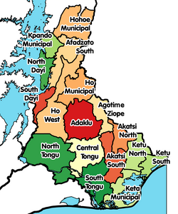
Ho, Ghana

Last updated

Ho
City
Ho, Ghana.JPG
View of Ho from Northern hills
Ghana adm location map.svg
Red pog.svg
Ho
Location of Ho in Volta Region
Coordinates: 6°36′43″N0°28′13″E / 6.61194°N 0.47028°E / 6.61194; 0.47028
Country Ghana
Region Volta Region
District Ho Municipal District
Elevation
150 m (490 ft)
Population
 (2012)
  Total96,213 [1]
Time zone GMT
  Summer (DST) GMT
Area code 036
Ho, Ghana Aerial view 2 of Ho municipality.jpg
Ho, Ghana

Ho is the capital city of the Ho Municipal District and the Volta Region of Ghana. [2] The city lies between Mount Adaklu and Mount Galenukui or Togo Atakora Range, and is home to the Volta Regional Museum, a cathedral, and a prison. [3] The city is the capital of unrecognised Western Togoland. [4] It was formerly the administrative capital of British Togoland now part of the Volta Region. The population of Ho Municipality according to the 2010 Population and Housing Census is 177,281 representing 8.4 percent of the region's total population. Females constitute 52.7 percent and males represent 47.3 percent. The population in Ho grew up to 180,420 National Population Census. About 62 percent of the population resides in urban localities. The Municipality shares boundaries with Adaklu and Agotime-Ziope Districts to the South, Ho West District to the North and West and the Republic of Togo to the East (see Figure 1.1). Its total land area is 2,361 square kilometers (912 sq mi) thus representing 11.5 percent of the region's total land area. [5]

Contents

History

Ho was a part of the German colony of Togoland until World War I, when it was occupied by the British. Ho later became the capital of the League of Nations mandate of British Togoland until that entity's incorporation into the British Gold Coast colony, which subsequently became Ghana. [6] The town was initially inhabited by the people of Hegbe (now Heve), followed by the people of Banakoe (now corrupted to Bankoe). These two groups lived alongside each other with individual chiefdoms. The first known chief of the Bankoe people was Afede Asor I, known in his private life as Akorli. The chief of Heve was Anikpi I, who was known in his private life as Amexo Doh (Adzah Doh). The Ahoe and Dome joined the settlement at a later stage but came to play leading roles in its development. The people of Dome(of Akan origin) became the ruling class until the emergence of modern-day chieftaincy which they ceded to the Bankoe people. The people of Hliha are a sub-group of Bankoe.

Areas

Areas within Ho include Ho Bankoe, Ho Dome, Ho Heve, Ho Hliha, Ho Ahoe, Ho Fiave, Anlokordzi, Anagokordzi, Little Bethlehem, Voradep Village, Barracks new town, Somey Down, Lokoe, Godokpoe, Housing, Ssnit Flats, Awatidome, Dave, Hoƒedo, Mawuli Estate, Powerhouse, Ho Kpevele, Donorkordzi and the Executive Gardens.

Surrounding towns and villages

Ho is surrounded by Ziavi, Klefe, Shia, Tokokoe, Taviefe, Atikpui, Nyive, Hodzo, Tanyigbe, Akrofu, Hoviepe, Akoepe, Kpenoe, Sokode and Juapong.

Climate

Generally, the mean monthly temperature in the municipality ranges between 22.0 and 32.0 °C (71.6 and 89.6 °F) while observed temperatures range from 16.5 to 37.8 °C (61.7 to 100.0 °F). Temperatures are generally high throughout the year which is good for crop farming.   

The rainfall pattern in Ho is characterized by two rainy seasons referred to as the major and the minor seasons. The major season begins from March to June while the minor season is from July to November.

Climate data for Ho, Ghana
MonthJanFebMarAprMayJunJulAugSepOctNovDecYear
Record high °C (°F)38.3
(100.9)
40.7
(105.3)
40.0
(104.0)
38.9
(102.0)
37.8
(100.0)
36.1
(97.0)
33.3
(91.9)
35.0
(95.0)
35.0
(95.0)
35.0
(95.0)
36.5
(97.7)
36.7
(98.1)
40.7
(105.3)
Mean daily maximum °C (°F)32.9
(91.2)
34.3
(93.7)
33.3
(91.9)
32.4
(90.3)
31.6
(88.9)
29.6
(85.3)
28.1
(82.6)
28.5
(83.3)
29.9
(85.8)
30.9
(87.6)
32.2
(90.0)
31.9
(89.4)
31.3
(88.3)
Daily mean °C (°F)27.4
(81.3)
28.4
(83.1)
28.1
(82.6)
27.6
(81.7)
27.0
(80.6)
25.7
(78.3)
24.6
(76.3)
24.6
(76.3)
25.5
(77.9)
26.2
(79.2)
27.1
(80.8)
26.9
(80.4)
26.6
(79.9)
Mean daily minimum °C (°F)21.9
(71.4)
22.4
(72.3)
22.9
(73.2)
22.8
(73.0)
22.5
(72.5)
21.8
(71.2)
21.0
(69.8)
20.6
(69.1)
21.1
(70.0)
21.5
(70.7)
22.0
(71.6)
21.8
(71.2)
21.9
(71.4)
Record low °C (°F)16.5
(61.7)
19.0
(66.2)
20.0
(68.0)
20.0
(68.0)
19.5
(67.1)
18.5
(65.3)
16.0
(60.8)
16.0
(60.8)
18.0
(64.4)
19.0
(66.2)
19.5
(67.1)
16.5
(61.7)
16.0
(60.8)
Average rainfall mm (inches)40
(1.6)
68
(2.7)
143
(5.6)
144
(5.7)
174
(6.9)
174
(6.9)
112
(4.4)
93
(3.7)
149
(5.9)
172
(6.8)
81
(3.2)
52
(2.0)
1,402
(55.4)
Average rainy days (≥ 0.3 mm)361213161814101418105139
Average relative humidity (%)62616871747878777876715172
Mean monthly sunshine hours 226.3217.5226.3204.0229.4147.0117.8145.7138.0223.2249.0260.42,384.6
Mean daily sunshine hours 7.37.77.36.87.44.93.84.74.67.28.38.46.2
Source: Deutscher Wetterdienst [7]

Attractions

The traditional festival in Ho is the Asogli Yam Festival, which is celebrated around September of every year. [6] Ho has a lively and huge open market that attracts people from all over the Volta Region and migrants from Togo. [6] There are numerous churches in the Ho municipality, including the cathedral of the Roman Catholic Diocese of Ho. [6] The Evangelical Presbyterian Church of Ghana has its headquarters in Ho. The church is predominantly in the Volta Region, the capital of which is Ho. The University of Health and Allied Sciences which was established in 2015 is located in Ho.

Sports

Ho Sports Stadium is also located in the town.

Transport

In central parts of Ho, the roads are paved, the roads outside are not. [6] An airport was completed in 2017 to serve Ho, although the airport was not opened to commercial traffic until 2021. [8] [9]

Healthcare

The town is home to three hospitals, including the Ho Teaching Hospital, [10] inaugurated in the year 2019, Ho Municipal Hospital [11] as major hospitals serving cities in the environs. There are also numerous clinics that serve the town. [6]

Education

There are many private and public basic schools in Ho. [12] A list of tertiary institutions in Ho follows:

Ho currently has one of the best innovation hubs in Ghana. Node Eight is a digital innovation hub that invests in young African innovators and startups building the future. Over the past few years, Node Eight Hub through the help of partnership program has been able to develop a couple of resources.

Tertiary institutions

Secondary education

See also

Related Research Articles

<span class="mw-page-title-main">British Togoland</span> 1916–1956 British territory in West Africa

British Togoland, officially the Mandate Territory of Togoland and later officially the Trust Territory of Togoland, was a territory in West Africa under the administration of the United Kingdom, which subsequently entered a union with Ghana, part of which became its Volta Region. The territory was effectively formed in 1916 by the splitting of the German protectorate of Togoland into two territories, French Togoland and British Togoland, during the First World War. Initially, it was a League of Nations Class B mandate. In 1922, British Togoland was formally placed under British rule, and French Togoland, now Togo, was placed under French rule.

<span class="mw-page-title-main">Volta Region</span> Region of Ghana

Volta Region is one of Ghana's sixteen administrative regions, with Ho designated as its capital. It is located west of Republic of Togo and to the east of Lake Volta. Divided into 25 administrative districts, the region is multi-ethnic and multilingual, including groups such as the Ewe, the Guan, and the Akan peoples. The Guan peoples include the Lolobi, Likpe, Akpafu, Buem,Nyangbo,Avatime, and Nkonya. This region was carved out of the Volta Region in December 2018 by the New Patriotic Party. The people of the Volta Region are popularly known as Ewes. The people of the Volta Region are popular known for their rich cultural display and music some of which include Agbadza, Borborbor and Zigi.

<span class="mw-page-title-main">Hohoe</span> Town in Volta Region, Ghana

Hohoe Municipal is one of the 25 administrative districts of the Volta Region of Ghana. It was carved out of the former Kpando District. It was established by the Legislative Instrument of 2012. The Municipality has a total land area of 1,172 km2, which is 5.6 per cent of the land area of the region. It shares borders with the Republic of Togo on the east, forming part of Ghana's international border; on the southeast by the Afadzato district and southwest by Kpando Municipality; on the north with Jasikan district; and on the northwest with the Biakoye districts. Its capital, Hohoe, is about 78 km from Ho, the regional capital and 220 km from Accra, the national capital. The population of Hohoe Municipality, according to the 2010 Population and Housing Census, is 167,016 representing 7.9 per cent of the total population of the Volta Region. It comprises 52.1 per cent females and 47.9 percent males.

<span class="mw-page-title-main">South Dayi District</span> District in Ghana

South Dayi District is one of the eighteen districts in Volta Region, Ghana. Originally it was formerly part of the then-larger Kpando District on 10 March 1989, until the southern part of the district was split off by a decree of president John Agyekum Kufuor on 19 August 2004 to create South Dayi District; thus the remaining part has been retained as Kpando District. The district assembly is located in the western part of Volta Region and has Kpeve as its capital town.

<span class="mw-page-title-main">Adaklu-Anyigbe District</span> Former District in Ghana

Adaklu-Anyigbe District is a former district that was located in Volta Region, Ghana. Originally it was formerly part of the then-larger Ho District on 10 March 1989, until the southern part was split off to create Adaklu-Anyigbe District on 13 August 2004; thus the remaining part has been retained as Ho Municipal District. However, on 28 June 2012, it was split off into two new districts: Agotime-Ziope District and Adaklu District. The district assembly was located in the central part of Volta Region and had Agortime-Kpetoe as its capital town.

<span class="mw-page-title-main">Evangelical Presbyterian Church, Ghana</span> Religious denomination

The Evangelical Presbyterian Church, Ghana is a mainline Protestant Christian denomination in Ghana. It is popularly referred to as the "EP Church". It has strong roots in the Evangelical and Reformed traditions. The denomination's Presbyterian sister church is the Presbyterian Church of Ghana.

<span class="mw-page-title-main">Christianity in Ghana</span> Religion in Ghana

Christianity is the religion with the largest following in Ghana. Christian denominations include Catholics, Methodists, Anglicans, Presbyterians, Lutherans, Seventh-Day Adventists, Pentecostals, Baptists, Evangelical Charismatics, Latter-day Saints, etc.

The Evangelical Presbyterian University College was established in 2008 by the Evangelical Presbyterian Church, Ghana.

<span class="mw-page-title-main">North German Missionary Society</span>

The North German Missionary Society or North German Mission is a Presbyterian Christian organisation based in Bremen formed on 19 April 1836 to unify missionary work in North Germany. The society has also been active among the Ewes in southeastern Gold Coast, now Ghana. The mission was engaged in New Zealand and India prior to concentrating its activities in Ghana from 1847.

<span class="mw-page-title-main">Mawuli School</span> Boarding high school in Ho, Volta Region, Ghana

Mawuli School is a co-educational, boarding senior high school located in Ho in the Ho Municipal district in the Volta Region of Ghana.

<span class="mw-page-title-main">Ho Municipal District</span> Municipal District in Ghana

Ho Municipal District is one of the eighteen districts in Volta Region, Ghana. Originally created as an ordinary district assembly on 10 March 1989 when it was known as Ho District, until the southern part of the district was split off by a decree of president John Agyekum Kufuor on 13 August 2004 to create Adaklu-Anyigbe District; thus the remaining part has been retained as Ho District. However on 28 June 2012, the western part of the district was later split off to create Ho West District; thus the remaining part was elevated to municipal district assembly status on that same year to become Ho Municipal District, which was established by Legislative Instrument (L.I.) 2074. The municipality is located in the central part of Volta Region and has Ho as its capital town.

Seth Senyo Agidi (1955–2020) was the Moderator of the General Assembly of the Evangelical Presbyterian Church, Ghana until his death in October 2020.

<span class="mw-page-title-main">Ho West District</span> District in Volta Region, Ghana

Ho West District is one of the eighteen districts in Volta Region, Ghana. Originally it was formerly part of the then-larger Ho District on 10 March 1989, until the western part was split off to create Ho West District on 28 June 2012; thus the remaining part was elevated to municipal district assembly status on that same year to become Ho Municipal District. The district assembly is located in the central part of Volta Region and has Dzolokpuita as its capital town.

Shia is a town in the Ho Municipal District, a district of the Volta Region of Ghana.

Ferdinand Koblavi Dra Goka (1919-2007) was a Ghanaian teacher and politician. He was a Volta Regional minister, and as Ghana's second finance minister during the first republic. He is often credited as the man who changed the name of Trans Volta Togoland to the Volta Region.

<span class="mw-page-title-main">Western Togoland Rebellion</span> Separatist conflict in eastern Ghana since 2020

The Western Togoland Rebellion is an ongoing separatist revolt led by the Ewe nationalist organization Western Togoland Restoration Front (WTRF) against the government of Ghana. The group seeks the independence of former British Togoland.

The R28 Regional Highway is a highway in the Volta Region of Ghana. It starts in the south from Sogakope through Ho the regional capital to Fume at its northern end. The total length is one hundred and seventeen (117) kilometres.

<span class="mw-page-title-main">Have, Ghana</span> Town in Ghana

Have is a town located in the western valley of the Akwapim Togo mountain range, locally called Ewetogbeka or Nyito, in the Afadzato South District of the Volta Region of Ghana. It is bounded on the south by Agate, on the north by Nyagbo, on the east by the mountain range and in the west by river Dayi. The citizens of Have are called Haveawo.

Kodzo Afelete Ayeke was a Ghanaian politician, teacher, journalist, lawyer, and author. He was a member of parliament for Ho West, getting twice elected into parliament in 1954 and 1956 as a Togoland Congress member before joining the United Party on the ban of the Togoland Congress in 1958. As a journalist, he founded the Togoland Vanguard the first ever newspaper in the then Trans-Volta Togoland. An ethnic Ewe, he published two novels in the Ewe language, Asitsu Atoawo and Hlobiabia.

References

  1. "World Gazetteer online". World-gazetteer.com. Archived from the original on 11 January 2012.
  2. "Ho Circuit Court denies bail for 21 suspected LGBT members and activists - MyJoyOnline.com". MyJoyOnline. Retrieved 22 May 2021.
  3. "Touring Ghana – Volta Region". Touring Ghana. 28 August 2008. Archived from the original on 14 April 2012. Retrieved 2 March 2024.
  4. Group to declare 'Volta region' independence on May 9, 2017 (Graphic News), Graphic Ghana.
  5. Ghana Statistical Service (2014). 2010 Population and Housing Census.
  6. 1 2 3 4 5 6 Touring Ghana – Volta Region Archived 14 April 2012 at the Wayback Machine .
  7. "Klimatafel von Ho / Ghana" (PDF). Baseline climate means (1961–1990) from stations all over the world (in German). Deutscher Wetterdienst. Retrieved 18 October 2016.
  8. Boadu, Kwame; Anane, Mary (19 September 2015). "Ho goes agog as Prez Mahama cuts sod for airport". Daily Graphic . Accra. Retrieved 23 January 2017.
  9. "Ho Airport receives first domestic flight". GhanaWeb. 1 December 2021. Retrieved 2 December 2021.
  10. Amponsah, Charles (30 April 2019). "Volta Regional Hospital now Ho Teaching Hospital". GBC Ghana Online. Retrieved 7 February 2020.
  11. "Ho Municipal Hospital is Volta's best for 2018". GhanaNewsAgency. Retrieved 7 February 2020.
  12. Schools in Volta Region. Ghana schools online
  13. "Evangelical Presbyterian University College". Evangelical Presbyterian University College. Retrieved 2 January 2017.
  14. "DataLink Institute, Ho". CoursesGhana. Retrieved 2 January 2017.
  15. "GCOM Institute of Science and Technology". GCOM.
  16. "Welcome to Sonrise Christian High School Ho, Ghana, West Africa". Son rise Ghana. Retrieved 4 September 2014.
  17. "Wallahs Academy Senior High School". Ghana Education Directory. Retrieved 2 January 2017.