South Tongu District Tongu Sud | |
|---|---|
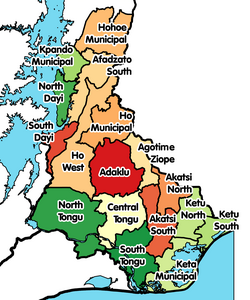 Districts of Volta Region | |
 South Tongu District Location of South Tongu District within Volta | |
| Coordinates: 6°0′0.36″N0°35′56.76″E / 6.0001000°N 0.5991000°E | |
| Country | |
| Region | |
| Capital | Sogakope |
| Government | |
| • District Executive | Hon. Emmanuel Louise Agamah |
| Area | |
• Total | 623 km2 (241 sq mi) |
| Population (2021 [1] ) | |
• Total | 113,114 |
| • Density | 180/km2 (470/sq mi) |
| Time zone | UTC+0 (GMT) |
| ISO 3166 code | GH-TV-ST |
South Tongu District is one of the eighteen districts in Volta Region, Ghana. Originally created as an ordinary district assembly on 10 March 1989, which was created from the former Tongu District Council, which was established by Legislative Instrument (L.I.) 1466. The district assembly is located in the southwest part of Volta Region and has Sogakope as its capital town. [2]