Anloga District

Last updated
Anloga District
Aŋlɔga Nutome
Districts of the Volta Region (2018).png
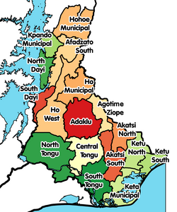
Districts of Volta Region
Ghana adm location map.svg
Red pog.svg
Anloga District
Location of Anloga District within Volta
Coordinates: 5°47′13.7″N0°53′25.8″E / 5.787139°N 0.890500°E / 5.787139; 0.890500
CountryFlag of Ghana.svg  Ghana
Region Flag of Volta Region.png Volta
Capital Angola
Government
  District ExecutiveHon. Seth Yormewu
  Awormefia of AnloHon. Togbui Sri III [1]
Area
  Total314 km2 (121 sq mi)
Population
 (2021 [2] )
  Total94,895
  Density300/km2 (780/sq mi)
Time zone UTC+0 (GMT)
Ghana Post GPS
VK
Area code 03626
ISO 3166 code GH-TV-AL

Anloga District is one of the eighteen districts in Volta Region, Ghana. Originally it was formerly part of the then-larger Keta District on 10 March 1989, which was created from the former Anlo District Council. However on 19 February 2019, the western part of the district was split off to create Anloga District as one of six districts inaugurated by the Akufo-Addo Government, [3] [4] thus the remaining part has been retained as Keta Municipal District . The district assembly is located in the southeast part of Volta Region and has Anloga as its capital town.

Contents

Populated places

The largest town in the district is the capital, Anloga. Some of the villages include Alakple, Kodzi, Dzita, Dewegodo, Dewenu, Srogboe, Whuti, Atsito, Fiaxor, Deta, Genui, Benadzi, Azanu, Apklorfudzi, Tregui, Trekume, Bleamezado, Dosukorpe, Lividzi, Agortoe, Salo, Nyikutor, Atorkor, Woe, Tegbi, Afiadenyigba, Anyako, Abor, Weta, Aƒiƒe, Aŋloga, Anyaŋui, Tunu, Akplowotorkor, and Fuveme. [5]

People

The main ethnic group in the Anloga District are the Ewe people. The main Ewe group are the Anlo Ewe. Their leader and king is the Awormefia of Anlo, Togbui Sri III. [3]

Administration

The District administration is based at Anloga. The head of its administration is the District Chief Executive (DCE) who is appointed by the President of Ghana. The current DCE is Seth Yormenu. [6]

Related Research Articles

<span class="mw-page-title-main">Keta</span> Town & Municipality Capital in Volta Region, Ghana

Keta is a coastal town in the Volta Region of Ghana. It is the capital of the Keta Municipal District.

<span class="mw-page-title-main">Regions of Ghana</span> 16 principal administrative areas of the republic in West Africa

The Regions of Ghana constitute the first level of subnational government administration within the Republic of Ghana. As of 2020, there are currently sixteen regions, which are further divided for administrative purposes into 260 local metropolitan, municipal and district assemblies.

<span class="mw-page-title-main">Volta Region</span> Region of Ghana

Volta Region is one of Ghana's sixteen administrative regions, with Ho designated as its capital. It is located west of Republic of Togo and to the east of Lake Volta. Divided into 25 administrative districts, the region is multi-ethnic and multilingual, including groups such as the Ewe, the Guan, and the Akan peoples. The Guan peoples include the Lolobi, Likpe, Akpafu, Buem, and Nkonya people. This region was carved out of the Volta Region in December 2018 by the New Patriotic Party. The people of the Volta Region are popularly known as Ewes. The people of the Volta Region are popular known for their rich cultural display and music some of which include Agbadza, Borborbor and Zigi.

<span class="mw-page-title-main">Fort Prinzenstein</span> Danish fort in Keta, Ghana

Fort Prinzenstein is a fort located at Keta, Ghana which was used in the slave trade. Many such forts were built in Africa, but Prinzenstein is one of the few that lie east of the Volta River. Keta served as an open port until the Tema Harbour commenced its operation to the west in 1962. The fort has been designated a World Heritage Site because of its historical importance and testimony to the Atlantic slave trade.

Padmore Enyonam Agbemabiese is a Ghanaian poet and scholar and lecturer in the Department of African American and African Studies at Ohio State University.

Ferdinand Kwasi Fiawoo was a Ghanaian religious minister, playwright and educator, founder of Zion College, the first secondary school in Ghana's Volta Region.

Wegbe Kpalime is a village located in the South Dayi District of the Volta Region of Ghana.

<span class="mw-page-title-main">Keta Lagoon</span> Lagoon in Volta Region, Ghana

Keta Lagoon, also called Anlo-Keta lagoon, is the largest of the over 90 lagoons that cover the 550 km stretch of the coastline of Ghana. This lagoon is 126.13 km in length. It is located in the eastern coast of Ghana and separated from the Gulf of Guinea by a narrow strip of sandbar. This open salty water is surrounded by flood plains and mangrove swamps. Together they form the Keta Lagoon Ramsar site which covers 1200 km2

Abor is a town in the Keta Municipal District of the Volta Region in southeast Ghana. Abor lies east of the Volta River and just north of the Keta Lagoon. Abor is known for Abor Senior High School, often referred to as ABORSCO. The school is a second cycle institution.

Anloga is a town in Keta District of the Volta Region in southeast Ghana. It lies east of the Volta River and just south of the Keta Lagoon. Anloga is the forty-seventh most populous town in Ghana, in terms of population, with a population of 35,933 people.

<span class="mw-page-title-main">Agbozume</span> Town in Volta Region, Ghana

Agbozume or Klikor-Agbozume is a town in Ketu Municipal District in the Volta Region of southeastern Ghana. The main language spoken is the Ewe language.

Anlo Afiadenyigba is a town in the Volta Region of Ghana. The town is located on the eastern part of the Keta Lagoon.

The Hogbetsotso festival(pronounced Hogbechocho) is celebrated by the chiefs and people of Anlo in the Volta region of Ghana. Some major Anlo towns include Anloga (capital), Keta, Kedzi, Vodza, Whuti, Srogboe, Tegbi, Dzita, Abor, Afiadenyigba, Anyako, Konu, Alakple, Atsito, Atiavi, Deʋegodo, Atorkor, Tsiame and many other villages. The festival is celebrated annually on the first Saturday in the month of November at Anloga which is the customary and ritual capital of the Anlo state. The name of the festival is derived from the Ewe language and translates as, the festival of exodus. or "coming from Hogbe (Notsie)". The celebration of the festival was instituted about four decades ago.

<span class="mw-page-title-main">Avenor Ewe</span> Ethnic groups in Ghana

The Avenor Ewe are a sub-tribe of the Ewe people of Ghana. The origin of the name Avenor is not known.

Alakple is a town in the Keta Municipality of the Volta Region of Ghana. This town is situated along the south western part of the Keta lagoon. The bust of the prominent African American boxer Muhammad Ali is planted at the junction along the Anloga and Dabala road. That road leads to Alakple. This town is prominent for the historical role it plays in the area. It is the home of the Nyigbla, 'god of war' who rode on horseback. The major clan in the town is Ameawo who are the custodians or clan responsible for nugbidodo 'settling disputes'. They are also believed to have control of all palm trees in Anloland. As custodians of Torgbi Nyigbla there are many taboos related to their dressing and food. for instance they are forbidden to wear shirts or blouse and sandals within the shrine.

<span class="mw-page-title-main">Ketu South Municipal District</span> Municipal District in Volta Region, Ghana

Ketu South Municipal Assembly formerly Ketu South District, is one of the eighteen districts in Volta Region, Ghana. Originally it was formerly part of the then-larger Ketu District on 10 March 1989, which was created from the former Anlo District Council, until the northern part of the district was split off to create Ketu North District on 29 February 2008; thus the remaining part has been renamed as Ketu South District. It was later elevated to municipal district assembly status on 28 June 2012 to become Ketu South Municipal District. The municipality is located in the southeast corner of Volta Region, immediately adjacent to the city of Lomé in Togo to the east, and has Denu as its capital town. The Municipality is known to be the largest Kente Production Hub in Ghana.

<span class="mw-page-title-main">Keta Municipal District</span> Municipal District in Ghana

Keta Municipal District is one of the eighteen districts in Volta Region, Ghana. Originally created as an ordinary district assembly in 1988 when it was known as Keta District, which was created from the former Anlo District Council, until it was elevated to municipal district assembly status on 1 November 2007 to become Keta Municipal District. However on 19 February 2019, the western part of the district was split off to create Anloga District; thus the remaining part has been retained as Keta Municipal District. The municipality is located in the southeast part of Volta Region and has Keta as its capital town.

St. Mary's Seminary/Senior High School (SMASCO), formerly St. Mary's Seminary Secondary School, is a boys-only second cycle institution in Lolobi, in the Oti Region of Ghana. The Oti Region was carved out of the northern part of the existing Volta Region.

The Keta-Sometutuza or Keta-Sometutu Festival is an annual festival celebrated by the chiefs and peoples of Agbozume in Ketu South District in the Volta Region of Ghana. It is usually celebrated two weeks after the Hogbetsotso festival. It is celebrated by the Somey people of Agbozume, Denu and surrounding communities to commemorate their migration from Keta in 1792-94 after the Keta -Anloga War. It is usually celebrated on the 3rd Saturday in November.

References

  1. "New Anloga District Inaugurated Despite Heavy Downpour". ghananet.co.uk. 19 February 2019. Retrieved 21 July 2020.
  2. Ghana: Administrative Division
  3. 1 2 "New Anloga District Inaugurated". voltaregion.gov.gh. Volta Regional Coordinating Council. Retrieved 21 July 2020.
  4. "Government to inaugurate six new districts today". ghanaweb.com. GhanaWeb. 19 February 2019. Archived from the original on 21 July 2020. Retrieved 21 July 2020.
  5. "Agavedzi residents call for support after tidal waves render 700 homeless - MyJoyOnline.com". www.myjoyonline.com. Retrieved 2021-05-29.
  6. "Group wants Anlo DCE removed over alleged corruption". myjoyonline.com.gh. 18 September 2019. Retrieved 21 July 2020.

5°47′13.7″N0°53′25.8″E / 5.787139°N 0.890500°E / 5.787139; 0.890500