South Dayi District

Last updated
South Dayi District
Districts of the Volta Region (2018).png
Districts of Volta Region
Ghana adm location map.svg
Red pog.svg
South Dayi District
Location of South Dayi District within Volta
Coordinates: 6°41′1″N0°20′1″E / 6.68361°N 0.33361°E / 6.68361; 0.33361
CountryFlag of Ghana.svg  Ghana
Region Flag of Volta Region.png Volta
Capital Kpeve
Government
  District ExecutiveHon. Ernest Patrick Kodzo Mallet [1]
Area
  Total236 km2 (91 sq mi)
Population
 (2021 [2] )
  Total57,526
  Density240/km2 (630/sq mi)
Time zone UTC+0 (GMT)
ISO 3166 code GH-TV-SD
Website Official Website

South Dayi District is one of the eighteen districts in Volta Region, Ghana. [3] Originally it was formerly part of the then-larger Kpando District on 10 March 1989, until the southern part of the district was split off by a decree of president John Agyekum Kufuor on 19 August 2004 to create South Dayi District; [4] thus the remaining part has been retained as Kpando District (which it was elevated to municipal district assembly status on 28 June 2012 to become Kpando Municipal District ). The district assembly is located in the western part of Volta Region and has Kpeve as its capital town.

Contents

Background

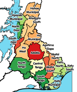
The is one of the eighteen districts in the Volta Region of Ghana. They are made up of 6 municipal and 12 ordinary districts since the referendum and subsequent redemarcation of regions in December 2018. [5]

Boundaries

The district covers part of what was formerly the southern part of the old Kpando district, thus reducing the latter's size. The South Dayi district lies between latitude 3°20N and 3.5°05N. It is approximately on longitude 0°17 E. The district has a total area of 1,000 km² with the Volta Lake, the largest artificial lake in the world, covering about 20% of this. [6]

The South Dayi District is bounded by:

Climate and vegetation

The climate is tropical and is influenced largely by the southwest monsoons from across the South Atlantic Ocean which bring in the rain and the North Easterly Trade Winds blowing in the dry harmattan across the Sahara Desert. The major rainy season is between mid April and early July while the minor one is from September to November. The harmattan/dry season is between November and March.

There are two main types of vegetation. The guinea savanna woodlands covers the Dayi basin and consists of scattered trees including acacia, bamboos, and baobabs. In the region of Tsatee, Kpalime and Dzemeni are the semi-deciduous forests found on the slopes of the Akwapim-Togo-Atakora range. [7]

Topography

The Akwapim-Togo-Atakora range forms a large part of the eastern border of the district with the exception of Wegbe Kpalime which is just at the base of its eastern slope. The topography is an undulating one due to the large numbers of ridges and hills scattered throughout the district. Some of these hills are Tsatee, Akpato, Amekulotoe, Gleme and Abanyakoe. [8] [9]

Population

The population from the 2005 census was estimated at 39,893 with a growth rate of 1.9%. Peki Avetile and Peki Dzake are the most populated towns in the district. Almost 50% of the total population is found in the Peki Traditional Area. The district also covers the Kpalime, Kpeve and Tongor traditional areas. The other main towns in this district include Kpeve (New Town) the capital, Peki Adzokoe, Peki Dzake, Peki-Dzogbati, Peki Sanga, Todome, Wegbe Kpalime and Dzemeni. [10]

Festivals

Festivals in South Dayi district include Gbi Dukorza celebrated by Peki and Hohoe, Kpalikpakpa zã [11] celebrated by Kpalime and Tongor Traditional Areas, Yam festivals celebrated all over the district and the Glimetso zã (Glimetso festival) celebrated by Kpeve, Klefe, Klikor, Tsorxor and Tsibu.

Settlements

In addition to Kpeve, the capital and administrative centre, South Dayi District contains the following towns:

  • Peki Avetile
  • Peki Blengo
  • Peki Dzake
  • Peki Sanga
  • Peki Tsame
  • Peki Wudome

Governance

District Assembly

South Dayi District Assembly was set up by Legislative Instrument No. 1753 of 2004. It is the highest political and administrative authority according to the Local Government Act of 1993. The jurisdiction of the local government involved the South Dayi Constituency, twelve electoral areas, two councils and two units. There are currently 21 electoral areas each of which elects a person onto the District Assembly. [12] The District Assembly has twenty members. Seven of them are appointed. The district is headed by a District Executive who is appointed by the President of Ghana in consultation with the local District Assembly. There are an additional six members who are also appointed by government. The other thirteen members are elected representatives. They include the Member of Parliament (MP) for South Dayi who also represents the district in the national parliament and twelve additional elected members of the assembly. The MP is elected during national general elections. The other twelve members are elected through local district assembly elections. The Assembly elects a Presiding Member who holds the office for a two-year term. It also has an Executive Committee which is chaired by the District Chief Executive. There are five sub-committees mandated by section 24 (1) of the Local Government Act, 1993 (Act 462). These are the Development Planning, Finance and Administration, Justice and Security, Works and the Public Relations and Complaints sub-committees. [13]

Electoral assembly members

The current elected members of the South Dayi assembly are as follows. [12]

Electoral AreaElected RepresentativeComments
Avetile EastBobi John Ransford
Avetile WestSeyram Kafui Akude
Dzemeni EastThomas Avuwadah
Dzemeni WestLotsoo George Bada
Kpalime Duga Prosper Ofosu
Kpeve New Town David KwasiAkukumah
Peki AdzokoeTimothy Freeman Kotope
Peki AgbateCourage Otchi
Peki BlengoOphilia Bediako – Nani
Peki DzakeVictor Amegbe
Peki DzogbatiAlexander Kwami Addo
Peki TsameAikins George Akortia
Peki WudomeWellington Elukpedzu
SangaJohn Kwesi Ahiati
To Kpalime Christian Jerry Owusu
TodomeEric Senaya
Tongor Kaira Godwin Gaitu
Tongor TsanakpeBlessed Vincent Dagbey
TsateDaniel Ofori-Attor
TsiyinuChristian Yao Dorvlo
Wegbe Kpalime Fred Nani

District Chief Executives

The current District Chief Executive, Ernest Patrick Kodzo Mallet was appointed by Nana Akufo-Addo in June 2017. [14] The past chief executives have been:

Sub districts

There are two sub-districts. These are the Peki Town Council and the Tongor Kaira Area Council. The Peki Town Council is urban in nature and has its headquarters at Peki Avetile. Peki has a lot of educational institutions including secondary and tertiary institutions. It also has a government hospital and good water and electricity supplies.

The Tongor Area Council consists of small communities and townships. It has a lively market at Dzemeni. [13]

Traditional authority

The chieftaincy institution is an important part of the running of the district. The Peki Traditional Council is based at Peki-Blengo. Other important traditional authorities in the district include the Kpalime, Kpeve and Tongor. [13]

Health

The health facilities in the district include the following: [15]

  1. Adzokoe Health Centre [16]
  2. Dzemini E. P. Clinic [17]
  3. Kpalime Duga Health Centre [18]
  4. Peki Dzake Health Centre [19]
  5. Salem Maternity Home [20]
  6. Tongor Tsanekpe Health Centre [21]
  7. Tsate Community-Based Health Planning and Services (CHPS) Zone [22]
  8. Tsiyinu CHPS Zone [23]
  9. Wegbe Kpalime Health Centre [24]

Education

The Evangelical Presbyterian University College has one of its campuses, the Greenhill Campus, at Peki, where the Evangelical Presbyterian Church Seminary was located. It was established in 2008. [25] The Peki College of Education is a long established teacher training college. Senior High Schools in the district include Kpeve Senior High School, Peki Senior High School, [26] Peki Secondary Technical School and the Tongor Secondary Technnical School at Tsanakpe.

Transportation

Roads

The N2 Highway from Tema through Jasikan to Bawku and Kulungugu cuts through the district from south to north. It enters the district from Asikuma in the Asuogyaman District of the Eastern Region. It then runs through the Peki towns including Dzake, Blengo and Adzokoe. It continues through Todome and Kpeve, the capital to Have-Etoe where it intersects the R26 Regional Highway.

Volta Lake

There is a thriving market at Dzemeni on the eastern edge of the Volta Lake. The Dodi Island, a popular stop for ferry services is just west of Dzemeni. [13]

Airports

There is no airport in the district. The nearest airport is the Ho Airport in the capital of the region. Its construction started in 2015. [27] Due to financial reasons however, regular commercial flights to the airport have been suspended by the domestic airlines. [28] The nearest aiport with regular flights is the Kotoka International Airport in Accra. [29]

Related Research Articles

<span class="mw-page-title-main">Volta Region</span> Region of Ghana

Volta Region is one of Ghana's sixteen administrative regions, with Ho designated as its capital. It is located west of Republic of Togo and to the east of Lake Volta. Divided into 25 administrative districts, the region is multi-ethnic and multilingual, including groups such as the Ewe, the Guan, and the Akan peoples. The Guan peoples include the Lolobi, Likpe, Akpafu, Buem,Nyangbo,Avatime, and Nkonya. This region was carved out of the Volta Region in December 2018 by the New Patriotic Party. The people of the Volta Region are popularly known as Ewes. The people of the Volta Region are popular known for their rich cultural display and music some of which include Agbadza, Borborbor and Zigi.

<span class="mw-page-title-main">Kpando Municipal District</span> Municipal District in Volta Region, Ghana

Kpando Municipal District is one of the eighteen districts in Volta Region, Ghana. Originally created as an ordinary district assembly on 10 March 1989 when it was known as Kpando District, until the southern part of the district was split off by a decree of president John Agyekum Kufuor on 19 August 2004 to create South Dayi District; thus the remaining part has been retained as Kpando District. However on 28 June 2012, the southern part of the district was later split off to create North Dayi District on 28 June 2012; while the remaining part was elevated to municipal district assembly status on the same year to become Kpando Municipal District. The municipality is located in the western part of Volta Region and has Kpando as its capital town.

Kpeve is a small town located in the Volta Region of Ghana and divided into Kpeve Old Town, which is part of the Afadjato South District and Kpeve New Town which is part of the South Dayi District, the administrative district capital of South Dayi district.

The Kpalime Traditional Area is located mainly in the South Dayi District of the Volta Region of Ghana. This area originally was located partly within the Kpando District of the Volta Region but with the creation of new districts in 2004, it now falls within the South Dayi District.

<span class="mw-page-title-main">North Dayi</span> Constituency in Ghana

North Dayi is one of the constituencies represented in the Parliament of Ghana. It elects one Member of Parliament (MP) by the first past the post system of election. North Dayi is located in the Anfoega district of the Volta Region of Ghana.

<span class="mw-page-title-main">South Dayi (Ghana parliament constituency)</span> Constituency in Ghana

South Dayi is one of the constituencies represented in the Parliament of Ghana. It elects one Member of Parliament (MP) by the first past the post system of election. South Dayi is located in the South Dayi district of the Volta Region of Ghana.

Anum is an Guan community in Asuogyaman District of the Eastern Region of Ghana, across from the Volta Lake.

<span class="mw-page-title-main">Akua Sena Dansua</span> Ghanaian politician

Akua Sena Dansua is an experienced Ghanaian media and communications consultant, politician and governance and leadership practitioner. She was the Member of Parliament for North Dayi in Ghana and former Ambassador to Germany.

Wegbe Kpalime is a village located in the South Dayi District of the Volta Region of Ghana.

<span class="mw-page-title-main">Peki</span> Town in Volta Region, Ghana

Peki is a town in the South Dayi District in the Volta Region of Ghana. It comprises eight subtowns, each with a subchief - Tsame, Avetile, Afeviwofe, Blengo, Dzake, Wudome, Dzobati and Adzokoe. All of these subchiefs swear allegiance to a paramount chief known as Deiga. The current paramount chief is Deiga Kwadzo Dei XII. The town is known for the Peki Secondary School, the E.P Seminary and the government training college GOVCO. The school is a second cycle institution.

Kpalime Duga is a village located in the South Dayi District of the Volta Region of Ghana.

Tongor Kaira is a village located in the South Dayi District of the Volta Region of Ghana.

<span class="mw-page-title-main">Afadzato South District</span> District in Ghana

Afadzato South District is one of the eighteen districts in Volta Region, Ghana. Originally it was formerly part of the then-larger Hohoe District on 10 March 1989, until the southern part of the district was split off to create Afadzato South District on 28 June 2012; thus the remaining portion has been retained as Hohoe Municipal District. The district assembly is located in the northern part of Volta Region and has Ve Golokwati as its capital town.

<span class="mw-page-title-main">North Dayi District</span> District in Ghana

North Dayi District is one of the eighteen districts in Volta Region, Ghana. Originally it was formerly part of the then-larger Kpando District on 10 March 1989, until the southern part of the district was split off to create North Dayi District on 28 June 2012; thus the remaining part was elevated to municipal district assembly status to become Kpando Municipal District on the same year. The district assembly is located in the western part of Volta Region and has Anfoega as its capital town.

To Kpalime or To is a village located in the South Dayi District of the Volta Region of Ghana. It is one of the towns of the Kpalime Traditional Area.

Kpaleis a village located in the Ho West District of the Volta Region of Ghana. It is one of the towns of the Kpalime Traditional Area.

Hlefi is a village in the Ho West District of the Volta Region of Ghana.

Bame is a village in the Ho West District of the Volta Region of Ghana.

References

  1. South Dayi District
  2. Ghana: Administrative Division
  3. South Dayi District
  4. ""We will not disappoint the government", says Togbe Agbi Nani". GhanaWeb. 20 August 2004. Retrieved 14 August 2009.
  5. Kaledzi, Isaac (26 June 2019). "Ghana: Six new regions created after a referendum". Africa Needs. Retrieved 16 July 2020.
  6. "Volta Region » South Dayi". Ministry of Local Government and Rural Development and Maks Publications & Media Services. Archived from the original on 2007-10-25. Retrieved 2009-08-14.
  7. "Climate & Vegetation". Ministry of Local Government and Rural Development and Maks Publications & Media Services. Retrieved 2009-08-14.
  8. "South Dayi District Assembly - Relevant Data". GhanaDistricts Government Of Ghana. Retrieved 5 June 2021.
  9. "About Us". South Dayi District Assembly. Retrieved 9 June 2021.
  10. "Demographic Characteristics". Ministry of Local Government and Rural Development and Maks Publications & Media Services. Retrieved 2009-08-14.
  11. "Kpalime Celebrate Kpalikpakpa Festival". General News of Wednesday, 5 November 1997. Ghana Home Page. Retrieved 2009-08-14.
  12. 1 2 "South Dayi District Assembly - All Electoral Areas and Assembly Members". GhanaDistricts Government Of Ghana. Retrieved 30 December 2020.
  13. 1 2 3 4 "Governance". GhanaDistricts. Retrieved 15 December 2020.
  14. "Ghana Districts: A repository of all Local Assemblies in Ghana". GhanaDistricts. Retrieved 15 December 2020.
  15. "List of facilities". Ghana hospitals. Retrieved 16 July 2020.
  16. "Adzokoe Health Center". ghanahospitals.org. Retrieved 16 July 2020.
  17. "Dzemini E.P. Clinic". ghanahospitals.org. Retrieved 16 July 2020.
  18. "Kpalime-Duga Health Center". ghanahospitals.org. Retrieved 16 July 2020.
  19. "Peki Dzake Health Centre". ghanahospitals.org. Retrieved 16 July 2020.
  20. "Salem Maternity Home". ghanahospitals.org. Retrieved 16 July 2020.
  21. "Tongor Tsanakpe Health Center". ghanahospitals.org. Retrieved 16 July 2020.
  22. "Tsatee CHPS Zone". ghanahospitals.org. Retrieved 16 July 2020.
  23. "Tsiyinu CHPS Zone". ghanahospitals.org. Retrieved 16 July 2020.
  24. "Wegbe Kpalime Health Center". ghanahospitals.org. Retrieved 16 July 2020.
  25. "Campuses". Evangelical Presbyterian University College. Archived from the original on 9 June 2011. Retrieved 15 December 2020.
  26. "Peki Senior High School pleads for Presidential Intervention". GhanaWeb. Retrieved 15 December 2020.
  27. "Ho goes agog as Prez Mahama cuts sod for airport". Graphic Online. Retrieved 15 December 2020.
  28. Maclean Kwofi (5 April 2022). "Airlines 'ghost' $25m Ho Airport". Graphic Online. Graphic Communications Group Ltd. Retrieved 3 April 2024.
  29. "Maps, Weather, and Airports for Wegbe, Ghana". fallingrain. Retrieved 15 December 2020.

6°41′1″N0°20′1″E / 6.68361°N 0.33361°E / 6.68361; 0.33361