Dunkwa-on-Offin

Last updated

Dunkwa-on-Offin
Dunkwa
Ghana adm location map.svg
Red pog.svg
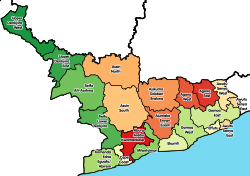
Dunkwa-on-Offin
Location of Dunkwa-on-Offin in Central region, South Ghana
Coordinates: 5°58′00″N1°47′00″W / 5.9667°N 1.7833°W / 5.9667; -1.7833
Country Ghana
Region Flag placeholder.svg Central Region
District Upper Denkyira East Municipal District
Elevation
117 m (384 ft)
Population
 (2013)
  Total
33,379 [1]
Time zone GMT
  Summer (DST) GMT

Dunkwa-On-Offin or simply Dunkwa, is a town and the capital of the Upper Denkyira East Municipal District, a district in the Central Region of south Ghana. [2] Dunkwa-On-Offin has a 2013 settlement population of 33,379 people. [1]

Contents

Geography

Topography

Dunkwa-On-Offin town is located along the Offin River. Dunkwa-On-Offin is low-lying with loose quaternary sands and the town rises up to 117 metres above sea level. [3] The town is drained by a number of rivers and streams, including the Offin River and other small steams. [3]

Culture

The Dunkwah-On-Offin Lodge No. 89 is an Orange Lodge within the Orange Order. They are governed by the Grand Orange Lodge of Ghana. They focus on developing the town's youth, promoting Christianity and history of the Orange Order. [4] [5]

See also

References

  1. 1 2 "World Gazetteer online". World-gazetteer.com. Archived from the original on September 30, 2007.
  2. Upper Denkyira East Municipal district
  3. 1 2 Upper Denkyira East Municipal district: Topography & Drainage
  4. "The Orange Order in Africa – History Ireland". historyireland.com. Retrieved 2026-01-07.
  5. "Orange Order on the equator: Keeping the faith in Ghana". BBC News. 2015-08-30. Retrieved 2026-01-07.