Mfantsiman Municipal District

Last updated

Mfantsiman Municipal Assembly
Municipal District
Saltpond Ghana.jpg
Saltpond (town centre)
Districts of the Central Region (2012).svg
Districts of Central Region
Ghana adm location map.svg
Red pog.svg
Mfantsiman Municipal Assembly
Location of Mfantsiman Municipal Assembly within Central
Coordinates: 5°12′11.16″N1°3′25.2″W / 5.2031000°N 1.057000°W / 5.2031000; -1.057000
CountryFlag of Ghana.svg  Ghana
Region Flag of Central Region (Ghana).gif Central
Capital Saltpond
Government
  Municipal Chief ExecutiveKenneth Kelly Essuman
Area
  Total
533 km2 (206 sq mi)
Population
 (2021)
  Total
168,905 [1]
Time zone UTC+0 (GMT)
ISO 3166 code GH-CP-MF [2]
Website Official Website

Mfantsiman Municipal Assembly is one of the twenty-two districts in Central Region, Ghana. Originally created as an ordinary district assembly in 1988 when it was known as Mfantsiman District , which was created from the former Mfantsiman District Council; until it was later elevated to municipal district assembly status on 29 February 2008 to become Mfantsiman Municipal District. However, on 28 June 2012, the eastern part of the district was split off to create Ekumfi District; thus, the remaining part has been retained as the Mfantsiman Municipal Assembly. The municipality is located in the southwest part of Central Region and has Saltpond as its capital town. [3]

Contents

Geography

The Mfantsiman municipality is located along the Atlantic coastline of the Central Region of Ghana and extends from latitudes 5° to 5°20’ north of the equator and longitudes 0°44’ to 1°11’ west of the Greenwich Meridian, stretching for about 21 kilometers along the coastline and for about 13 kilometers inland and constituting an area of 612 square kilometers. The municipal capital is Saltpond.

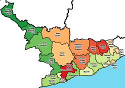
The municipality is bounded to the west and northwest by Abura-Asebu-Kwamankese District, to the east by Ekumfi District and to the south by the Atlantic Ocean. The District as of 2012 stretched from Mankessim to Yamoransa.

Economy

The inhabitants are mainly employed through fishing, farming or trading. The capital Saltpond was the birthplace of Convention People's Party (CPP), The founders use to stay in a house named Caanan Lodge, the party of Osagyefo Dr Kwame Nkrumah. Kwame Nkrumah planted a palm tree that signified the birth of UGCC in the town. The palm tree is found in the centre of Saltpond. The first tarred road in Ghana is also found in Saltpond.

The municipality houses the Akanland Ceramics factory (formerly) but now a paper producing company and also known to be the first place to begin off-shore oil-drilling in Ghana.

List of settlements

Settlements of Mfantsiman Municipal Assembly
No.SettlementPopulationPopulation year
1Abonko1,538 [4] :792010
2 Anomabo 13,401 [4] :792010
3Baifikrom3,705 [4] :792010
4 Biriwa 7,086 [4] :792010
5Ankaful
6 Kormantse 8,501 [4] :792010
7Egya No. 1,2 & 3
8Dominase
9Asafora1,127 [4] :792010
10Nsanful960 [4] :792010
11Kyeakor2,491 [4] :792010
12Kuntu
13Mankessim38,313 [4] :792010
14Taido
15 Saltpond 24,1322012
16Aminsakrom
17 Yamoransa 6,816 [4] :792010
18Eguase1,025 [4] :792010
19Akatakyiwa
20Oguakuma
21Akoanso
22Kobina Ansah
23Egyirfa
24Waakrom
25Akroful
26Amoanukumah
27Akraman
28Nsanfokuma
29Fomena/Begyin
30Edzimbor
31Ekutukrom
32Nkwantakesedo
33Mampong
34Brofoyedur
35Tayido
36Pomadze
37Ekurabadze
38Oboadze
39Anomansa
40 Abandze 3,632 [4] :792010
41Ewoyaa
42Hiini
43Pebi
44Eshiro
45Krofu1,321 [4] :792010
46Nkwanta
47Effutuakwa
48Opim
49Duadze
50Towoboase
51Edumanu
52Kwesi Ansah
53Mprenkyi
54Akropong
55Kwaakrom
56Essamutan
57Odumano
58Kyekyewere
59Taabosom
60Kaawonsere1,265 [4] :792010
61Akobima

Past members of parliament

Notable people

Some important people who hail from Mfantsiman Municipality are:

Sources

References

  1. Ghana: Administrative Division
  2. http://www.statoids.com/ygh.htm%5B%5D
  3. "Mfantseman Municipal Assembly – The Official Website of Mfantseman Municipal Assembly" . Retrieved 26 November 2024.
  4. 1 2 3 4 5 6 7 8 9 10 11 12 13 14 "2010 Population & Housing Census District Analytical Report: Mfantseman District" (PDF). 2010. Archived from the original (PDF) on 5 March 2016. Retrieved 17 November 2023.
  5. "Francis Kofi Ampenyin Allotey (1932-2017)". nuclearprinceton.princeton.edu. Retrieved 16 May 2022.
  6. "James Emman Kwegyir Aggrey Papers, 1920-1927". www.columbia.edu. Retrieved 16 May 2022.
  7. Ankrah, K. D. (December 2017). Unsung Nationalist Hero: The Biographical Sketch of Sir Kobina Arku Korsah (Thesis thesis). University of Ghana. Archived from the original on 18 April 2021. Retrieved 16 May 2022.
  8. Kamata, Suzanne. "A Profile of Ama Ata Aidoo". Literary Mama. Retrieved 16 May 2022.

5°12′11.16″N1°3′25.2″W / 5.2031000°N 1.057000°W / 5.2031000; -1.057000