Elmina

Last updated

Elmina
Edina
Benya lagoon and it surroundings located in Elmina.jpg
St. George Castle, Elmina, Ghana.JPG
Canoes at the shore.jpg
Top picture: Skyline of Elmina, Bottom left picture: Elmina Castle Bottom right picture: Coast of Elmina on the Gulf of Guinea
Etymology: Elmina ("The mine") [1]
Ghana adm location map.svg
Red pog.svg
Elmina
Location of Elmina in Central Region, South Ghana
Africa location map.svg
Red pog.svg
Elmina
Elmina (Africa)
Coordinates: 5°05′N1°21′W / 5.083°N 1.350°W / 5.083; -1.350
CountryFlag of Ghana.svg  Ghana
Region Central Region
District Komenda/Edina/Eguafo/Abirem Municipal District
Government
[2]
  Municipal chiefHon. Solomon Ebo Appiah
Elevation
10 m (30 ft)
Population
 (2013) [3] [4] :32
  Total33,576
  Religions
Time zone GMT
  Summer (DST) GMT
Postal distict
CK
Area code 033
Climate Aw
Website keeama.gov.gh OOjs UI icon edit-ltr-progressive.svg

Elmina (Fante: Edina) is a town and the capital of the Komenda/Edina/Eguafo/Abirem District on the south coast of Ghana in the Central Region. [4] :1 It is situated on a bay on the Atlantic Ocean, 12.2 km (7.6 mi) west of Cape Coast. [5] Elmina was the first European settlement in West Africa and it has a population of 33,576 people, as of 2013. [6] [3] The current Municipality chief of Elmina is Hon. Solomon Ebo Appiah. [2]

Contents

When the Portuguese, after first coming in contact with the Gold Coast, struck an agreement with the King of Elmina to built the São Jorge da Mina Castle in the 1470s, the settlement grew to become an important centre of commerce and trade in the region. [7] Nowadays, Elmina shows strong influences from Europe in its culture and people. [6]

Etymology

Prior to the arrival of the Portuguese, the town was originally called Anomansah ("perpetual" or "inexhaustible drink") from its position on the peninsula between the Benya lagoon and the sea. [8] It eventually was named after the Elmina Castle, which is also called "São Jorge da Mina". The word "Elmina" simply means "the mine". [1]

History

Early settlement

Based on oral traditions, the town was founded by Kwaa Amankwaa, a hunter who was in search of food. After discovering a stream and settling there, he exchanged the word "M'enya", which means "I have found or got it". The exact origins of Elmina is conflicted. [9]

Colonization era

Historical affiliations

In 1478, during the War of the Castilian Succession, a Castilian armada of 35 caravels and a Portuguese fleet fought a large naval battle near Elmina for the control of the Guinea trade (gold, slaves, ivory and melegueta pepper), the Battle of Guinea. The war ended with a Portuguese naval victory, followed by the official recognition by the Catholic Monarchs of Portuguese sovereignty over most of the West African territories in dispute embodied in the Treaty of Alcáçovas, 1479. [10] [11] This was the first colonial war among European powers. Many more would come.

The town grew around São Jorge da Mina Castle, built by the Portuguese Diogo de Azambuja in 1482 on the site of a town or village called Amankwakurom or Amankwa. It was Portugal's West African headquarters for trade and exploitation of African wealth. The original Portuguese interest was gold, with 8,000 ounces shipped to Lisbon from 1487 to 1489, 22,500 ounces from 1494 to 1496, and 26,000 ounces by the start of the sixteenth century. [7]

Later, the port expanded to include tens of thousands of slaves channeled through the trading post of Elmina, ten to twelve thousand from 1500 to 1535 alone. By 1479, the Portuguese were transporting slaves from as far away as Benin, who accounted for 10 percent of the trade in Elmina, and were used to clear land for tillage. [7] :23–24

Dutch troops on the shore who have landed are shown battling with natives to take the local fort AMH-7708-NA View of the fort and the roadstead at Elmina.jpg
Dutch troops on the shore who have landed are shown battling with natives to take the local fort

Elmina is also home to Fort Coenraadsburg on St. Jago Hill, built by the Portuguese in 1555 under the name Forte de Santiago; it was used for commerce. In 1637, it was conquered and renamed by the Dutch, after they captured Elmina's main castle. Today, Elmina's main economic industry is fishing, salt production and tourism. Elmina Castle is very close to Cape Coast Castle, another historic fortress notable for its role in the transatlantic slave trade. [12]

17th Century to present

The location of Elmina made it a significant site for re-provisioning ships headed south towards the Cape of Good Hope on their way to India. After years of Portuguese commerce on the Elmina Coast, the Dutch learned of the profitable activity taking place through Barent Eriksz of Medemblik, one of the earliest traders and Guinea navigators. Ericksz learned about trading on the Elmina coast while he was a prisoner on Principe and subsequently became a major resource to the Dutch in terms of providing geographical and trading information. [13] The Dutch West India Company captured Elmina in 1637; in subsequent centuries it was mostly used as a hub for the slave trade. The British attacked the city in 1782, but it remained in Dutch hands until 1872, when the Dutch Gold Coast was sold to the British. The king of Ashanti, claiming to be suzerain, objected to the transfer, and initiated the third Anglo-Ashanti war of 1873–1874. [14]

Economy

Beginning in 2003, Elmina, along with foreign investors, began The Elmina Strategy 2015, a massive project to improve many aspects of the town, consisting of water drainage and waste management helping to improve the health of the citizens, repairing the fishing industry and harbour of within Elmina, tourism and economic development, improved health services, and improved educational services. [15]

Tourism

Tourism in the town is regulated by the Central Region Development Commission (CEDECOM), where the principle centre of tourism is the Elmina Castle. The site, along with Fort Coenraadsburg, attracts around 100,000 tourists annually, half of whom is foreign. [4] :4 Due to the lack of sufficient infrastructure, the development of this sector is hindered. [16]

Fishing

Elmina is home to the Elmina Fishing Harbour, the third largest fish landing site in Ghana, beaten by the Tema and Sekondi harbours. [17] In August 2020, a $93 million rehabilitation project began, improving the harbour's infrastructure to help with increasing demand. It was completed in May 2020. [18]

Although fishing activities are largely artisanal, the town account for 15% of Ghana's total fish output. About 75% of the population's livelihood is reliant on fishing or related activities. [17]

Demographics

Most of the population is religious, coming in at around 91.7% with the biggest religion being Christianity (85.3%). Of this, 28.4% are Pentecostal/Charismatic, 20.9% are other Christians, 18.2% are Catholics and 17.8% are Protestant. Christianity is followed by Islam, traditional African religions, and other religions. [4] :32

Administration

Although the town itself doesn't have a mayor, the municipal does have a mayor–council form of government. The mayor (executive chief) is appointed by the president of Ghana and approved by the town council, the Komenda/Edina/Eguafo/Abirem Municipal Assembly. [19] The current municipal chief of Elmina is Hon. Solomon Ebo Appiah. [2]

Geography

Municipality area

Ghana Elmina City Panorama.jpg
Panoramic view of Elmina Town. In harbour some fishing boats may be seen. The view is from Elmina Castle (St. George's Castle). The castle on St. Jago Hill is Fort São Jago da Mina (Fort Conraadsburg).

Elmina is located about 12.2 km (7.6 mi) from Cape Coast. [5] The town is located in the Komenda/Edina/Eguafo/Abirem Municipal of the Western Region, which covers a land area of 452.5 km2 (174.7 sq mi). The municipality borders the Gulf of Guinea to the south, the Cape Coast Metropolitan towards the east, the Twifo/Hemang/Lower Denkyira District to the north and the Mpohor district and the Wassa East District towards the west and northwest. [4] :1

Climate

Like most of Ghana, Elmina has a tropical savanna climate (Köppen Aw) with consistently hot weather year-round. Typically for the far south of the country, there are two rainy seasons, a main one from April to June and a lesser one from September to November and two dry seasons, a typical West African dry season from December to February due to the harmattan wind, and a less typical dry season from mid-July to mid-September with less hot temperatures and abundant fog due to the northward extension of the Benguela Current. [20]

Climate data for Elmina
MonthJanFebMarAprMayJunJulAugSepOctNovDecYear
Mean daily maximum °C (°F)30.8
(87.4)
31.4
(88.5)
31.8
(89.2)
31.5
(88.7)
30.6
(87.1)
28.7
(83.7)
27.4
(81.3)
26.9
(80.4)
27.9
(82.2)
29.5
(85.1)
30.8
(87.4)
30.9
(87.6)
29.9
(85.8)
Mean daily minimum °C (°F)22.7
(72.9)
23.5
(74.3)
23.8
(74.8)
23.8
(74.8)
23.7
(74.7)
23.1
(73.6)
22.3
(72.1)
21.8
(71.2)
22.5
(72.5)
22.9
(73.2)
22.7
(72.9)
22.8
(73.0)
23.0
(73.4)
Average rainfall mm (inches)25
(1.0)
36
(1.4)
84
(3.3)
103
(4.1)
203
(8.0)
325
(12.8)
102
(4.0)
42
(1.7)
55
(2.2)
116
(4.6)
84
(3.3)
30
(1.2)
1,205
(47.6)
Source: Climate-Data.org [21]

Culture

Elmina is home to the annual Bakatue Festival, a celebration of the sea and the local fishing culture, held on the first Tuesday of July each year. Bakatue translated means "the opening of the lagoon" or the "draining of the Lagoon". It is celebrated to commemorate the founding of the town, Elmina by the Europeans. It is also celebrated to invoke the deity, Nana Benya's continuous protection of the state and its people. [22]

Sister cities

The following is a list of sister cities of Elmina, designated by Sister Cities International:

CountryCityCounty / District / Region / StateDate [lower-alpha 1] Ref.
Flag of the Netherlands.svg  Netherlands Flag of Gouda.svg Gouda Flag of Zuid-Holland.svg  South Holland 2006 [23]
Flag of the United States.svg  United States Flag placeholder.svg Macon Flag of Georgia (U.S. state).svg  Georgia 2001 [24]

Notable people

See also

Explanatory notes

  1. Numbers in date column list the year of twinning

Related Research Articles

<span class="mw-page-title-main">Cape Coast</span> City in Central Region, Ghana

Cape Coast is a city, fishing port, and the capital of Cape Coast Metropolitan District and Central Region of Ghana. It is one of the country's most historic cities, a World Heritage Site, home to the Cape Coast Castle, with the Gulf of Guinea situated to its south. It was also the first capital of Ghana. According to the 2021 census, Cape Coast had a settlement population of 189,925 people. The language of the people of Cape Coast is Fante.

<span class="mw-page-title-main">Fante people</span> Ethnic group in Ghana

The modern Mfantsefo or Fante confederacy is a combination of Akan people and aboriginal Guan people. The Fante people are mainly located in the Central and Western regions of Ghana, occupying the forest and coastal areas. Their land stretches from the eastern part of western region in the west to Gomoa in the east. The Fante can be broadly categorized into two groups - the Borbor Fante and the Etsii Fante who are also aboriginal Guan people. Over the last half century, Fante communities have been established as far as Gambia, Liberia, and even Angola due to fishing expeditions. Major Fante cities in modern Ghana include Oguaa, Edina (Elmina), Agona Swedru, Mankessim, Saltpond, Komenda and Anomabo.

<span class="mw-page-title-main">Elmina Castle</span> Fort and former trading post in Elmina, Ghana

Elmina Castle was erected by the Portuguese in 1482 as Castelo de São Jorge da Mina, also known as Castelo da Mina or simply Mina, in present-day Elmina, Ghana, formerly the Gold Coast. It was the first trading post built on the Gulf of Guinea, and the oldest European building in existence south of the Sahara.

<span class="mw-page-title-main">Central Region (Ghana)</span> Region of Ghana

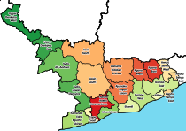
The Central Region is one of the sixteen administrative regions of Ghana. It is bordered by Ashanti and Eastern regions to the north, Western region to the west, Greater Accra region to the east, and to the south by the Gulf of Guinea. The Central Region is renowned for its many elite high schools and an economy based on an abundance of industrial minerals and tourism. The Central region boasts of many tourist attractions such as castles, forts and beaches dotted along the region's coastline.

<span class="mw-page-title-main">Komenda/Edina/Eguafo/Abirem Municipal District</span> Municipal District in Central, Ghana

Komenda/Edina/Eguafo/Abirem Municipal District is one of the twenty-two districts in the Central Region of Ghana. Originally created as an ordinary district assembly in 1988, when it was known as Komenda/Edina/Eguafo/Abirem District, it was created from the Cape Coast Municipal Council, until it was later elevated to municipal district assembly status on 29 February 2008, to become Komenda/Edina/Eguafo/Abirem Municipal District. The municipality is located in the southwest part of Central Region and has Elmina as its capital town.

<span class="mw-page-title-main">Dutch Gold Coast</span> Dutch possession in Western Africa between 1598-1872

The Dutch Gold Coast or Dutch Guinea, officially Dutch possessions on the Coast of Guinea was a portion of contemporary Ghana that was gradually colonized by the Dutch, beginning in 1612. The Dutch began trading in the area around 1598, joining the Portuguese which had a trading post there since the late 1400s. Eventually, the Dutch Gold Coast became the most important Dutch colony in West Africa after Fort Elmina was captured from the Portuguese in 1637, but fell into disarray after the abolition of the slave trade in the early 19th century. On 6 April 1872, the Dutch Gold Coast was, in accordance with the Anglo-Dutch Treaties of 1870–71, ceded to the United Kingdom.

<span class="mw-page-title-main">Portuguese Gold Coast</span> Portuguese colony in west Africa (1482–1642)

The Portuguese Gold Coast was a Portuguese colony on the West African Gold Coast along the Gulf of Guinea. Established in 1482, the colony was officially incorporated into Dutch territory in 1642. From their seat of power at the fortress of São Jorge da Mina, the Portuguese commanded a vast internal slave trade, creating a slave network that would expand after the end of Portuguese colonialism in the region. The primary export of the colony was gold, which was obtained through barter with the local population. Portuguese presence along the Gold Coast increased seamanship and trade in the Gulf, introduced American crops into the African agricultural landscape, and made Portuguese an enduring language of trade in the area.

<span class="mw-page-title-main">Paa Kwesi Nduom</span> Ghanaian politician, business consultant and Member of Parliament

Paa Kwesi Nduom or Papa Kwesi Nduom, is a Ghanaian business consultant, politician, and founder of Ghana's Progressive People's Party. A three-time candidate for president, he was the member of parliament for the Komenda-Edina-Eguafo-Abirem constituency and served as minister of state in the Kufuor government.

<span class="mw-page-title-main">Treaty of Axim</span> 1642 treaty between the Netherlands and the chiefs of Axim

The Treaty of Axim was concluded between the Netherlands and the chiefs of Axim in the western region of the Gold Coast and signed at Fort St. Anthony near Axim on 17 February 1642. The treaty regulated the jurisdiction of the Netherlands and the Dutch West India Company in the town and polity of Axim after the Dutch West India Company had successfully attacked the Portuguese who were the occupants of Fort St. Anthony in the town. Over time, the agreement was in part superseded and replaced by new contracts and agreements. The treaty did remain the basis for Dutch jurisdiction and political relations between Axim and the Dutch until the latter left the Gold Coast in 1872.

<span class="mw-page-title-main">Fort Coenraadsburg</span> 1652 Dutch-built fort in coastal Ghana

Fort Coenraadsburg or Conraadsburg, also Fort São Tiago da Mina, is a small Portuguese chapel built in honor of Saint Jago and it is situated opposite the Elmina Castle in the Central region of Ghana, to protect Fort Elmina from attacks. Owing to its historical importance and testimony to the Atlantic slave trade, Fort Conraadsburg was inscribed on the UNESCO World Heritage List in 1979 along with several other castles in Ghana.

<span class="mw-page-title-main">Fort Saint Anthony</span> Material cultural heritage site in Ghana

Fort Saint Anthony was a fort built by the Portuguese in 1515 near the town of Axim, in what is now Ghana. In 1642, the Dutch captured the fort and subsequently made it part of the Dutch Gold Coast. The Dutch expanded the fort considerably before they turned it over, with the rest of their colony, to the British in 1872. The fort is now the property of the Ghanaian state and is open to the public.

<span class="mw-page-title-main">Fort Vredenburgh</span> UNESCO World Heritage Site in Central Region, Ghana

Fort Vredenburgh was a Dutch fort on the Gold Coast, established on the left bank of the Komenda River. The fort exists as preserved ruins. Because of its testimony to European economic and colonial influence in West Africa, the fort was inscribed on the UNESCO World Heritage List in 1979, along with other nearby forts and castles.

<span class="mw-page-title-main">Bakatue Festival</span> Festival in Ghana by the people of Elmina

Name:Jurgen Ofori. Representing:Fante Land. Festival:Bakatue. The Bakatue Festival is celebrated by the chiefs and peoples of Elmina in the Central Region of Ghana. The festival, established at least as far back as 1847, is celebrated on the first Tuesday in the month of July every year.

<span class="mw-page-title-main">Komenda Wars</span>

The Komenda Wars were a series of wars from 1694 until 1700 largely between the Dutch West India Company and the English Royal African Company in the Eguafo Kingdom in the present day state of Ghana, over trade rights. The Dutch were trying to keep the English out of the region to maintain a trade monopoly, while the English were attempting to re-establish a fort in the city of Komenda. The fighting included forces of the Dutch West India Company, the Royal African Company, the Eguafo Kingdom, a prince of the kingdom attempting to rise to the throne, the forces of a powerful merchant named John Cabess, other Akan tribes and kingdoms like Twifo and Denkyira. There were four separate periods of warfare, including a civil war in the Eguafo Kingdom, and the wars ended with the English placing Takyi Kuma into power in Eguafo. Because of the rapidly shifting alliances between European and African powers, historian John Thornton has found that "there is no finer example of [the] complicated combination of European rivalry merging with African rivalry than the Komenda Wars."

<span class="mw-page-title-main">Dutch Cemetery, Elmina</span> Cemetery in Elmina, Ghana

The Dutch Cemetery of Elmina was constructed on the order of Governor of the Dutch Gold Coast Johannes Petrus Hoogenboom in 1806. Up until that date, the Dutch had buried their dead inside or just outside Elmina Castle, but by the beginning of the 19th century, little space was left there, so it was decided to construct a new cemetery in what was known as "the Garden" of Elmina. Ironically, Governor Hoogenboom was also one of the first people to be interred in the cemetery, after he was murdered by local Elminese people with whom he had a disagreement.

Komenda may refer to:

Elmina is a town and the capital of the Komenda/Edina/Eguafo/Abirem District in the Central Region of Ghana.

Nana Ato Arthur is the member of parliament for Komenda-Edina-Ehuafo-Abirem in the Central region of Ghana.

<span class="mw-page-title-main">Cape Coast Municipal Council</span> Former Municipal Council in Central, Ghana

Cape Coast Municipal Council is a former district council that was located in Central Region, Ghana. Originally created as a municipal council in 1975. However on 1988, it was split off into two new district assemblies: Cape Coast Municipal District and Komenda/Edina/Eguafo/Abirem District. The municipal council was located in the southwest part of Central Region and had Cape Coast as its capital town.

<span class="mw-page-title-main">History of Elmina</span> History of the district capital

The documented history of Elmina begins in 1482 with an agreement between the Portuguese navigator Diogo de Azambuja and the ruler of Elmina, called Caramansa by the Portuguese. In it, the Portuguese were allowed to build the first European fortress in sub-Saharan Africa. For the next 150 years until the conquest by the Dutch in 1637, Elmina was the capital of the Portuguese bases on the Gold Coast, then for about 250 years the capital of the Dutch Empire in West Africa. Since the capture of the lease for the two fortresses of Elmina by the Ashanti in 1701, the city was also important to the Ashanti Empire. Until the 19th century, Elmina was one of the most populous cities in the Gold Coast, surpassing Accra and Kumasi. The trade in gold, slaves and palm oil brought the city into direct contact with Europe, North America, Brazil and, through the recruitment of soldiers, also with Southeast Asia. It was not until the takeover and destruction of the city by the British in 1873 that Elmina lost its prominent position in the Gold Coast.

References

  1. 1 2 Walker, N.; Jones J. (eds) (1998). "1". Africans in America: America's Journey Through Slavery. Public Broadcasting Service (PBS) . Retrieved 5 September 2024.
  2. 1 2 3 Nartey, L. (1 June 2022). "It won't make economic sense to import raw sugar to be refined at Komenda Sugar Factory – Vanni-Amoah". 3News. para. 1. Retrieved 5 September 2024.
  3. 1 2 "World Gazetteer online". World-gazetteer.com. Archived from the original on 11 January 2012.
  4. 1 2 3 4 5 2010 population & housing census (Komenda/Edina/Eguafo/Abirem Municipal) (PDF) (Report). Ghana Statistical Service. 2014. Retrieved 4 September 2024.
  5. 1 2 Straight line distances from: Daft Logic; "Google Maps Distance Calculator". Archived from the original on 26 July 2010. Retrieved 6 September 2024.
  6. 1 2 Adjaye 2018, p. 1.
  7. 1 2 3 Wilks, I. (1997). Bakewell, Peter (ed.). Mines of Silver and Gold in the Americas. Aldershot: Variorum, Ashgate Publishing Limited. pp. 4–5. JSTOR   182036.
  8. Ampene, K. "National Commission On Culture". ghanaculture.gov.gh. Archived from the original on 19 April 2018. Retrieved 19 April 2018.
  9. Adjaye 2018, pp. 6, 7.
  10. Malyn 2004, pp. 39, 40.
  11. Diffie & Winius 1977, p. 152.
  12. Hadeler, N. (1904). Geschichte der holländischen Colonien auf der Goldküste, mit besonderer Berücksichtigung des Handels (in German). Vol. 19. University of California. LCCN   05030403.
  13. Marees, Pieter. Description and Historical Account of the Gold Kingdom of Guinea. London: The Oxford University Press, 1602. 206–22. Print.
  14. Wikisource-logo.svg One or more of the preceding sentences incorporates text from a publication now in the public domain :  Chisholm, Hugh, ed. (1911). "Elmina". Encyclopædia Britannica . Vol. 9 (11th ed.). Cambridge University Press. p. 297.
  15. "Building on the past to create a better future". Elminaheritage.com. 14 October 2004. Archived from the original on 22 April 2008. Retrieved 25 April 2024.
  16. Koutra, C. (2009). "Corporate Social Responsibility: An Application in Tourism Development in Ghana". Journal of Global Management Research. Bournemouth University: 4, 5, 7. ISSN   1488-4569 . Retrieved 6 September 2024.
  17. 1 2 Aheto, D.; Asare, N.; Quaynor, B.; et al. (2012). "Profitability of Small-Scale Fisheries in Elmina, Ghana". Sustainability. 4 (11): 2, 3. doi: 10.3390/su4112785 .
  18. Arkoh, I. (27 May 2023). "President Akufo-Addo commissions €84m Elmina Fishing Harbour". Ghana News Agency . Retrieved 6 September 2024.
  19. A Guide to District Assemblies in Ghana (PDF). Friedrich-Ebert-Stiftung Ghana. 2010. pp. 37, 38. ISBN   978-9988572136 . Retrieved 23 August 2024.
  20. Trewartha, Glenn Thomas (1961). The Earth's problem climates. Madison, Wisconsin: University of Wisconsin Press. p. 108. ISBN   9780299022709.
  21. "Climate Elmina". Climate-Data.org. 2019. Retrieved 22 September 2019.
  22. "Visit Ghana - Edina Bakatue Festival". Visit Ghana. Retrieved 16 March 2023.
  23. van Ewijk, E. (2008). Decentralized cooperation between Dutch municipalities and municipalities in migrant countries: Main developments and main theoretical debates illustrated by several case studies (PDF) (Report). University of Amsterdam. p. 24. hdl:11245/1.301098 . Retrieved 5 September 2024.
  24. "Ghana: Investors Tour Elmina". Accra Daily Mail. 7 June 2001. Retrieved 5 September 2024 via AllAfrica.
  25. Allen, T. (21 January 2020). "Big dreams by long distance". Winnipeg Free Press. Retrieved 6 September 2024.
  26. Keough, Leyla J. (2005). Appiah, Kwame Anthony; Gates Jr, Henry Louis (eds.). Africana: The Encyclopedia of the African and African American Experience. Oxford University Press. p. 738. ISBN   978-0-1951-7055-9 . Retrieved 6 September 2024.
  27. Isaac S. Ephson (1971). Gallery of Gold Coast Celebrities, 1632–1958. Ilen Publications. Retrieved 6 September 2024.
  28. Everts, N. (1996). "Cherchez la Femme: Gender-Related Issues in Eighteenth-Century Elmina". Itinerario. 20 (1): 53. doi:10.1017/S0165115300021525. S2CID   161114872.
  29. Ten Hove, O. (1996). "Creools-Surinaamse familienamen: De samenstelling van de Creools-Surinaamse bevolking in de negentiende eeuw". OSO. Tijdschrift voor Surinaamse Taalkunde, Letterkunde en Geschiedenis. 15 (2): 168. Retrieved 6 September 2024.
  30. Rambonnet, F. (1 October 1839). "Acte van erkenning, aktenummer 3468". kampennotarieel.nl. Retrieved 6 September 2024.
  31. "Morrison, Cynthia Mamle". Ghana MPS. Retrieved 20 November 2022.
  32. Jenkins, Ray G. (1985). Gold Coast Historians and their Pursuit of the Gold Coast Pasts: 1882-1917. Birmingham: University of Birmingham. p. 585.
  33. Doortmont 2004, pp. 424, 448.
  34. Doortmont 2004, p. 429.

Bibliography

Further reading

5°05′N1°21′W / 5.083°N 1.350°W / 5.083; -1.350