Agona East District | |
|---|---|
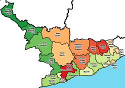 Districts of Central Region | |
 Agona East District Location of Agona East District within Central | |
| Coordinates: 5°38′35.88″N0°45′2.88″W / 5.6433000°N 0.7508000°W | |
| Country | |
| Region | |
| Capital | Nsaba |
| Government | |
| • District Executive | Martin Luther Obeng |
| Area | |
• Total | 318 km2 (123 sq mi) |
| Population (2021) | |
• Total | 98,324 [1] |
| • Density | 309/km2 (801/sq mi) |
| Time zone | UTC+0 (GMT) |
| ISO 3166 code | GH-CP- |
Agona East District is one of the twenty-two districts in Central Region, Ghana. [2] [3] Originally it was formerly part of the then-larger Agona District in 1988, until the eastern part of the district was split off to create Agona East District on 29 February 2008; thus the remaining part has been renamed as Agona West District , which was also elevated to municipal district assembly status on that same year to become Agona West Municipal District . The Agona East district assembly is located in the northeast part of Central Region and has Agona Nsaba as its capital town. [4] However Agona West has Agona Swedru as its capital town.