Saltpond

Last updated

Saltpond
Saltpond Ghana.jpg
Saltpond skyline and Town centre
Ghana adm location map.svg
Red pog.svg
Saltpond
Location of Saltpond in Central region, South Ghana
Coordinates: 5°12′N1°4′W / 5.200°N 1.067°W / 5.200; -1.067
Country Ghana
Region Central Region
District Mfantsiman Municipal
Elevation
1 m (3 ft)
Population
 (2013)
  Total24,689 [1]
Time zone GMT
  Summer (DST) GMT
Website www.mfantsemanma.gov.gh

Saltpond is a town and the capital of the Mfantsiman Municipal District in the Central Region of South Ghana. Saltpond has a population of 24,689 people. [1] [2]

Contents

Economy

History

Saltpond was in a state of economic decline since the landing beach was abandoned for the Tema and Takoradi harbours in the 1960s. Another factor was the building of a bypass on the N1:Aflao-Elubo Highway around the same time which meant that transit traffic through the town virtually ceased. Most of its factories collapsed. The Saltpond Ceramic factory, Coil Factory and the UAC (now Unilever) soft drink factory held on into the early 1990s but then failed too. The economy has resurged since the town recently grew to meet the bypass.

Petroleum

Saltpond is noted for offshore crude oil resources. Saltpond Offshore Producing Company Limited, and two joint venture partners operate the Saltpond Oil Field. [3]

Non-Petroleum

The town is a major market centre in the Mfantsiman Municipality. Fish and other foodstuffs are traded in the market. It also has several shops. The Ghana Commercial Bank has a branch in the town.

The Palm Beach hotel is located atop a hill in town. Schools are a major source of employment, and the Mfantsiman Girl's Senior High School is the biggest single employer. The Saltpond Ceramic Factory has been bought by a Chinese firm, which is attempting to revive it and has now employed countless number of Youths in the town. Fishing takes place mainly in the Nankesido a suburb of Saltpond. Maize farming is prominent as well as bee-keeping. The government also has a District Hospital in Saltpond, Geological Survey Department, Meteorological Department, The District Police Office and Ghana Education Resource Centre. The Municipal Authority is also a major source of employment in the town.

Climate

Saltpond has a relatively dry tropical savanna climate (Köppen Aw) with two rainy seasons: a heavier one from March to July and a secondary wetter period in October and November. [4] Despite the modest rainfall, humidity is high, notably in the shorter dry season centred upon August and September when the cold Benguela Current extends into the Northern Hemisphere.

Climate data for Saltpond, Ghana
MonthJanFebMarAprMayJunJulAugSepOctNovDecYear
Record high °C (°F)35.0
(95.0)
35.0
(95.0)
35.0
(95.0)
35.0
(95.0)
33.9
(93.0)
32.2
(90.0)
31.9
(89.4)
29.4
(84.9)
30.6
(87.1)
32.8
(91.0)
35.0
(95.0)
35.0
(95.0)
35.0
(95.0)
Average high °C (°F)30.8
(87.4)
31.3
(88.3)
31.7
(89.1)
31.8
(89.2)
30.8
(87.4)
28.4
(83.1)
27.2
(81.0)
26.6
(79.9)
27.8
(82.0)
29.6
(85.3)
31.2
(88.2)
31.2
(88.2)
29.9
(85.8)
Daily mean °C (°F)27.1
(80.8)
27.6
(81.7)
27.9
(82.2)
28.0
(82.4)
27.4
(81.3)
25.8
(78.4)
24.8
(76.6)
24.5
(76.1)
25.0
(77.0)
26.3
(79.3)
27.2
(81.0)
26.2
(79.2)
26.5
(79.7)
Average low °C (°F)23.4
(74.1)
24.0
(75.2)
24.1
(75.4)
24.1
(75.4)
23.9
(75.0)
23.3
(73.9)
22.3
(72.1)
22.4
(72.3)
22.3
(72.1)
23.0
(73.4)
23.3
(73.9)
21.3
(70.3)
23.1
(73.6)
Record low °C (°F)16.5
(61.7)
19.5
(67.1)
20.5
(68.9)
21.0
(69.8)
20.5
(68.9)
19.0
(66.2)
18.0
(64.4)
18.5
(65.3)
20.0
(68.0)
20.5
(68.9)
20.5
(68.9)
18.0
(64.4)
16.5
(61.7)
Average rainfall mm (inches)21
(0.8)
23
(0.9)
74
(2.9)
96
(3.8)
194
(7.6)
304
(12.0)
87
(3.4)
24
(0.9)
35
(1.4)
104
(4.1)
73
(2.9)
24
(0.9)
1,059
(41.6)
Average rainy days (≥ 0.3 mm)23681518118101173102
Average relative humidity (%) (at 15:00)74737273778281818077737276
Mean monthly sunshine hours 220.1217.5232.5219.0201.5117.0170.5189.1165.0244.9252.0251.12,480.2
Mean daily sunshine hours 7.17.77.57.36.53.95.56.15.57.98.48.16.8
Source: Deutscher Wetterdienst [5]

Education

University

The International Ahmadiyya University Of Theology, is located in Mankessim.

Pre-University

Saltpond has the Mfantsiman Girls' Senior High School and Saltpond Methodist Senior High School. The two institutions offer the West African Examinations Council's Senior High School Certificate Examination. Mfantsiman Girls' also has a Primary and Junior High School, which are unisex. The District Authority is in charge of all these schools but they have varying degrees of autonomy. The Anglican Church and some other churches including the Roman Catholic and Methodist all have Basic Schools, which offer both Primary and Junior High Education.

Notable Natives

NativeNotability
Nana Akua Owusu Afriyie Politician, Deputy Minister for Information; Member of Parliament for Ablekuma North constituency.
Ama Ata Aidoo Writer and former Minister of Education.
Francis Allotey world renowned mathematical physicist. [6]
Edward Benjamin Kwesi Ampah Jnr Author and politician. Former member of parliament.
Kofi Baako Politician, Minister of State in the first republic.
Kwamena Bentsi-Enchill Academic and judge, Justice of the Supreme Court of Ghana (1971–1972)
Kwesi Dickson Theologian, seventh President of the Methodist Church Ghana [7]
Kobina Hagan politician. Former member of parliament.
Kobina Arku Korsah Jurist, First Chief Justice of Ghana
Ato Sekyi-Otu Ghanaian political philosopher.
J. N. K. Taylor Judge, Justice of the Supreme Court of Ghana (1980–1990)
Joseph Wilfred Abruquah Novelist and educationist
Kweku Budu-Acquah Diplomat

Organizations

Official website - The Saltpond Forum Concern Mission Foundation

Related Research Articles

<span class="mw-page-title-main">Accra</span> Capital and the largest city of Ghana

Accra is the capital and largest city of Ghana, located on the southern coast at the Gulf of Guinea, which is part of the Atlantic Ocean. As of 2021 census, the Accra Metropolitan District, 20.4 km2 (7.9 sq mi), had a population of 284,124 inhabitants, and the larger Greater Accra Region, 3,245 km2 (1,253 sq mi), had a population of 5,455,692 inhabitants. In common usage, the name "Accra" often refers to the territory of the Accra Metropolitan District as it existed before 2008, when it covered 199.4 km2 (77.0 sq mi). This territory has since been split into 13 local government districts: 12 independent municipal districts and the reduced Accra Metropolitan District (20.4 km2), which is the only district within the capital to be granted city status. This territory of 199.4 km2 contained 1,782,150 inhabitants at the 2021 census, and serves as the capital of Ghana, while the district under the jurisdiction of the Accra Metropolitan Assembly proper (20.4 km2) is distinguished from the rest of the capital as the "City of Accra".

<span class="mw-page-title-main">Tamale, Ghana</span> Major city in Northern Region, Ghana

Tamale, officially called Tamale Metropolitan Area, is the capital city of the Northern Region of Ghana. Tamale is Ghana's third largest city. It has a projected population of 950,124 according to the Tamale Metropolitan Assembly Official Website. It is the fastest-growing city in West Africa. It is located 600 km (370 mi) north of Accra. Most residents of Tamale are Muslims and Dagombas by tribe, as reflected by the multitude of mosques in Tamale, most notably the Central Mosque, Afa Ajura Mosque, Afa Basha mosque and The Ahmadiyyah Muslim mission Mosque.

<span class="mw-page-title-main">Ho, Ghana</span> City in Volta Region, Ghana

Ho is the capital city of the Ho Municipal District and the Volta Region of Ghana. The city lies between Mount Adaklu and Mount Galenukui or Togo Atakora Range, and is home to the Volta Regional Museum, a cathedral, and a prison. It was formerly the administrative capital of British Togoland now part of the Volta Region. The population of Ho Municipality according to the 2010 Population and Housing Census is 177,281 representing 8.4 percent of the region's total population. Females constitute 52.7 percent and males represent 47.3 percent. About 62 percent of the population resides in urban localities. The Municipality shares boundaries with Adaklu and Agotime-Ziope Districts to the South, Ho West District to the North and West and the Republic of Togo to the East. Its total land area is 2,361 square kilometers thus representing 11.5 percent of the region's total land area.

<span class="mw-page-title-main">Sekondi-Takoradi</span> City in Western Region, Ghana

Sekondi-Takoradi is a city in Ghana comprising the twin cities of Sekondi and Takoradi. It is the capital of Sekondi – Takoradi Metropolitan Assembly and the Western Region of Ghana. Sekondi-Takoradi is the region’s and largest Fante city as well as an industrial and commercial center, with a population of 445,205 people (2012). The chief industries in Sekondi-Takoradi are timber, cocoa processing, plywood, shipbuilding, its harbour and railway repair, and recently, sweet crude oil and crude oil. The fundamental job in Sekondi-Takoradi is fishing. Sekondi-Takoradi lies on the main railway lines to Kumasi.

<span class="mw-page-title-main">Bolgatanga</span> Town in Upper East Region, Ghana

Bolgatanga, colloquially known as Bolga, is a town and the capital of the Bolgatanga Municipal District and Upper East Region of Ghana, adjacent to the border with Burkina Faso. Bolgatanga has over 2012 settlement and a population of about 66,685 people. Bolgatanga is 161 km to the north of Tamale. Bolgatanga lies in the Red Volta River Valley, with the White Volta River and the cliffs of the Gambaga Escarpment to the south of the town forming the southern boundary of the Upper East Region.

<span class="mw-page-title-main">Wa, Ghana</span> Town in Upper West Region, Ghana

Wa is a town and the capital of Wa Municipal District and the Upper West Region of northern Ghana. Wa had a 2012 settlement population of 102,446. Features of the town include several churches and mosques, the Wa-Na Palace, the St. Andrew's Catholic cathedral, the University for Development Studies (UDS), a museum, a nearby hippopotamus sanctuary in Wicheau, the mushroom rock In Jirapa and the ants hill at Nanvielle. The geography of Wa is notable for the dramatic monadnock Ombo Mountain, which is located around Kaleo and visible from much of the Wa town. Other notable towns around Wa region include Naaha and Ga.

<span class="mw-page-title-main">Tema</span> City in Greater Accra Region, Ghana

Tema is a city on the Bight of Benin and Atlantic coast of Ghana. It is located 25 kilometres (16 mi) east of the capital city; Accra, in the region of Greater Accra, and is the capital of the Tema Metropolitan District. As of 2013, Tema is the eleventh most populous settlement in Ghana, with a population of approximately 161,612 people – a marked decrease from its 2005 figure of 209,000. The Greenwich Meridian passes directly through the city. Tema is locally nicknamed the "Harbour City" because of its status as Ghana's largest seaport. It consists of 25 different communities which are numbered accordingly with each of them having easy access to the basic amenities.

<span class="mw-page-title-main">Nsawam</span> Town in Eastern Region, Ghana

Nsawam is a town in south Ghana and is the capital of the Nsawam-Adoagyire Municipal District, a district in the Eastern Region of south Ghana. The main ethnic group is Akan, followed by Ga and then Ewe. Nsawam is controlled by Nsawam-Adoagyire Municipal District (ASMD). As of 2013, Nsawam has a settlement population of 44,522 people. Nsawam is situated on the main railway between Accra and Kumasi and highway to Kumasi. It has Densu river acting as a border between itself and Adoagyiri. Densu River, is the main source of water for both domestic and industrial purposes for people in and around Nsawam.

<span class="mw-page-title-main">Central Region (Ghana)</span> Region of Ghana

The Central Region is one of the sixteen administrative regions of Ghana. It is bordered by Ashanti and Eastern regions to the north, Western region to the west, Greater Accra region to the east, and to the south by the Gulf of Guinea. The Central Region is renowned for its many elite high schools and an economy based on an abundance of industrial minerals and tourism. The Central region boasts of many tourist attractions such as castles, forts and beaches dotted along the region's coastline.

<span class="mw-page-title-main">Eastern Region (Ghana)</span> Region of Ghana

The Eastern Region is located in the Eastern part of Ghana and is one of the sixteen administrative regions of Ghana. Eastern region is bordered to the east by the Lake Volta, to the north by Bono East Region and Ashanti region, to the west by Ashanti region, to the south by Central region and Greater Accra Region. Akans are the dominant inhabitants and natives of Eastern region and Akan, Ewe, Krobo, Hausa and English are the main spoken languages. The capital town of Eastern Region is Koforidua.The Eastern region is the location of the Akosombo dam and the economy of the Eastern region is dominated by its high-capacity electricity generation. Eastern region covers an area of 19,323 square kilometres, which is about 8.1% of Ghana's total landform.

<span class="mw-page-title-main">Greater Accra Region</span> Region of Ghana

The Greater Accra Region has the smallest area of Ghana's 16 administrative regions, occupying a total land surface of 3,245 square kilometres. This is 1.4 per cent of the total land area of Ghana. It is the most populated region, with a population of 5,455,692 in 2021, accounting for 17.7 per cent of Ghana's total population.

<span class="mw-page-title-main">Koforidua</span> City in Eastern Region, Ghana

Koforidua, also popularly known as K-dua or Koftown and now Kofcity, is a city and the capital of Eastern Region in southern Ghana. Koforidua was founded in 1875 by migrants from Ashanti. It is also called New Juaben. The city has a settlement city proper population of 183,727 people as of 2010, Koforidua is an amalgamation of two Municipalities; New Juaben North and South. The city has a blend of colonial and modern architecture.

<span class="mw-page-title-main">Akim Oda</span> Town in Eastern Region of Ghana

Akim Oda is a town in the Eastern Region of Ghana, and is the capital of the Birim Central Municipal District and the traditional capital of Akyem Kotoku. In 2013, Akim Oda had a settlement population of 60,604 people.

<span class="mw-page-title-main">Teshie</span> Town in Greater Accra Region, Ghana

Teshie is a coastal town in the Ledzokuku Municipal District, a district in the Greater Accra Region of southeastern Ghana. Teshie is the ninth most populous settlement in Ghana, with a population of 171,875 people.

<span class="mw-page-title-main">Biriwa</span> Town in Central Region, Ghana

Biriwa is a town of Mfantsiman Municipal District in the Central Region of Ghana. According to the Ghana Statistical Service's 2010 Population and Housing Census, the population of Biriwa was 7,086. The main occupation is fishing, with a few people engaged in farming. It is a traditional setting which celebrates the Okyir festival every October. The current chief of the town, Nana Kwabonko V, resides in Saltpond.

<span class="mw-page-title-main">Mfantsiman Municipal District</span> Municipal District in Central, Ghana

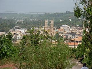
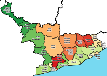
Mfantsiman Municipal Assembly is one of the twenty-two districts in Central Region, Ghana. Originally created as an ordinary district assembly in 1988 when it was known as Mfantsiman District, which was created from the former Mfantsiman District Council; until it was later elevated to municipal district assembly status on 29 February 2008 to become Mfantsiman Municipal District. However, on 28 June 2012, the eastern part of the district was split off to create Ekumfi District; thus, the remaining part has been retained as the Mfantsiman Municipal Assembly. The municipality is located in the southwest part of Central Region and has Saltpond as its capital town.

Duayaw Nkwanta is a town and the capital of Tano North Municipal District, a municipal in the Ahafo Region of Ghana. It is located close to Sunyani, the capital of Bono Region. The infrastructure of Duayaw Nkwanta is well structured. Duayaw Nkwanta has a settlement population of 27,476. This town boast of good schools such as: Boakye Tromo Senior High Technical School, Serwaa Kesse Girls Senior High School, Presbyterian Midwifery Training College among others.

Mfantsiman Girls' Senior High School is an all-girls second cycle institution in Saltpond in the Central Region of Ghana. The school was founded in 1960 by Kwame Nkrumah, originally under the name Saltpond Girls' Secondary School. The school is also known as 'Syte'.

<span class="mw-page-title-main">Nana Klutse</span> Ghanaian climate change researcher

Nana Ama Browne Klutse is a Ghanian lecturer and Climatologist.

References

  1. 1 2 "World Gazetteer online". World-gazetteer.com. Archived from the original on September 30, 2007.
  2. "Saltpond on the map Ghana, location on the map, exact time". gh.maptons.com. Retrieved 2023-08-02.
  3. "Saltpond Field" (PDF). Ghana National Petroleum Company (GNPC). Archived from the original (PDF) on 2011-07-11. Retrieved 2010-06-29.
  4. Climate Summary for Saltpond
  5. "Klimatafel von Saltpond / Ghana" (PDF). Baseline climate means (1961-1990) from stations all over the world (in German). Deutscher Wetterdienst. Retrieved 18 October 2016.
  6. "Professor Francis Allotey" . Retrieved 2019-11-28.
  7. "President Kufuor and nation mourn Prof Dickson" . Retrieved 2010-06-29.